Rate this trail

GR 10 VARIANTE DE SERRA

Promoter: Generalitat Valenciana

Certification status: Positive quality control

0 reviews

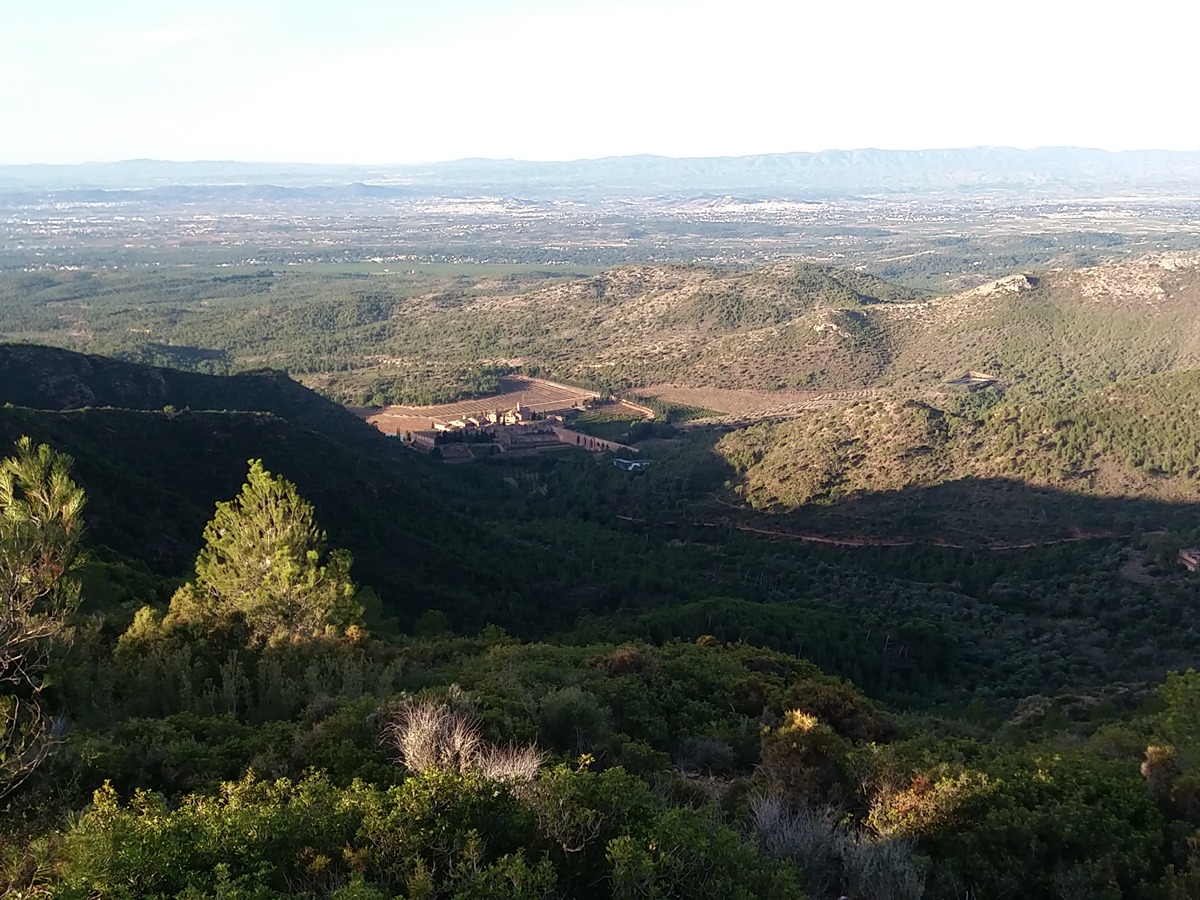
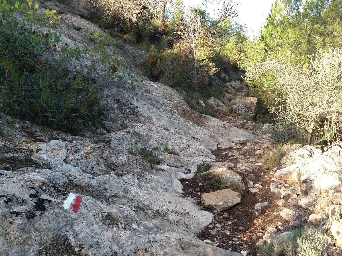
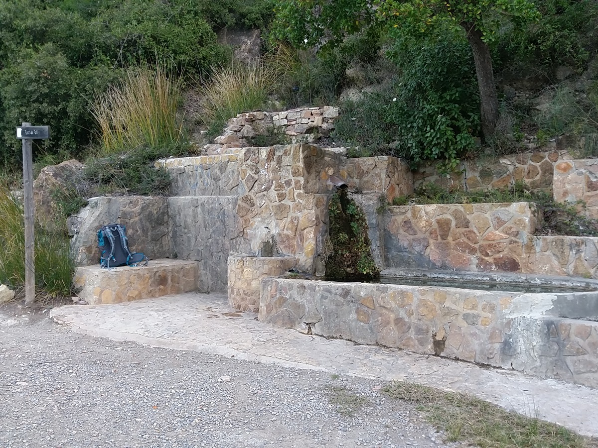
This variant goes through Serra, a town where all kinds of shops and services are available. This route with exceptional views of the monastery of Portacoeli and La Pobleta, follows a path to the col of Morería and a track to the font del Poll spring. Then it finds its way back to the main path.

Trail:
One way (point-to-point)
Technical data:
Length:
7,30 km
Estimated walking time:
02:25:00
Elevation gain:
425 m
Elevation loss:
90 m
MIDE ratings:
Level of natural risks:
1
Navigation on the trail:
2
Hiking difficulty:
2
Fitness level needed:
2

More information on Montaña Segura

Difficulty rating according to FEDME:
Unknown
Starting point:
End Point:
Interest Tags:
Trail with environmental interes

Useful information:
Date of the act of registration in the Public Register:
22-05-2007
Date of the last Quality Control:
february de 2024
Reference municipality:
District:
Province:
Valencia/València
Cartography IGN MTN25:
0668-3

Downloadable from the Catalogue of the IGN Map Library

See other trails of this promoter:
Protected Natural Spaces:

We advise you to look up the regulations and/or authorisations for using the trails in these conservation areas on the website of the Conselleria de Medio Ambiente, Agua, Infraestructuras y Territorio

  • Sierra Calderona (SIC - Site of Community Interest)
  • Sierra Calderona (SPAB - Special Protection Area for Birds)
  • Sierra Calderona (Natural Park)
Key points of the route:

Serra - Barranco de Deula (ravine) - Collado de la Moreria (col) - Font del Poll (spring)

Route description (only available in Spanish)

Iniciamos el recorrido en la calle les Eres y recorrer el pueblo para salir de Serra por la calle de la Pobleta, paralelo al barranco de Deula, y seguir la pista hasta llegar al barranco de les Coves que remontamos en dirección al mirador de la Pobleta. Seguimos la senda que bordea Rebalsadors hasta el collado de la Morería pasando junto a les Penyes de la Pobleta y el Racó de les Voltes. Desde el collado cogemos el camino de la Falaguera hasta la Casa del mismo nombre donde cogemos el camino que nos lleva a la font del Poll.

Downloads:

Beware! Navigation devices may fail, batteries may run out of power and devices may break down. Do not use only electronic means to track your activities in the mountains; they must be used as a complement to the map and compass. Get some proper training and enjoy the mountains.