Rate this trail

PR-CV 376 RUTA CICLOTURISTICA DE PERTECATES

Promoter: Ayuntamiento de Tous

Certification status: Conditioned quality control

0 reviews

Following the inspection carried out by trail technicians, this trail has been declared of "limited adequacy" as a result of the faults detected in the signage. These include inadequate horizontal signs (paint markers) and/or vertical ones (trailheads and information boards) or lacking direction markers that do not provide sufficient information to properly follow the route. The builder of this trail has been informed of the situation.
For safety reasons and during maintenance work, it is advised to be extremely careful while taking this route. Furthermore, mountain sports entail risks associated with the activity itself and the environment where they take place, for which any person is fully liable. For this reason, hikes need to be planned properly and adequate training, equipment and sensible use of the trails are required.

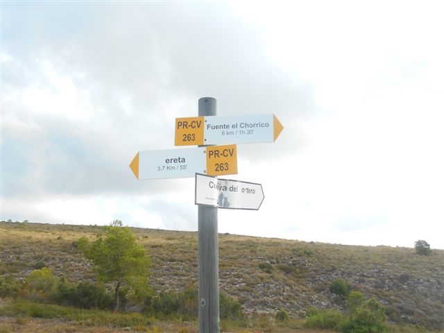
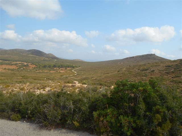
A comfortable trail that runs entirely on paved roads and tracks. It starts in the village of Tous, leading to the Pertecaste cave, passing through several micro-reserves of flora and ending at the beautiful natural amphitheatre and waterfall of the Pertecaste ravine.

Trail:
One way (point-to-point)
Technical data:
Length:
21,00 km
Estimated walking time:
05:05:00
Elevation gain:
520 m
Elevation loss:
295 m
MIDE ratings:
Level of natural risks:
1
Navigation on the trail:
2
Hiking difficulty:
1
Fitness level needed:
3

More information on Montaña Segura

Difficulty rating according to FEDME:
Unknown
Starting point:
End Point:
Useful information:
Date of certification:
15-11-2010
Date of the act of registration in the Public Register:
20-10-2015
Date of the last Quality Control:
july de 2018
Reference municipality:
District:
Province:
Valencia/València
Cartography IGN MTN25:
0769-2; 0746-4

Downloadable from the Catalogue of the IGN Map Library

See other trails of this promoter:
Protected Natural Spaces:

We advise you to look up the regulations and/or authorisations for using the trails in these conservation areas on the website of the Conselleria de Medio Ambiente, Agua, Infraestructuras y Territorio

  • Puntal de Bujes, Bco. de Pertecaste y Port de Tous (Flora Micro-reserve)
  • Sierra de Martés - Muela de Cortes (SPAB - Special Protection Area for Birds)
Key points of the route:

Port de Tous (peak) - Puntal de Bujes (peak) - Barranco de Pertecaste (ravine) - Cueva Pertecaste (cave) - Fuente Pertecaste (spring)

Route description (only available in Spanish)

El itinerario comienza al lado de la Piscina Municpal, en la población de Tous, desde donde cogeremos la carretera CV-5412 en dirección a la presa de Tous. Siguiendo la carretera en contínuo ascenso pasaremos por la microrreserva del port de Tous.
Continuaremos por la carretera en ascenso hasta el Alt del Pollet, y por la vereda del mismo nombre dejamos a la izquierda la cueva del Candil, y atravesaremos la microrreserva del Puntal de Bujes.
Continuamos, alternando tramos de alfalto con pista, hasta llegar al tramo más elevado del recorrido en el puntal de la Cueva Palera, donde en cómodo descenso llegaremos a la microreserva de Pertecaste, ya nuestro destino final, la Cueva de Pertecaste.
Desde el sendero que llega a la cueva, parte un camino que conduce a la Fuente de Pertecaste.

Downloads:

Beware! Navigation devices may fail, batteries may run out of power and devices may break down. Do not use only electronic means to track your activities in the mountains; they must be used as a complement to the map and compass. Get some proper training and enjoy the mountains.

Other trails connecting with this trail