Rate this trail

PR-CV 437 VOLTA DEL CANTAL

Promoter: Ayuntamiento de la Villajoyosa

Certification status: Conditioned quality control

0 reviews

Following the inspection carried out by trail technicians, this trail has been declared of "limited adequacy" as a result of the faults detected in the signage. These include inadequate horizontal signs (paint markers) and/or vertical ones (trailheads and information boards) or lacking direction markers that do not provide sufficient information to properly follow the route. The builder of this trail has been informed of the situation.
For safety reasons and during maintenance work, it is advised to be extremely careful while taking this route. Furthermore, mountain sports entail risks associated with the activity itself and the environment where they take place, for which any person is fully liable. For this reason, hikes need to be planned properly and adequate training, equipment and sensible use of the trails are required.

Trail:
Loop
Technical data:
Length:
25,77 km
Estimated walking time:
06:00:00
Elevation gain:
380 m
Elevation loss:
380 m
MIDE ratings:
Level of natural risks:
Unknown
Navigation on the trail:
Unknown
Hiking difficulty:
Unknown
Fitness level needed:
Unknown

More information on Montaña Segura

Difficulty rating according to FEDME:
Unknown
Starting point:
Ermita de San Antoni
Useful information:
Date of certification:
15-06-2015
Date of the act of registration in the Public Register:
20-10-2015
Date of the last Quality Control:
september de 2020
Reference municipality:
District:
Province:
Alicante/Alacant
Cartography IGN MTN25:

Downloadable from the Catalogue of the IGN Map Library

See other trails of this promoter:
Key points of the route:

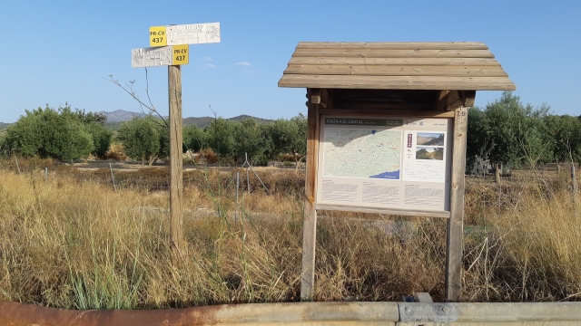
CV 770 road (Partida de la Ermita) - Foies Granades - Barranc de l'Aigueta (ravine)- El Cantál - Alt de Sebatiá (peak) or Les Cremades - L'Alfondó - La Rancallosa - Water treatment plant - Río Amadorio (river) - Partida de la Ermita (plot) - Panel marking start of the trail

Route description (only available in Spanish)

Desde el camino de la partida de la Ermita, al otro lado de la Ctra. se toma a la izq. hacia les Foies Granades, pasando por la Creu de Pedra, La roca Encantada y el estrecho puente sobre el Río en el Salt d´En Gil.
Esta parte está asfaltado, a partir de aquí ya todo son pistas, en este lugar se puede tomar la Variante a Alfondó pasando por el costado de una enorme balsa de riego y Alt de Sebastiá, acortando el recorrido.
Si seguimos la pista nos lleva por el Bcº de l´Aigueta hasta el alto del Cantal, y posteriormente al Alt de Sebastiá o Les Cremades.
En este punto se inicia la senda que discurre por la crestería finalizando en el Coll de Sorell (aunque sigue hasta el Pantano de Amadorio) el recorrido es de 3 Km. y otros tantos de vuelta.
Desde Les Cremades se continua pista abajo hasta el paraje de L´Alfondó de Salomó donde se puede optar por el camino de la dcha. hasta Les Foies Granades o por el Camino de la izq. hacia la Ermita por la Rancallosa (bastante más largo) pasando por la Depuradora, cruzando el Ríu Amadorio y en el camino veremos un Olivo posiblemente milenario, llegando al Panel de Inicio.
 

Downloads:

Beware! Navigation devices may fail, batteries may run out of power and devices may break down. Do not use only electronic means to track your activities in the mountains; they must be used as a complement to the map and compass. Get some proper training and enjoy the mountains.