Cambiar idioma a español / Cambiar idioma a english / Cambiar idioma a valencià

Rate this trail

PR-CV 165 ALTO DE DON PEDRO

Promoter: Ayuntamiento de Salinas

Certification status: No quality controls

1 review

There is no proof of quality control on the record of this trail in the last years. For this reason, it is unknown whether it complies with the optimal signage and maintenance conditions for hikers to take the trail following these signs exclusively.
Hikers have to take into consideration that the information about the signage and maintenance of the trails for which the promoter entity is responsible might not be up to date anymore, since it refers to its state on the date of its approval. Furthermore, mountain sports entail risks associated with the activity itself and the environment where they take place, for which any person is fully liable. For this reason, hikes need to be planned properly and adequate training, equipment and sensible use of the trails are required.

Trail:
One way (point-to-point)
Technical data:
Length:
12,50 km
Estimated walking time:
04:15:00
Elevation gain:
570 m
Elevation loss:
490 m
MIDE ratings:
Level of natural risks:
2
Navigation on the trail:
2
Hiking difficulty:
2
Fitness level needed:
3

More information at Montaña Segura

Difficulty rating according to FEDME:
Unknown
Starting point:
End Point:
Useful information:
Date of certification:
15-03-2001
Date of the last Quality Control:
august de 2020
Reference municipality:
District:
Province:
Alicante/Alacant
Cartography IGN MTN25:
0870-2; 0845-4

You can download them from the IGN Map Library Catalog

See other trails of this promoter:
Protected Natural Spaces:

It is recommended to consult the regulations and/or authorizations for the use of trails in these protected natural areas on the website of the Regional Ministry of Environment, Water, Infrastructure, and Territory

  • Sierra de Salinas (SIC - Site of Community Interest)
Weather information:
Nearest AVAMET weather station
Key points of the route:

Pozo Casa del Puntal (well) - Poblado El Puntal Intersection - Cresta Sierra de la Sima (crest) - Alto de D. Pedro (peak) - Camino dels Pradets (path) - Collado de Carabina (col) - Rambla del Garrincho (wadi) - Barranco Ancho (ravine) - Camino de las Fontanas (path) - Ermita de San isidro (chapel)

Route description (only available in Spanish)

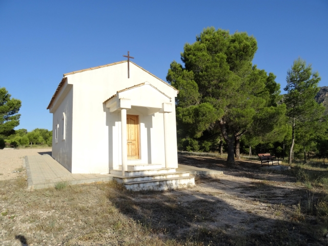
Iniciamos en el Pozo Casa del Puntal, seguimos pista forestal derecha, dirección suroeste en suave ascenso y más adelante la pista pasa a senda; a la izquierda, ascenso suave, pasamos cruce de sendas del Poblado del Puntal. Llegamos cruce con camino, giramos a la izquierda y seguimos camino en ascenso. Llegamos a una curva del camino y volvemos a senda, que aparece a la derecha y en ascenso volvemos a camino, giro a la derecha ascendemos y llegamos a la Cresta de la Sima. Seguimos por senda y en curva hacia la derecha ascenso al collado cruce cumbre del Alto de D. Pedro; por senda de ascenso a la izquierda. Bajamos de la cumbre, giramos a la izquierda y empezamos el descenso por senda en zig zag, hasta llegar al cruce de caminos en Camí dels Pradets, giramos a la izquierda, continuamos por pista forestal, un poco más adelante giro a la derecha por camino ascendente. Pasamos por el Collado de Carabina,  descenso fuerte por camino, se suaviza la pendiente, nos encontraremos campos de cultivo y más adelante a la derecha casa de campo de lujo. Seguimos por pista forestal hasta que llegamos al puente sobre la Rambla del Garrincho, nos introducimos por dentro de la rambla, seguimos senda, cruzamos camino, continuamos por rambla, hasta llegar al cruce con el Barranco Ancho, aquí giramos a la izquierda, continuamos por dentro del barranco por senda, salimos en cruce camino asfaltado, giramos a la derecha y en siguiente cruce, giro a la izquierda, abandonamos camino asfaltado por pista forestal Camino de las Fontanas, pasamos por un cruce giramos a la derecha por camino en descenso, llegamos a otro pista forestal. Continuamos por la derecha y llegamos a una zona con valla metálica, andamos paralelos a ella, hasta la puerta, donde sale un camino a la izquierda, ascendemos por éste hasta el siguiente cruce de pista, seguimos por la izquierda. Un par de cruces con pistas, siempre derecha, bordeamos una balsa y llegamos a la Ermita de San isidro. 

Downloads:

Beware! Navigation devices may fail, batteries may run out of power and devices may break down. Do not use only electronic means to track your activities in the mountains; they must be used as a complement to the map and compass. Get some proper training and enjoy the mountains.