Rate this trail

PR-CV 2 CABEÇÓ D'OR

Promoter: Ayuntamiento de Busot

Certification status: Positive quality control

4 reviews

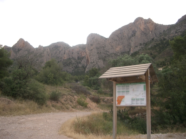
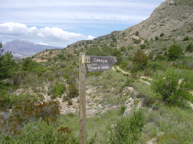
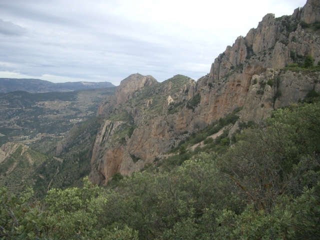
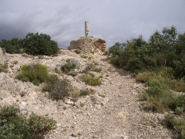
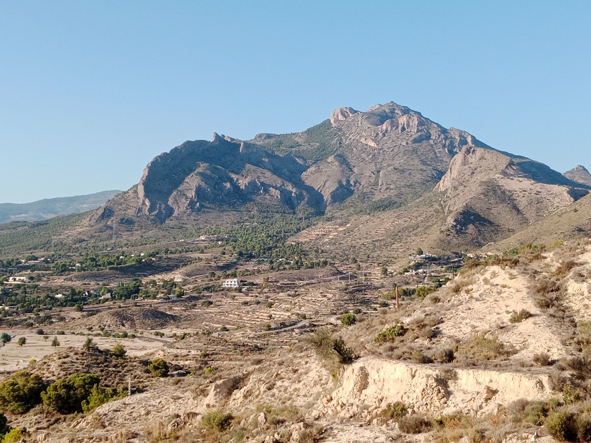
The Cabeçó d'Or route is one of the classic and essential routes in Alicante. Cabeçó d'Or is located in the region of l'Alacantí, on the border with Marina Baixa. It is an important visual reference point to the north of the Alicante countryside, and this mountain range divides the municipalities of Xixona, Busot, Aigües de Busot and Relleu. The mountain hides a great treasure inside: the Canelobre Caves (Cuevas de Canelobre).

Trail:
Loop with some overlapping out and back sections
Technical data:
Length:
10,40 km
Estimated walking time:
04:55:00
Elevation gain:
855 m
Elevation loss:
855 m
MIDE ratings:
Level of natural risks:
2
Navigation on the trail:
2
Hiking difficulty:
4
Fitness level needed:
3

More information on Montaña Segura

Difficulty rating according to FEDME:
Unknown
Interest Tags:
Trail with geological interest

Useful information:
Date of certification:
16-10-1995
Date of the act of registration in the Public Register:
22-05-2007
Date of the last Quality Control:
may de 2022
Reference municipality:
District:
Province:
Alicante/Alacant
Cartography IGN MTN25:
0847-3

Downloadable from the Catalogue of the IGN Map Library

See other trails of this promoter:
Protected Natural Spaces:

We advise you to look up the regulations and/or authorisations for using the trails in these conservation areas on the website of the Conselleria de Medio Ambiente, Agua, Infraestructuras y Territorio

  • Cabeçó d'Or y la Grana (SPAB - Special Protection Area for Birds)
  • Racó de Seva y Cova del Canelobre (Flora Micro-reserve)
Key points of the route:

Pla de la Gralla (plain) - Coves de Canelobre (cave) - Pla del Cabeçó (plain) (PR-CV 226 connection) - Casa de Polset (old rural house) - Technical stretch with stemples - Cima Cabeçó d'Or (summit) - Racó de Seva (hiking area) - Casa de Gorges (old rural house) - Pla de la Gralla (plain)

Route description (only available in Spanish)

Desde el mismo parking del Pla de la Gralla seguimos por la carretera asfaltada hasta las Cuevas del Canelobre, donde al final de esta comienza un sendero que desciende en dirección al Pla del Cabeçó. Iremos bajando haciendo pequeños zigzags hasta ver un poste indicador que nos señalará la dirección hacía el Collado de Polset. Desde este punto comenzamos a ascender de nuevo en zigzag hasta llegar a la Casa de Polset. La senda se encuentra muy marcada. Desde la Casa de Polset, veremos delante nuestra un poste indicador, si queremos subir a la cumbre, lo haremos tomando la senda que sale a la derecha. Esta va cruzando pequeñas pedreras y pasando por debajo de paredes hasta llegar a un pequeño collado. Para llegar a este collado hay que hacer una pequeña y sencilla trepada ayudados de las manos, este tramo está equipado con peldaños metálicos tipo 'vía ferrata'. Desde el collado continuando hacia la izquierda llegaremos a la cumbre del Cabeçó d'Or. Para continuar el itinerario, descendemos regresando a la Casa de Polzet para seguir por la senda de la derecha según bajamos, donde el mismo poste indicador que vimos en la subida nos marca la dirección de regreso. El resto del itinerario es en descenso, la senda atraviesa unas pedreras hasta el Racó de Seva, donde pasa a ser pista forestal, la cual cogeremos hacía la izquierda, pasaremos por la Casa de Gorges y el Raçó de Calderó (escuela de escalada). Seguimos la pista y nos llevara hasta el parking del inicio.

Downloads:

Beware! Navigation devices may fail, batteries may run out of power and devices may break down. Do not use only electronic means to track your activities in the mountains; they must be used as a complement to the map and compass. Get some proper training and enjoy the mountains.

Other trails connecting with this trail