Rate this trail

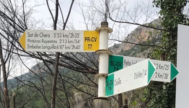
PR-CV 223 SOT DE CHERA - EL JUSTAL

Promoter: Ayuntamiento de Sot de Chera

Certification status: No quality controls

1 review

There is no proof of quality control on the record of this trail in the last years. For this reason, it is unknown whether it complies with the optimal signage and maintenance conditions for hikers to take the trail following these signs exclusively.
Hikers have to take into consideration that the information about the signage and maintenance of the trails for which the promoter entity is responsible might not be up to date anymore, since it refers to its state on the date of its approval. Furthermore, mountain sports entail risks associated with the activity itself and the environment where they take place, for which any person is fully liable. For this reason, hikes need to be planned properly and adequate training, equipment and sensible use of the trails are required.

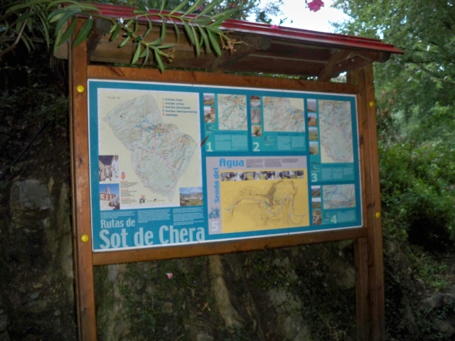
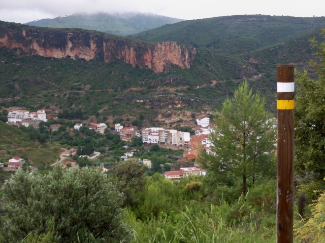
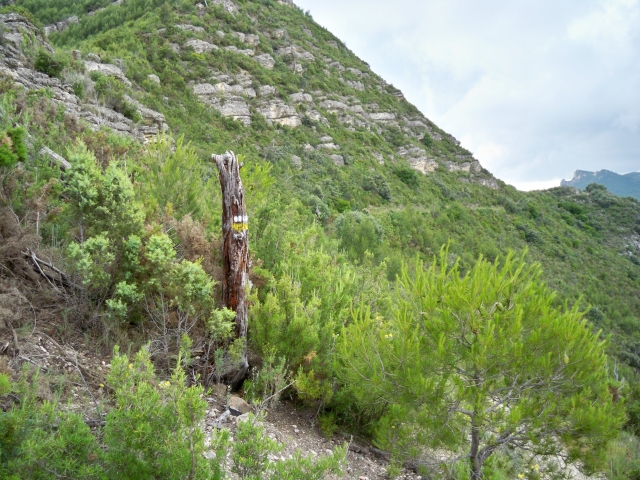
There is a route that runs along paths and forest tracks, over hills and slopes. Its first stretch consists of a small urban section and the way back runs along the river bank. It is a trail combining linear sections for the way there and back and a central circular section. Its highest points are at Las Minas, El Mirador, El Morroncillo and Los Monegrillos. This route has no steep ascents or descents.

Trail:
Loop with some overlapping out and back sections
Technical data:
Length:
11,00 km
Estimated walking time:
03:15:00
Elevation gain:
480 m
Elevation loss:
480 m
MIDE ratings:
Level of natural risks:
2
Navigation on the trail:
2
Hiking difficulty:
2
Fitness level needed:
3

More information on Montaña Segura

Difficulty rating according to FEDME:
Unknown
Starting point:
Interest Tags:
Trail with environmental interes
Useful information:
Date of certification:
15-06-2010
Date of the act of registration in the Public Register:
20-10-2015
Reference municipality:
District:
Province:
Valencia/València
Cartography IGN MTN25:
0694-2

Downloadable from the Catalogue of the IGN Map Library

See other trails of this promoter:
Protected Natural Spaces:

We advise you to look up the regulations and/or authorisations for using the trails in these conservation areas on the website of the Conselleria de Medio Ambiente, Agua, Infraestructuras y Territorio

  • Alto Turia y Sierra del Negrete (SPAB - Special Protection Area for Birds)
  • Chera - Sot de Chera (Natural Park)
  • Sierra del Negrete (SIC - Site of Community Interest)
Key points of the route:

Sot de Chera Town Hall - Rio Sot (river) - Las Minas - Mirador el Morroncillo (viewpoint) - Corrales de la Pera (corral) - Los Monegrillos - La Pinada Preñada (pine grove) - Albergue Turismo Rural El Cerrao (refuge)- End of trail- Sot de Chera Town Hall

Route description (only available in Spanish)

El sendero tiene su inicio en el Ayuntamiento de Sot de Chera, andaremos por el casco urbano hasta el final de la Avenida de Pera cruzaremos el puente sobre el río y atravesando otro grupo de viviendas buscaremos una pista que nos dirige al Oeste por el collado hacia El Justal y Las Minas, a partir de la mina encontraremos unos campos de cultivo siguiendo esta pista hasta una bifurcación donde seguimos por una pista principal, a partir de aquí caminaremos sin dejar esta, aunque aparezcan entradas y salidas a nuestros lados hasta llegar a una masía para tomar un desvío a la derecha por El Camino de La Pera durante 100 metros y girar de nuevo a la derecha para tomar el Camino de la Jaca a Cazón hasta llegar al mirador El Morroncillo a 764 metros de altitud. Retrocederemos lo andado hasta el cruce anterior y a la altura de Los Corrales de La Pera tomaremos de nuevo una pista que desaparece a los 200 metros para continuar por una senda forestal atravesando Los Monegrillos y dirección La Pinada Preñada donde tomaremos de nuevo la pista dirección al Norte y desviarnos a 1 km, dirección Sot de Chera, pasaremos por el Albergue de Turismo Rural El Cerrao y a orillas del río volveremos al Ayuntamiento, nuestro punto final.

Downloads:

Beware! Navigation devices may fail, batteries may run out of power and devices may break down. Do not use only electronic means to track your activities in the mountains; they must be used as a complement to the map and compass. Get some proper training and enjoy the mountains.

Other trails connecting with this trail