Rate this trail

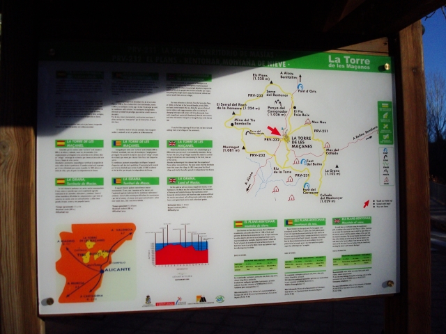
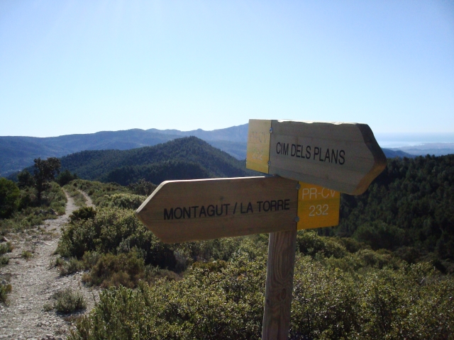
PR-CV 232 EL RETONAR - MONTAÑA DE NIEVE

Promoter: Ayuntamiento de Torremanzanas

Certification status: No quality controls

1 review

There is no proof of quality control on the record of this trail in the last years. For this reason, it is unknown whether it complies with the optimal signage and maintenance conditions for hikers to take the trail following these signs exclusively.
Hikers have to take into consideration that the information about the signage and maintenance of the trails for which the promoter entity is responsible might not be up to date anymore, since it refers to its state on the date of its approval. Furthermore, mountain sports entail risks associated with the activity itself and the environment where they take place, for which any person is fully liable. For this reason, hikes need to be planned properly and adequate training, equipment and sensible use of the trails are required.

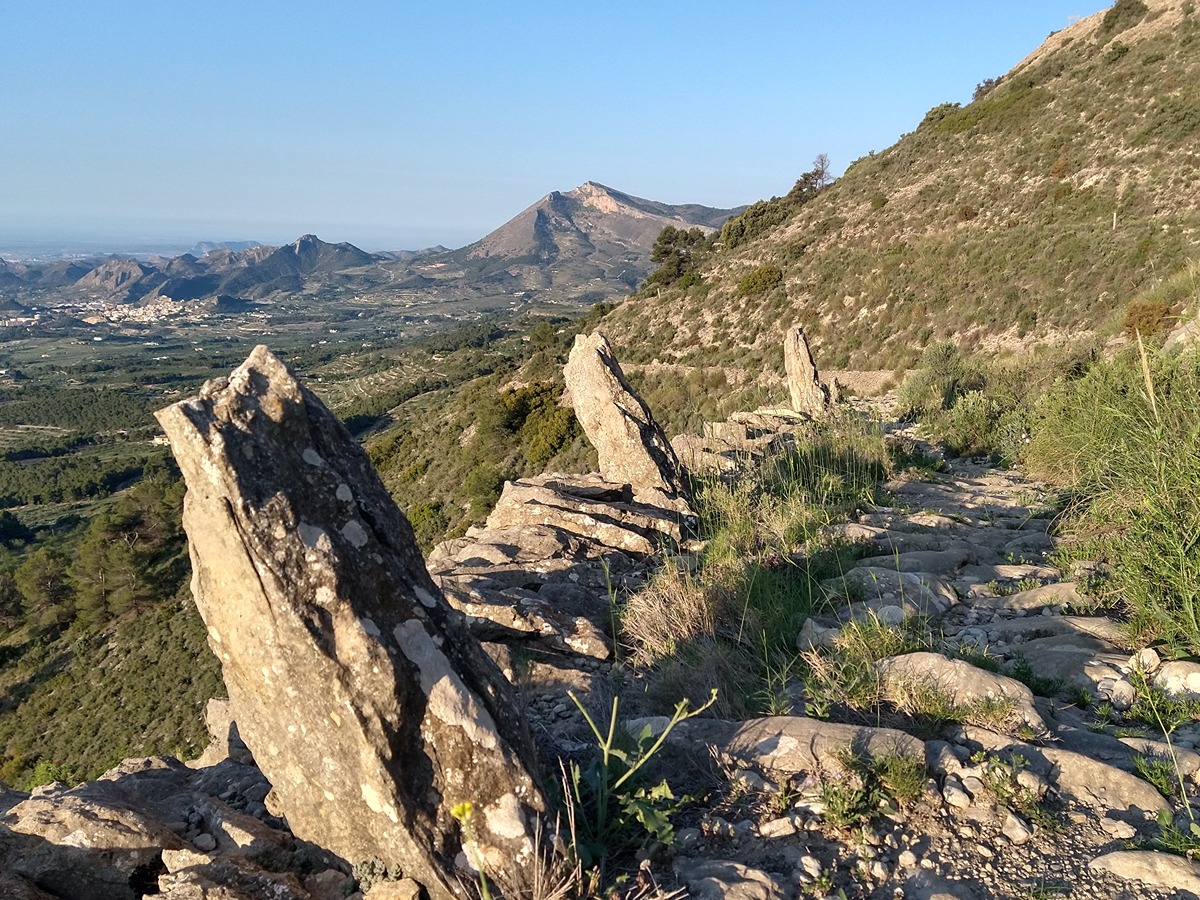
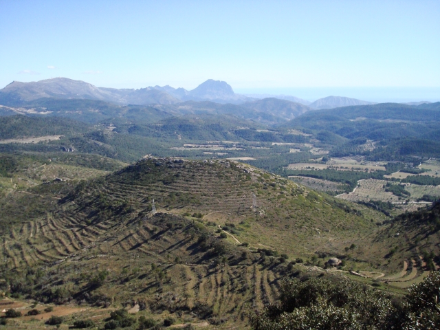
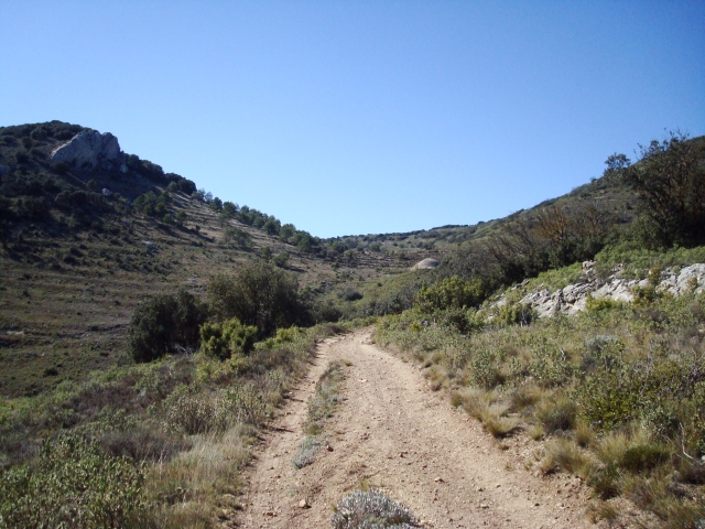
This route runs through part of a mountainous area of great ecological and scenic value. On its slopes there are holm oak formations. In its surroundings you can find the cave paintings of the Sarga shelter, the Iberian settlement of Puig and the ice well of Rentonar. There are magnificent views from its highest point.

Trail:
Loop
Technical data:
Length:
13,90 km
Estimated walking time:
05:05:00
Elevation gain:
775 m
Elevation loss:
775 m
MIDE ratings:
Level of natural risks:
2
Navigation on the trail:
2
Hiking difficulty:
2
Fitness level needed:
3

More information on Montaña Segura

Difficulty rating according to FEDME:
Unknown
Starting point:
Useful information:
Date of certification:
15-02-2009
District:
Province:
Alicante/Alacant
Cartography IGN MTN25:
0847-1

Downloadable from the Catalogue of the IGN Map Library

See other trails of this promoter:
Route description (only available in Spanish)

Iniciamos nuestro recorrido desde el Puente sobre el Río de la Torre, para tomar dirección al Pla de Péndula en el paraje dels Masets, continuando un tramo por la ctra. CV-780 dirección a Benifallim, en La Canaleta la dejamos para tomar a la izquierda la Canyada Reial del Port que nos conducirá al Pou de Neu del Rentonar.Tomaremos la senda a la derecha obviando la pista y ascenderemos por ella hasta el Cordel de la Mare de Deu, que tomaremos a la izquierda.Si deseamos llegar hasta la Cumbre dels Plans (1.330 m) podemos seguir unos pocos metros a la derecha por el PR-CV 270, donde también finaliza el PR-CV 132 desde Alcoi.Ya en el Cordel o Costera de la Mare de Deu iniciaremos descenso siguiendo por el PR-CV 270 que va al Port de la Carrasqueta y Xixona, hasta el Serral de Xamarra donde se abandona el PR-CV 270 tomando el camino de la izquierda.Seguimos unos metros por el camino hasta tomar a la izquierda la Senda del Racó. Empezamos el descenso por senda serpenteante hasta llegar a una pista para descender hasta el cauce del Río de la Torre, lo cruzamos y ascendemos de frente hasta el camino asfaltado en el Paraje del Cister, hasta llegar al punto de inicio. 

Downloads:

Beware! Navigation devices may fail, batteries may run out of power and devices may break down. Do not use only electronic means to track your activities in the mountains; they must be used as a complement to the map and compass. Get some proper training and enjoy the mountains.

Other trails connecting with this trail