Rate this trail

PR-CV 396 LA BARSELLA

Promoter: Ayuntamiento de Barxeta

Certification status: No quality controls

0 reviews

There is no proof of quality control on the record of this trail in the last years. For this reason, it is unknown whether it complies with the optimal signage and maintenance conditions for hikers to take the trail following these signs exclusively.
Hikers have to take into consideration that the information about the signage and maintenance of the trails for which the promoter entity is responsible might not be up to date anymore, since it refers to its state on the date of its approval. Furthermore, mountain sports entail risks associated with the activity itself and the environment where they take place, for which any person is fully liable. For this reason, hikes need to be planned properly and adequate training, equipment and sensible use of the trails are required.

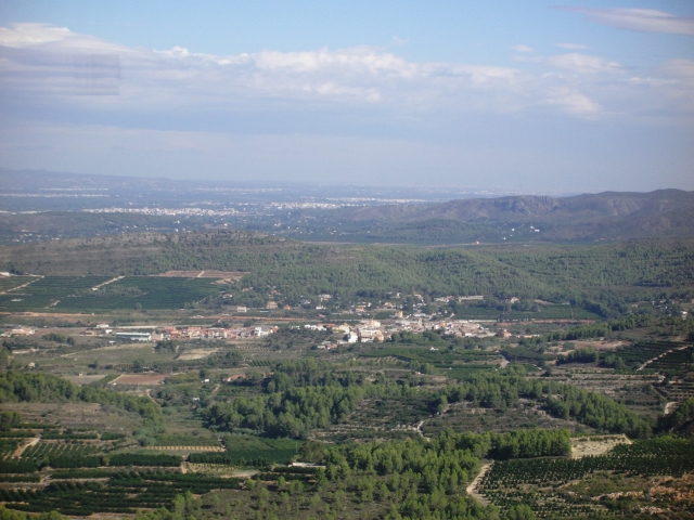
This circular path will allow you to discover the Local Natural Area of Interest of the Barxeta river, an example of a typical riverside ecosystem, with characteristic flora and fauna, as well as its tributary ravines.

Trail:
Loop
Technical data:
Length:
10,80 km
Estimated walking time:
03:20:00
Elevation gain:
310 m
Elevation loss:
310 m
MIDE ratings:
Level of natural risks:
1
Navigation on the trail:
2
Hiking difficulty:
3
Fitness level needed:
3

More information on Montaña Segura

Difficulty rating according to FEDME:
Unknown
Starting point:
Useful information:
Date of certification:
15-04-2011
Date of the act of registration in the Public Register:
20-10-2015
Reference municipality:
Otros municipios por los que transcurre:
District:
Province:
Valencia/València
Cartography IGN MTN25:
0770-3

Downloadable from the Catalogue of the IGN Map Library

See other trails of this promoter:
Protected Natural Spaces:

We advise you to look up the regulations and/or authorisations for using the trails in these conservation areas on the website of the Conselleria de Medio Ambiente, Agua, Infraestructuras y Territorio

  • Riu de Barxeta (Municipal Natural Site)
Key points of the route:

Alt del Mig Almud (peak) - Camino del Pinar (path) - La Barcella - Molló Roig (peak) - Barranc del Llop (ravine) - Camino de les Solanes (path)

Route description (only available in Spanish)

La salida de esta ruta la iniciamos al final de la Avenida Jaime I, hacía al puente que da entrada a la población de Barxeta , pasaremos por el viaducto que cruza el Riu Barxeta, seguimos hacia la rotonda y cogeremos el camino con dirección a Rafelguaraf; en la primera intersección de caminos, nosotros seguiremos recto, por la urbanización La Solana hacia el Mig Almud, donde nos encontraremos con el enlace a la derivación al Pinar des Frares. Poco después encontraremos la derivación que va desde el sendero principal a l'Alt del Mig Almud.
Nos dirigiremos ahora hacia la zona del Rabosero a buscar el cruce con el Camí del Pinar; una vez en este camino seguiremos por nuestra derecha, hacia el Este para poco después llegar al cruce del Camí de Barxeta al Pinar dels Flares, nosotros continuaremos la marcha recto, ahora nos encontraremos en la zona de La Barcella.
Después de caminar durante un rato por esta pista y antes de llegar a su parte alta veremos a nuestra derecha el Alto de la Barsella donde la Derivación 3 se dirige a su cumbre.
Siguiendo el camino llegaremos a un punto en el que pasamos a caminar por senda, y descendiendo por la misma llegaremos al Mollo Roig.
Continuando por la senda bajaremos al Barranc del Llop, por donde descenderemos hasta llegar a su cauce. Seguiremos por el cauce del barranco buscando el Camí de les Solanes hasta llegar al cruce con la carretera CV-600. Continuaremos por la carretera CV-600, por nuestra derecha y nos desviaremos por el Camino Real, antigua vereda que queda a nuestra derecha.
Continuamos por el camino pasando por la zona de la Solana siguiendo la dirección al Paratge del Riu Barxeta, donde antes de llegar encontraremos la derivación que nos lleva al Polideportivo.
Cruzaremos el curso del río por una pasarela de tubos de hormigón y por un camino de asfalto que nos lleva hacia Barxeta , encontraremos la derivación que nos conduce al observatorio de aves, llegaremos a nuestro punto de partida

Downloads:

Beware! Navigation devices may fail, batteries may run out of power and devices may break down. Do not use only electronic means to track your activities in the mountains; they must be used as a complement to the map and compass. Get some proper training and enjoy the mountains.

Other trails connecting with this trail