Cambiar idioma a español / Cambiar idioma a english / Cambiar idioma a valencià

Rate this trail

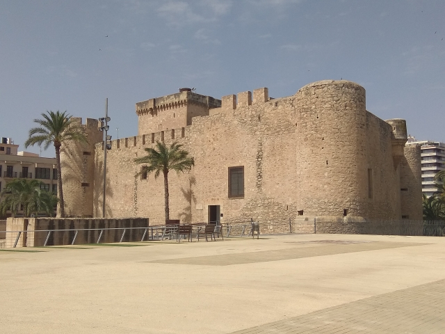
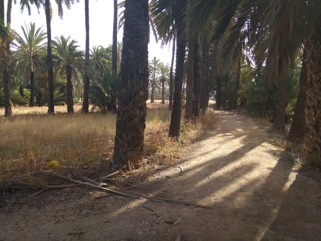
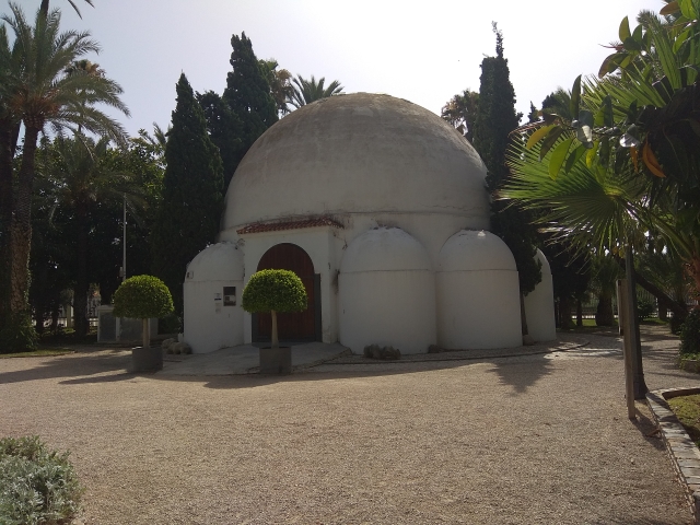
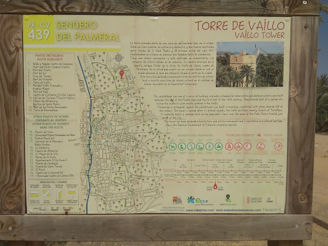
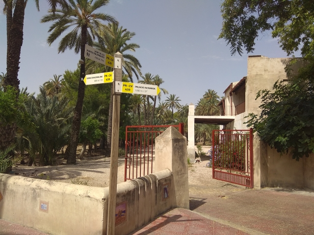
PR-CV 439 SENDERO DEL PALMERAL

Promoter: Ayuntamiento de Elche

Certification status: No quality controls

1 review

There is no proof of quality control on the record of this trail in the last years. For this reason, it is unknown whether it complies with the optimal signage and maintenance conditions for hikers to take the trail following these signs exclusively.
Hikers have to take into consideration that the information about the signage and maintenance of the trails for which the promoter entity is responsible might not be up to date anymore, since it refers to its state on the date of its approval. Furthermore, mountain sports entail risks associated with the activity itself and the environment where they take place, for which any person is fully liable. For this reason, hikes need to be planned properly and adequate training, equipment and sensible use of the trails are required.

The circular trail of El Palmeral is the first approved trail created in Elche, in which the main element of interest is palm trees. This trail runs through a multitude of orchards from north to south and from east to west, trying not to lose the connection with the palm trees throughout the whole route.

Trail:
Loop
Technical data:
Length:
10,00 km
Estimated walking time:
02:10:00
Elevation gain:
85 m
Elevation loss:
85 m
MIDE ratings:
Level of natural risks:
1
Navigation on the trail:
2
Hiking difficulty:
1
Fitness level needed:
2

More information at Montaña Segura

Difficulty rating according to FEDME:
Unknown
Starting point:
Useful information:
Date of certification:
15-06-2015
Date of the act of registration in the Public Register:
20-10-2015
Date of the last Quality Control:
july de 2020
Reference municipality:
District:
Province:
Alicante/Alacant
Cartography IGN MTN25:
0893-1; 0893-2

You can download them from the IGN Map Library Catalog

See other trails of this promoter:
Weather information:
Nearest AVAMET weather station
Key points of the route:

Horts del Pontos (orchards) - Creu del terme (cross) - Torre de Vaíllo (tower) - Mirador del Valle Trenzado (viewpoint) and Acequia Mayor (irrigation ditch) - Edificio Molí del Real (building) - Visitors' Centre - Palacio Altamira (palace) - Palacio Santa María (palace) - Hort de les Portes (orchard) Encarnades - Torre Ressemblanch (tower)

Route description (only available in Spanish)

El recorrido empieza en la plaza del centro de congresos de Elche. Nos dirigimos  hacía el Hort dels Pontos y el Hort del Sol hasta llegar a la sede de la policía nacional donde volveremos a entrar al Hort del Gat.Al salir y siguiendo el sendero atravesaremos el Hort de Villa Carmen. Desde allí a solo unos escasos 200m pasaremos por el Hort de Jaume I y entraremos por el Hort de Vicentet hasta llegar a la salida norte del huerto. Una vez salimos del huerto, nos dirigiremos al Hort de la Torre que está justo en frente donde está el conservatorio de música y la Torre de Vaillos, antigua torre vigía. Después de pasar por la torre de Vaillos iremos más hacia el norte para cruzar, pasando por el camino entre los huertos de Revenga y la Molinera hasta situarnos frente al nuevo Convento de las Clarisas. A partir de ahí nuestra primera parada será en el parque de trafico donde hay un punto-mirador de la ladera del Rio Vinalopó que se pueden divisar 5 de los 9 puentes y pasarelas que hay en la ciudad y el valle trenzado. Después del parque de trafico cruzaremos al parque municipal donde visitaremos el Molí del Real, el centro de Visitantes, La oficina de Turismo ,Hort de Baix y el Castillo de Altamira, un castillo de época medieval integrado en la ruta de los castillos del vinalopó. A partir del Castillo de Altamira, todo el recorrido lo haremos por la ladera del vinalopó pasando por todos los puentes que unen un extremo y otro de Elche. Desde el Hort de Casimira, junto al puente de la Generalitat, cruzaremos al Hort de la Verge. Pasaremos por la periferia de otros huerto públicos y privados hasta llegar a la torre de Ressemblanc, otra Torre vigía que conecta con la de Vaillos. A pocos metros de la torre, pasaremos por el Hort del Matadero. El último tramo, para finalizar el sendero, pasará por varias palmeras singulares y cruzando un lago artificial en el Hort del Montjo hasta llegar al punto de llegada en la plaza de centro de congresos. 

Downloads:

Beware! Navigation devices may fail, batteries may run out of power and devices may break down. Do not use only electronic means to track your activities in the mountains; they must be used as a complement to the map and compass. Get some proper training and enjoy the mountains.