Rate this trail

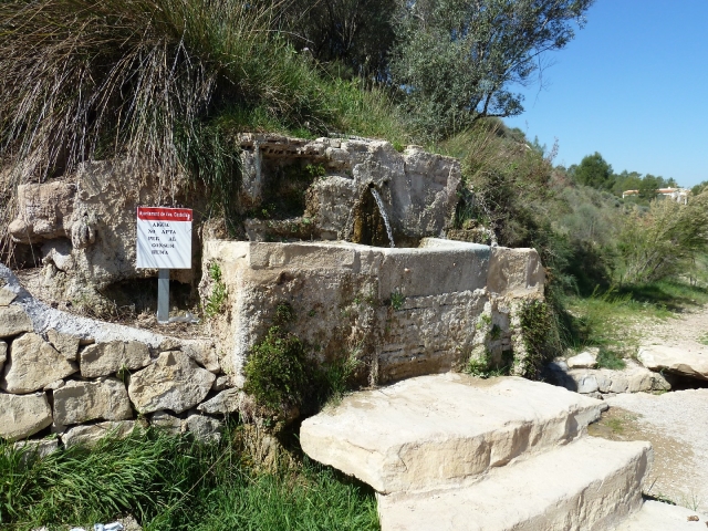
SL-CV 120 LA FONT AMARGA - EL CASTELLET

Promoter: Ayuntamiento de Castelló

Certification status: No quality controls

0 reviews

There is no proof of quality control on the record of this trail in the last years. For this reason, it is unknown whether it complies with the optimal signage and maintenance conditions for hikers to take the trail following these signs exclusively.
Hikers have to take into consideration that the information about the signage and maintenance of the trails for which the promoter entity is responsible might not be up to date anymore, since it refers to its state on the date of its approval. Furthermore, mountain sports entail risks associated with the activity itself and the environment where they take place, for which any person is fully liable. For this reason, hikes need to be planned properly and adequate training, equipment and sensible use of the trails are required.

Trail:
Loop with some overlapping out and back sections
Technical data:
Length:
5,90 km
Estimated walking time:
01:40:00
Elevation gain:
95 m
Elevation loss:
95 m
MIDE ratings:
Level of natural risks:
1
Navigation on the trail:
2
Hiking difficulty:
2
Fitness level needed:
2

More information on Montaña Segura

Difficulty rating according to FEDME:
Unknown
Starting point:
Interest Tags:
Trail with historical-artistic interest
Useful information:
Date of certification:
15-04-2011
Reference municipality:
District:
Province:
Valencia/València
Cartography IGN MTN25:
0770-3; 0769-4

Downloadable from the Catalogue of the IGN Map Library

See other trails of this promoter:
Weather information:
Key points of the route:

Font amarga (spring) - Paratge de la Font amarga (natural area) - Barranc Cuenca (ravine) - Barranc el Castellet (ravine) - Caseta Coets (old rural house) on the Font Amarga path- Barranc d'Escuriet (ravine) - Escales - Camino de la Font Amarga (path) - Ginesta - Paratge font Amarga (natural area) - Font Amarga (spring)

Route description (only available in Spanish)
Iniciamos el recorrido desde el paraje de la Font Amarga. Junto en la zona para aparcar hay un cartel informativo del paraje y el primer poste indica la dirección a través de Las Salinas de Manuel por un sendero a la parte más externa del paraje. Ya en las Salinas observamos el Limonium Manssnetianum. A la salida de las Salinas tenemos el Panel 2 con información del sendero y sobre el Limonium y junto el poste 2 Indica la dirección a Font Amarga y al Barranc de Cuenca continuamos hacia el barranco de Cuenca por un camino de tierra y pronto encontramos el poste 3, indica Font amarga, Limonium o Terrer Roig, atravesamos el camino asfaltado y encontramos el poster 4 indica tomar el barranco de Cuenca, continuamos por su interior, pasamos junto al barranco del Castellet y a continuación veremos una carrasca centenaria y llegamos hasta la Caseta Coets. La Caseta Coets también podría ser el punto de inicio puesto que cerca de este lugar aparcan coches y es el punto más próximo a la población. De hecho tanto en la prehomologación como en la homologación se ha iniciado el recorrido desde aquí. Junto a la Caseta Coets tenemos el Panel 3 Caseta Coets explicativo del recorrido y el poste 5 indica la dirección a seguir a través del Barranc de l´Escuriet. Seguimos por el interior del l´Escuriet a través de una galería de vegetación. Llegamos al Poste 6 que nos indica Font Amarga l´Escuriet Castellet, junto una escalera con escalones de madera para subir al Camí de La Font Amarga. Continuamos por el camino asfaltado entre campos de naranjos llegamos a la bifurcación del poste 4, señala el barranco de Cuenca que hemos tomado antes y el otro poste 3 a en el otro lado de camino que indica a la Font Amarga Limonium continuamos por este hasta llegar al paraje de la fuente Amarga y observar dos sendas, cogemos la más en el interior del paraje hasta llegar a la Font Amarga.
Downloads:

Beware! Navigation devices may fail, batteries may run out of power and devices may break down. Do not use only electronic means to track your activities in the mountains; they must be used as a complement to the map and compass. Get some proper training and enjoy the mountains.