Cambiar idioma a español / Cambiar idioma a english / Cambiar idioma a valencià

Rate this trail

SL-CV 135 PASEAR POR BENIJÓFAR

Promoter: Ayuntamiento de Benijófar

Certification status: No quality controls

0 reviews

There is no proof of quality control on the record of this trail in the last years. For this reason, it is unknown whether it complies with the optimal signage and maintenance conditions for hikers to take the trail following these signs exclusively.
Hikers have to take into consideration that the information about the signage and maintenance of the trails for which the promoter entity is responsible might not be up to date anymore, since it refers to its state on the date of its approval. Furthermore, mountain sports entail risks associated with the activity itself and the environment where they take place, for which any person is fully liable. For this reason, hikes need to be planned properly and adequate training, equipment and sensible use of the trails are required.

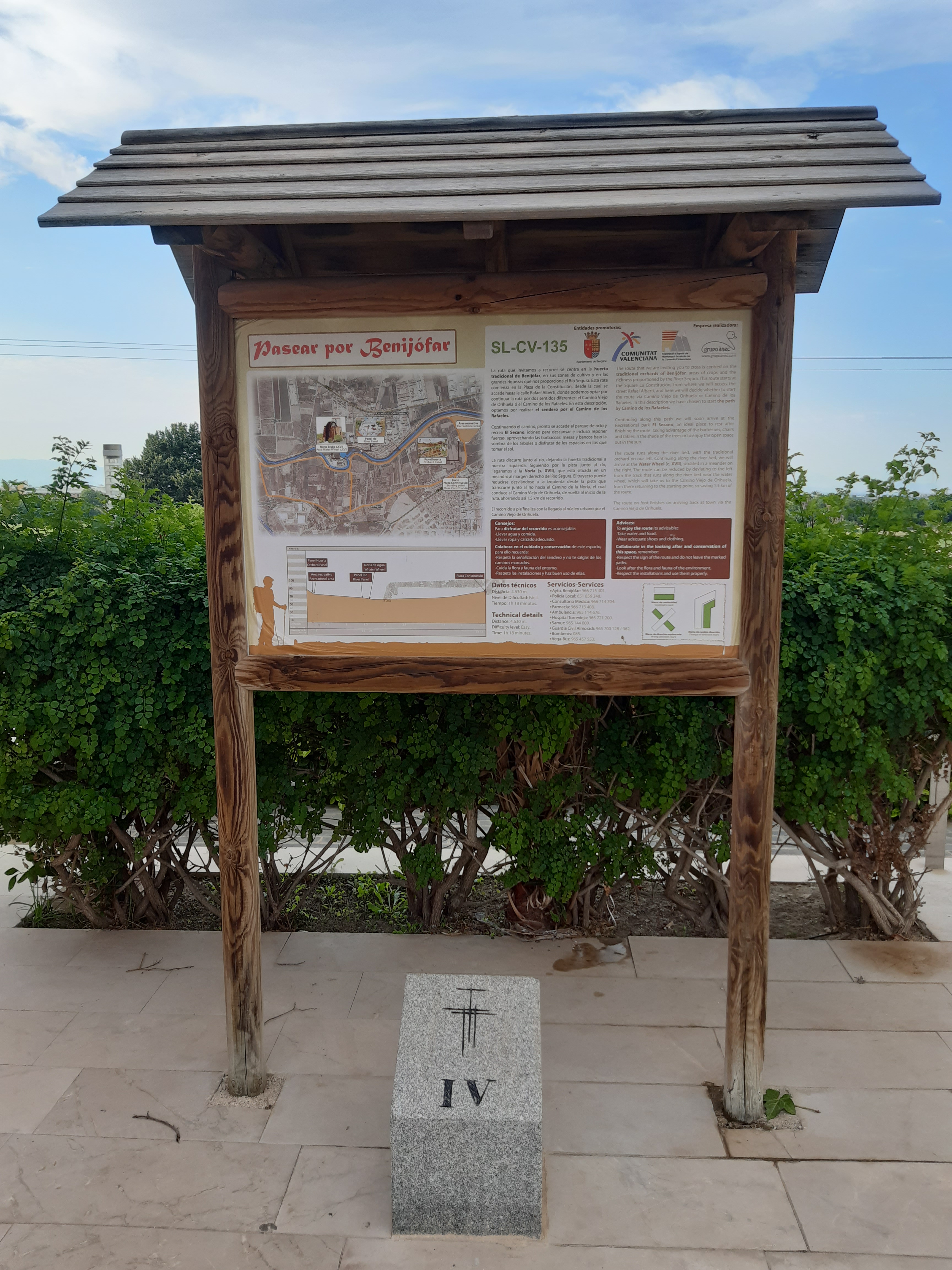
This is an easy route of cultural interest, which goes through the agricultural landscapes of Benijófar, visiting old constructions such as the waterwheel and the network of irrigation ditches that belong to the water system of the Segura River.

Trail:
Loop
Technical data:
Length:
4,60 km
Estimated walking time:
01:10:00
Elevation gain:
25 m
Elevation loss:
25 m
MIDE ratings:
Level of natural risks:
1
Navigation on the trail:
2
Hiking difficulty:
1
Fitness level needed:
1

More information at Montaña Segura

Difficulty rating according to FEDME:
Unknown
Starting point:
Useful information:
Date of certification:
28-12-2010
Date of the act of registration in the Public Register:
20-10-2015
Date of the last Quality Control:
august de 2019
Reference municipality:
Province:
Alicante/Alacant
Cartography IGN MTN25:
0914-3; 0914-1

You can download them from the IGN Map Library Catalog

See other trails of this promoter:
Weather information:
Nearest AVAMET weather station
Key points of the route:

Plaza Constitución (square) - El Secano Area - Acequia de Arriba (irrigation ditch) - Noria de Benijófar (water wheel) - Casa de los Valeros (old rural house) - Plaza de la Constitución (square)

Route description (only available in Spanish)

En el municipio de Benijófar, encontramos el panel inicio-fin del sendero ubicado en la Plaza de la Constitución. El sendero comienza en este punto, desde el cual y bajando por unas escaleras en dirección NO, vemos el primer poste que nos indica hacia la derecha el área recreativa 'El Secano', y hacia la izquierda la Noria del S.XVII. Continuamos hacia la derecha, (aunque podríamos realizarlo al contrario), por la carretera poco frecuentada de asfalto, que en breve nos conduce hacia el área recreativa 'El Secano'. Sin entrar en ella, nos desviamos por la parte izquierda de la carretera, zona de parque, por donde transcurre el sendero durante unos minutos, y en el cual encontramos el panel interpretativo Huerta. Poco después volvemos a la carretera de nuevo, para posteriormente encontrar la pista de tierra paralela al río Segura, por la que seguimos hacia la izquierda. Sin dejarla, pronto llegamos al panel interpretativo Ecosistema Río Segura. Continuamos y seguidamente encontramos la Noria, elemento del patrimonio hidráulico rural del s. XVII, donde vemos otro panel interpretativo. Justo después un poste nos indica el retorno a Benijófar por el sendero, o bien por otro camino más corto, con el que vuelve a enlazar el sendero posteriormente. La pista continúa paralela al río, hasta que encontramos un poste que nos indica de nuevo el regreso al casco urbano de Benijófar, comenzando la carretera asfaltada. Llegando a un cruce, en el que continuamos por la izquierda, atravesando zonas de huerta y el enlace con el camino que traía desde la Noria. Llegamos a la calle Rafael Alberti y al punto de inicio-fin del sendero.

Downloads:

Beware! Navigation devices may fail, batteries may run out of power and devices may break down. Do not use only electronic means to track your activities in the mountains; they must be used as a complement to the map and compass. Get some proper training and enjoy the mountains.

Comments: