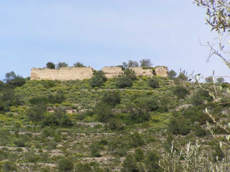
This variant offers a shortcut for the SL-CV 137 trail running through the foot of the castle of Navarrés.
More information on Montaña Segura
Downloadable from the Catalogue of the IGN Map Library
We advise you to look up the regulations and/or authorisations for using the trails in these conservation areas on the website of the Conselleria de Medio Ambiente, Agua, Infraestructuras y Territorio
Los Chorradores (parking lot)- Granja de la Perdiz (farm) - Cementerio de Navarrés (cemetery) - Casica de Castelló (old country house)- Castillo de Navarrés (fort) - Road to Escalona
Desde un segundo parking en el paraje natural de los Chorradores tomamos la variante del Castillo para ascender durante 2 km por carretera y camino entre masas forestales, campos de cultivo y alguna casa de campo. El descenso pronunciado hasta el final. Pasaremos cerca del Castillo de Navarrés dejando este a unos 250 m.
Beware! Navigation devices may fail, batteries may run out of power and devices may break down. Do not use only electronic means to track your activities in the mountains; they must be used as a complement to the map and compass. Get some proper training and enjoy the mountains.