Rate this trail

PR-CV 105 CERRO DE LOS MOLINOS - ALCUBLAS - CUEVA SABUQUERA

Promoter: Ayuntamiento de Alcublas

Certification status: Conditioned quality control

1 review

Following the inspection carried out by trail technicians, this trail has been declared of "limited adequacy" as a result of the faults detected in the signage. These include inadequate horizontal signs (paint markers) and/or vertical ones (trailheads and information boards) or lacking direction markers that do not provide sufficient information to properly follow the route. The builder of this trail has been informed of the situation.
For safety reasons and during maintenance work, it is advised to be extremely careful while taking this route. Furthermore, mountain sports entail risks associated with the activity itself and the environment where they take place, for which any person is fully liable. For this reason, hikes need to be planned properly and adequate training, equipment and sensible use of the trails are required.

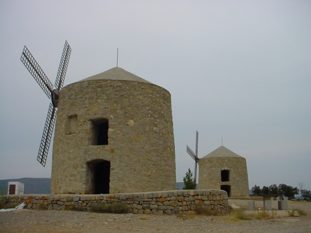
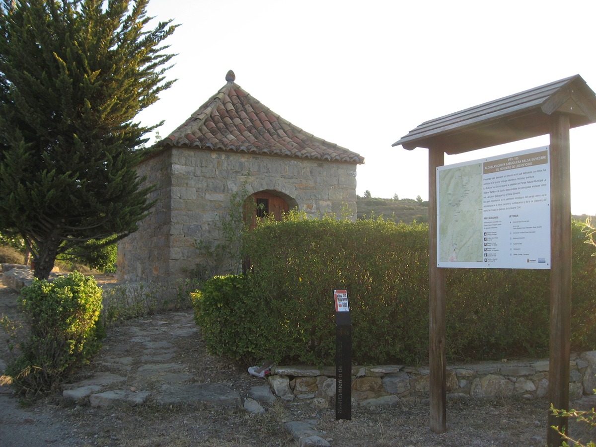
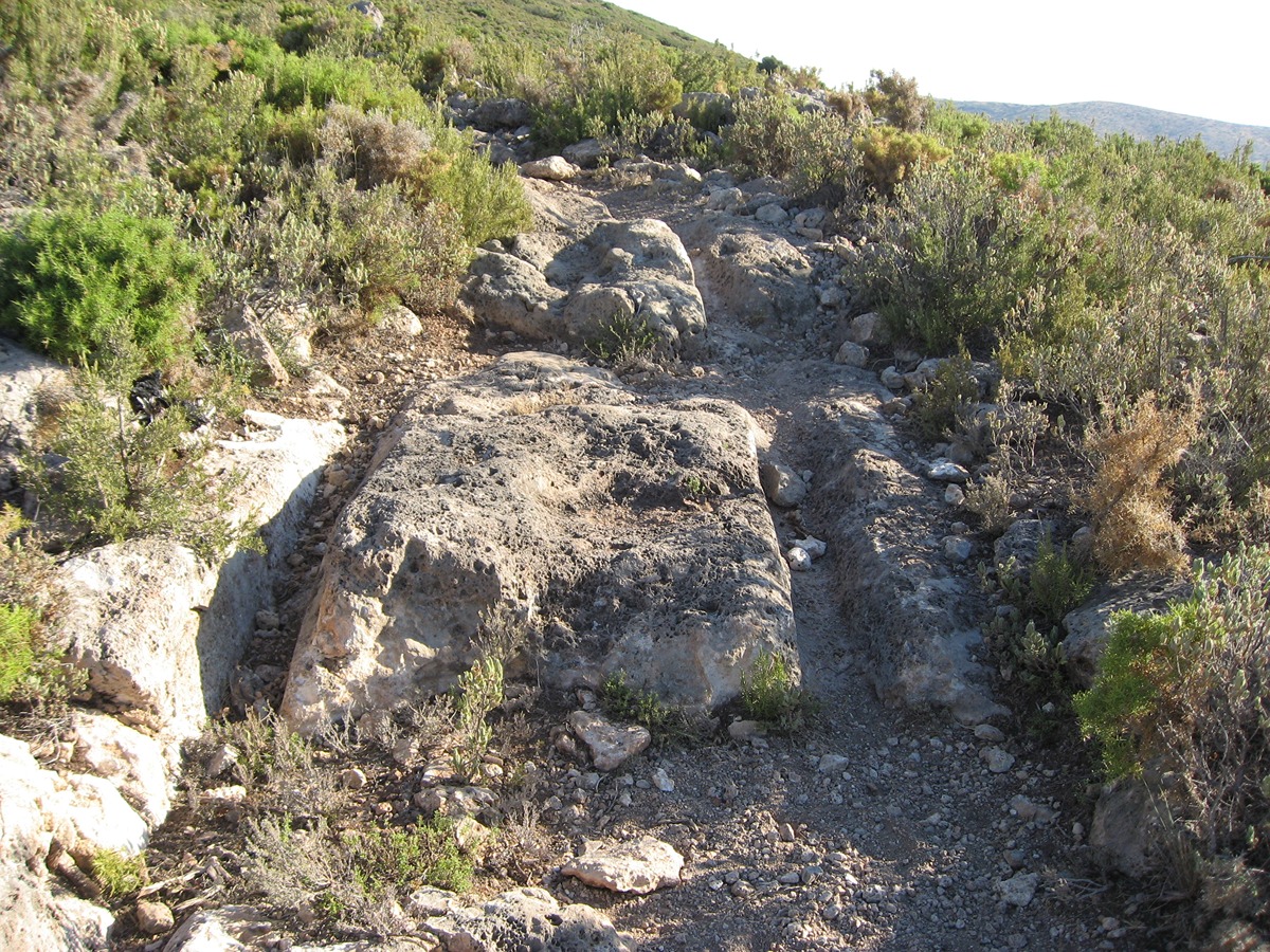
This trail follows the old path used by the wagons to bring down the snow from the snowdrifts, where you will find old ice houses and lime kilns built in dry stone. Additionally, in its final stretch you will find the Sabuquera cave and old trenches from the war.

Trail:
One way (point-to-point)
Technical data:
Length:
8,40 km
Estimated walking time:
02:45:00
Elevation gain:
340 m
Elevation loss:
260 m
MIDE ratings:
Level of natural risks:
2
Navigation on the trail:
2
Hiking difficulty:
2
Fitness level needed:
2

More information on Montaña Segura

Difficulty rating according to FEDME:
Unknown
Starting point:
Useful information:
Date of certification:
15-11-1998
Date of the act of registration in the Public Register:
22-05-2007
Date of the last Quality Control:
september de 2023
Reference municipality:
District:
Province:
Valencia/València
Cartography IGN MTN25:
0667-1; 0639-3

Downloadable from the Catalogue of the IGN Map Library

See other trails of this promoter:
Protected Natural Spaces:

We advise you to look up the regulations and/or authorisations for using the trails in these conservation areas on the website of the Conselleria de Medio Ambiente, Agua, Infraestructuras y Territorio

  • Solana y Barranco Lucía (Municipal Natural Site)
Key points of the route:

Cerro de los Molinos (peak) - Alcublas - Ermita de Santa Bárbara and San Agustín (chapels) - Balsa Silvestre (pond) - Sabuquera Cave Road - Cueva Sabuquera (cave) - CV-235

Route description (only available in Spanish)

Desde el cerro de los Molinos comenzaremos nuestra andadura con una bajada pronunciada hacia la población de Alcublas. Atravesaremos el casco urbano por su calle principal para abandonar el pueblo en dirección a la ermita de Santa Bárbara y a la ermita de San Agustín. Continuaremos por un tramo de senda hasta encontrarnos con el camino de la Balsa de Silvestre para desviarnos a una senda dirección a la balsa y la Cumbre. Ya empezamos a encontrar con caleras. A partir de aquí empieza nuestra subida pronunciada hacia la cumbre por una antigua senda de herradura donde podemos comprobar las huellas de rodadura de los carros marcadas sobre la piedra. Seguimos encontrando caleras a nuestro paso y ventisqueros. A partir del ventisquero de la Silla nuestra ruta continua por un antiguo camino que nos llevará en su parte final al ventisquero del Barranco de Lucia para tomar una pista forestal que es el camino de la Cueva Sabuquera que ya no la abandonaremos hasta el final de nuestro recorrido. Pasaremos por la cueva Sabuquera con un ventisquero en su interior y más adelante con trincheras y refugios de la guerra civil. Nuestro sendero termina en la carretera CV-235 de Alcublas-Sacañet.

Downloads:

Beware! Navigation devices may fail, batteries may run out of power and devices may break down. Do not use only electronic means to track your activities in the mountains; they must be used as a complement to the map and compass. Get some proper training and enjoy the mountains.

Other trails connecting with this trail