Rate this trail

PR-CV 131.6 RUTA DEL BOHILGUES Y DEL VAL

Promoter: ADIRA. Asociación para el Desarrollo Integral del Rincón de Ademuz

Certification status: No quality controls

0 reviews

There is no proof of quality control on the record of this trail in the last years. For this reason, it is unknown whether it complies with the optimal signage and maintenance conditions for hikers to take the trail following these signs exclusively.
Hikers have to take into consideration that the information about the signage and maintenance of the trails for which the promoter entity is responsible might not be up to date anymore, since it refers to its state on the date of its approval. Furthermore, mountain sports entail risks associated with the activity itself and the environment where they take place, for which any person is fully liable. For this reason, hikes need to be planned properly and adequate training, equipment and sensible use of the trails are required.

Through the centre and south of the Rincón de Ademuz region and following the babbling of the Bohilgues river, you will be protected by dense vegetation until you reach the village of Ademuz. The second part of This route goes up the Rambla del Val, crossing the mountains of La Muela and Picadoras to first approach the village of Val de la Sabina and then finish in the town of Casas Altas.

Trail:
One way (point-to-point)
Technical data:
Length:
14,90 km
Estimated walking time:
04:45:00
Elevation gain:
375 m
Elevation loss:
620 m
MIDE ratings:
Level of natural risks:
2
Navigation on the trail:
2
Hiking difficulty:
2
Fitness level needed:
3

More information on Montaña Segura

Difficulty rating according to FEDME:
Unknown
Starting point:
Useful information:
Date of certification:
15-07-1999
Date of the act of registration in the Public Register:
22-05-2007
Reference municipality:
Otros municipios por los que transcurre:
District:
Province:
Valencia/València
Cartography IGN MTN25:
0612-4

Downloadable from the Catalogue of the IGN Map Library

Protected Natural Spaces:

We advise you to look up the regulations and/or authorisations for using the trails in these conservation areas on the website of the Conselleria de Medio Ambiente, Agua, Infraestructuras y Territorio

  • Río Bohilgues (Flora Micro-reserve)
  • Ríos del Rincón de Ademuz (SIC - Site of Community Interest)
Key points of the route:

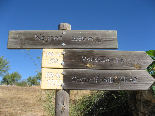
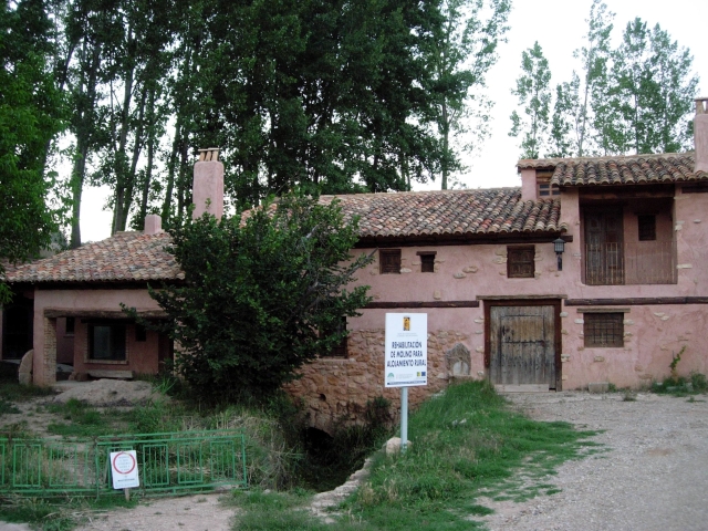
Vallanca - Molino de la Villa (mill) - La Fuencaliente - La Veguilla - Hoz del río Bohilgues (gorge) - Fuente del Tío J. Manzano (spring) - Ademuz - La Muela - El Cerrito - Val de la Sabina - Casas Altas

Route description (only available in Spanish)

Salimos de Vallanca por la senda que baja hacia los molinos. Enseguida pasamos por las ruinas del Molino de la Villa y accedemos a otro camino más ancho que nos conduce a La Fuencaliente. Después de pasar la presa de Vallanca y antes de llegar a las casas de La Veguilla cogemos la senda de la Hoz. Poco a poc finaliza el camino y el sendero se encajona entre las paredes siguiendo el cauce del río Bohilgues que atraviesa el paraje de la Hoz. Al final de la misma cruzamos al otro lado por el puente de la Central y seguimos por la senda de la Fuensanta pasando por la Fuente del tío Juan Manzano hasta un camino ya en las proximidades de Ademuz. El primer tramo acaba en la Fuente vieja y la oficina de información turística en el restaurado Molino de la Villa.Cruzamos de sur a norte la población de Ademuz por la Avda. de Valencia (N-330ª) hasta llegar al Puente de la Vega y la carretera a Val de la Sabina.  Pasamos por el barrio de San Roque donde está la casa forestal y en la parte alta abandonamos la pista a la izquierda y remontamos la Rambla de la Vega pasando bajo el viaducto de la N-330 y remontando la Rambla del Val por la senda de la umbría de la Muela.Llegamos a la bifurcación de Val de la Sabina o Casas Altas en la partida de Picadoras. Bajamos por la izquierda hasta la Rambla del Val que seguimos a la derecha hasta la carretera del Val a Sesga y ahora a la izquierda hasta la entrada de la aldea de Ademuz.Volvemos atrás por el mismo camino y en el cruce, ahora el sendero se dirige al collado del cerrito. Dejamos atrás el bosque y por los caminos de los cultivos de secano donde podremos observar algunas de las barracas, construcciones de piedra en seco como la de las Picadoras. Entramos en Casas Altas por los Pajares del Otro Lado y el paraje de La Puente. 

Downloads:

Beware! Navigation devices may fail, batteries may run out of power and devices may break down. Do not use only electronic means to track your activities in the mountains; they must be used as a complement to the map and compass. Get some proper training and enjoy the mountains.

Other trails connecting with this trail