Rate this trail

PR-CV 228 MOLA DE LA TODOLELLA.

Promoter: Ayuntamiento de Todolella

Certification status: Positive quality control

0 reviews

There is no proof of quality control on the record of this trail in the last years. For this reason, it is unknown whether it complies with the optimal signage and maintenance conditions for hikers to take the trail following these signs exclusively.
Hikers have to take into consideration that the information about the signage and maintenance of the trails for which the promoter entity is responsible might not be up to date anymore, since it refers to its state on the date of its approval. Furthermore, mountain sports entail risks associated with the activity itself and the environment where they take place, for which any person is fully liable. For this reason, hikes need to be planned properly and adequate training, equipment and sensible use of the trails are required.

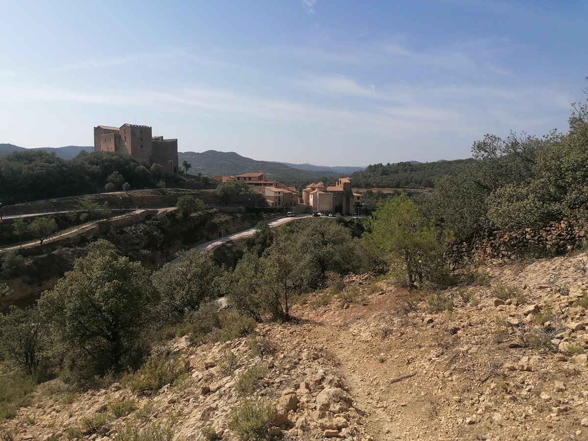
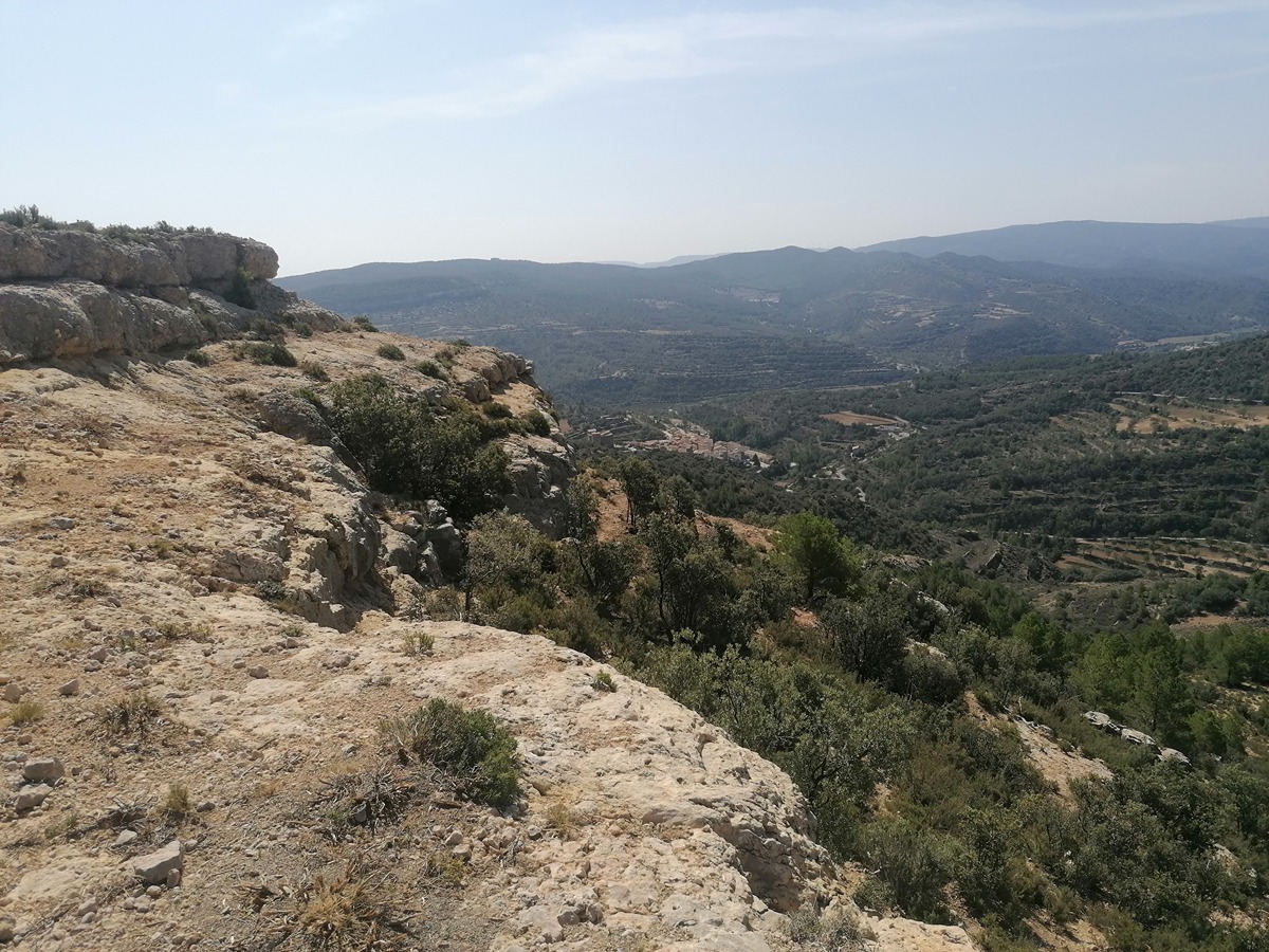
Circular trail that goes up to the Todolella butte along the Bordón path, a pilgrimage route to the town in the region of Teruel. You will see the remains of trenches from the Civil War going down through Roca Alta and l'Home de Pedra, where you will have a spectacular panoramic view of the town and its medieval castle.

Trail:
Loop with some overlapping out and back sections
Technical data:
Length:
13,20 km
Estimated walking time:
04:15:00
Elevation gain:
530 m
Elevation loss:
530 m
MIDE ratings:
Level of natural risks:
2
Navigation on the trail:
2
Hiking difficulty:
2
Fitness level needed:
3

More information on Montaña Segura

Difficulty rating according to FEDME:
Unknown
Starting point:
Useful information:
Date of certification:
28-05-2003
Date of the act of registration in the Public Register:
22-05-2007
Date of the last Quality Control:
september de 2024
Reference municipality:
District:
Province:
Castellón/Castelló
Cartography IGN MTN25:
0519-4; 0544-2

Downloadable from the Catalogue of the IGN Map Library

See other trails of this promoter:
Key points of the route:

Todolella - Mas de Jaume (estate) - Morral de l'Àguila. - Mola de la Todolella (butte) - Assagador de les Refoies (cattle track) - Mas de Vinyals (estate). - Puntal de la Lloma (peak) - L'Home de Pedra - Todolella.

Route description (only available in Spanish)

Desde la entrada de Todolella cruzaremos el pueblo y tomaremos un camino a mano derecha paralelo al barranco de Todolellla hasta llegar al mas de Jaume donde, tras cruzar el camino y seguir paralelos al barranco del Lladró, llegaremos a una pista que nos llevara al collado. Tomaremos el camino por la derecha por todo el cordal que limita con Teruel siguiendo la vereda de San Jaime, donde se encuentra el parque eólico. En dos tramos el PR-CV 228 deja el camino para ir por la vía pecuaria en un nivel superior.

Pasaremos por unas trincheras, bajaremos hasta un collado y giraremos a la derecha hacia la balsa para tomar el camino al mas de Vinyals. Cruzaremos el barranco del mas de Vito y seguiremos el antiguo camino paralelo a la pista que nos llevara a un cruce donde seguiremos recto por un llano y desde aquí comenzaremos a subir hasta llegar a Roca Alta. Seguiremos cresteando y llegaremos en bajada por el azagador hacia la población de Todolella hasta llegar al barranco de Pixatinters donde giraremos a la izquierda y ya por camino hasta a la fuente y lavadero. Solo nos quedará cruzar el pueblo para volver al punto de inicio.

Downloads:

Beware! Navigation devices may fail, batteries may run out of power and devices may break down. Do not use only electronic means to track your activities in the mountains; they must be used as a complement to the map and compass. Get some proper training and enjoy the mountains.

Other trails connecting with this trail