Rate this trail

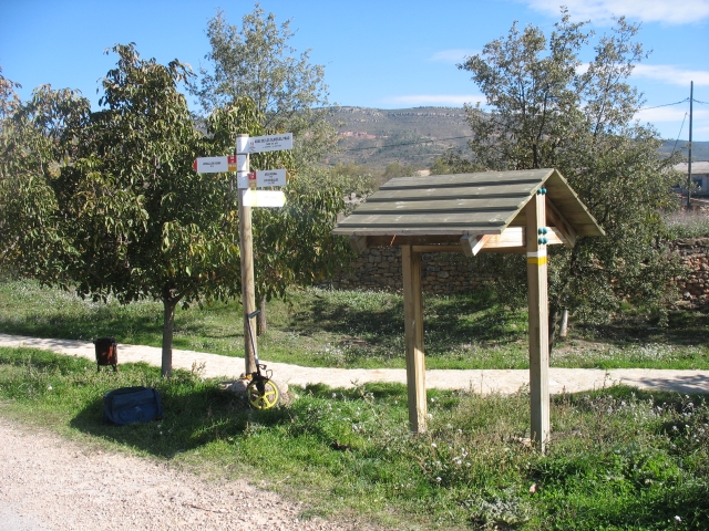
PR-CV 323 RIO ARCOS - PEÑA BLANCA - LOSILLA DE ARAS

Promoter: Ayuntamiento de Aras de los Olmos

Certification status: No quality controls

0 reviews

There is no proof of quality control on the record of this trail in the last years. For this reason, it is unknown whether it complies with the optimal signage and maintenance conditions for hikers to take the trail following these signs exclusively.
Hikers have to take into consideration that the information about the signage and maintenance of the trails for which the promoter entity is responsible might not be up to date anymore, since it refers to its state on the date of its approval. Furthermore, mountain sports entail risks associated with the activity itself and the environment where they take place, for which any person is fully liable. For this reason, hikes need to be planned properly and adequate training, equipment and sensible use of the trails are required.

The PR-CV 323 trail runs through one of the most important forest heritage sites in the province of Valencia. Along its route, between the provinces of Cuenca, Valencia and Teruel, you can alternate sections along the banks of the Arcos River with rugged trails through extensive pine forests and ascend to Puntal de Peña Blanca, where you will enjoy the best views of Peña Rubia, the gorge of the Arcos River and the Javalambre mountain range to the north.

Trail:
One way (point-to-point)
Technical data:
Length:
19,90 km
Estimated walking time:
07:05:00
Elevation gain:
1.125 m
Elevation loss:
685 m
MIDE ratings:
Level of natural risks:
2
Navigation on the trail:
2
Hiking difficulty:
2
Fitness level needed:
4

More information on Montaña Segura

Difficulty rating according to FEDME:
Unknown
Useful information:
Date of certification:
15-11-2007
Date of the act of registration in the Public Register:
02-06-2009
Reference municipality:
District:
Province:
Valencia/València
Cartography IGN MTN25:
0637-2; 0638-1

Downloadable from the Catalogue of the IGN Map Library

See other trails of this promoter:
Protected Natural Spaces:

We advise you to look up the regulations and/or authorisations for using the trails in these conservation areas on the website of the Conselleria de Medio Ambiente, Agua, Infraestructuras y Territorio

  • Sabinar de Alpuente (SIC - Site of Community Interest)
Weather information:
Key points of the route:

Río Turia (river) - Pino de la Legua (pine tree) - Mompedroso - Puntal de Peña Banca (peak) - Senda del Mas de Soria (path) - Las Torcas. Río Arcos (river) - Barranco Escaiz (ravine) - Losilla de Aras

Route description (only available in Spanish)

El itinerario del sendero PR-CV 323 tiene su inicio en la desembocadura del río Arcos en el río Turia. Remontamos unos metros el río y subiremos por el camino llegando a un cruce de pistas con un enlace al sendero PR-CU 11, nosotros seguiremos por la derecha y vadearemos el río Arcos continuando por el camino de la Cuesta de los Flicos que asciende haciendo lazadas hasta un collado donde cambiamos de vertiente de la sierra y continuamos en ascenso hasta llegar a la bifurcación del acceso al Pino de la Legua. El sendero sigue de frente en este cruce y se dirige al Barranco del Fresno por donde seguimos durante un poco más de medio kilómetro. El camino sale del barranco y continuamos por él hasta llegar al cruce con la pista de la Umbría del Hornillo que seguiremos por la izquierda. Llegaremos así a la Ceja de Mompedroso, una pista-cortafuegos por donde subiremos al Alto de Mompedroso y nos cruzaremos con el PR-CV 130. Seguimos rectos en este enlace dejando a nuestra derecha la cumbre del Mompedroso y cuando se acaba la pista continuaremos rectos por una senda que nos llevará al Puntal de Peña blanca (1.121 metros). La senda desciende del Puntal de Peña Blanca por el Barranco de la Cueva de la Jaranga donde se nos une el PR-CV 130. Seguimos por la Senda del Mas de Soria y de las Carboneras donde el PR-CV 130 se desvía por la derecha y nosotros seguimos por la Umbría del Tajadal hasta que llegamos a Las Torcas del río Arcos. Cruzamos el río y remontándolo por su margen derecha pasaremos por los Molinos de Las Torcas y de las Viñas. Vadeamos el río de nuevo y comenzamos a subir por el margen derecho del Barranco Escaiz. Pasaremos por la Peña de las Cruces y más adelante cruzaremos el barranco (enlaces PR-CV 130 y GR 37) para seguir ascendiendo por su margen izquierda. Volveremos a cruzar el barranco de Escaiz y seguiremos por un camino (rumbo este) que nos llevará a Losilla de Aras, fin de la ruta y enlaces a SL-CV 63, PR-CV 130 y GR 37. 

Downloads:

Beware! Navigation devices may fail, batteries may run out of power and devices may break down. Do not use only electronic means to track your activities in the mountains; they must be used as a complement to the map and compass. Get some proper training and enjoy the mountains.

Other trails connecting with this trail