Rate this trail

PR-CV 331 SENDERO DE LAS TRAVINAS

Promoter: Ayuntamiento de Alpuente

Certification status: Conditioned quality control

0 reviews

Following the inspection carried out by trail technicians, this trail has been declared of "limited adequacy" as a result of the faults detected in the signage. These include inadequate horizontal signs (paint markers) and/or vertical ones (trailheads and information boards) or lacking direction markers that do not provide sufficient information to properly follow the route. The builder of this trail has been informed of the situation.
For safety reasons and during maintenance work, it is advised to be extremely careful while taking this route. Furthermore, mountain sports entail risks associated with the activity itself and the environment where they take place, for which any person is fully liable. For this reason, hikes need to be planned properly and adequate training, equipment and sensible use of the trails are required.

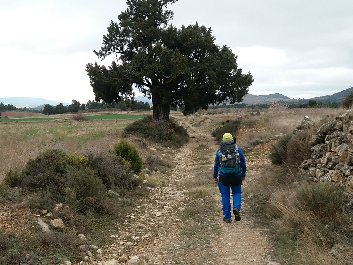
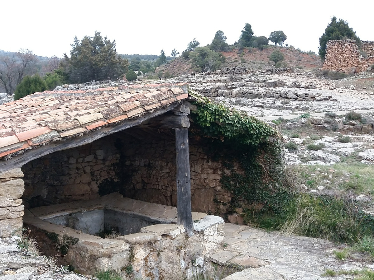
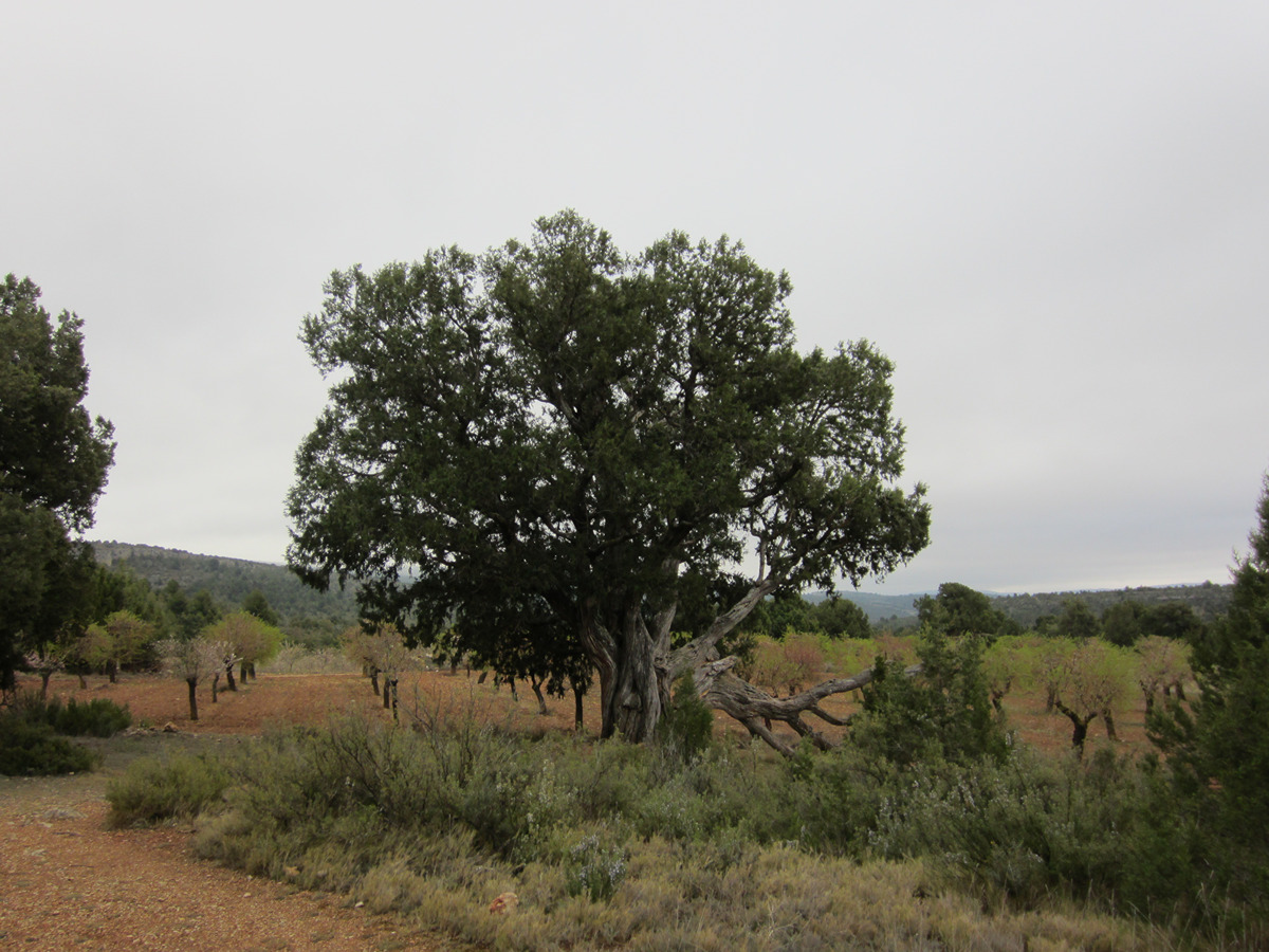
This trail runs through relict forests of juniper and it will allow you to discover some of the most genuine mountain elements, such as the agricultural landscape of grain fields or the traditional architecture of the area.

Trail:
Loop
Technical data:
Length:
11,55 km
Estimated walking time:
03:30:00
Elevation gain:
310 m
Elevation loss:
310 m
MIDE ratings:
Level of natural risks:
1
Navigation on the trail:
2
Hiking difficulty:
2
Fitness level needed:
3

More information on Montaña Segura

Difficulty rating according to FEDME:
Unknown
Interest Tags:
Trail with historical-artistic interest

Useful information:
Date of certification:
15-09-2006
Date of the last Quality Control:
march de 2022
Reference municipality:
District:
Province:
Valencia/València
Cartography IGN MTN25:
0638-1; 0638-2

Downloadable from the Catalogue of the IGN Map Library

See other trails of this promoter:
Protected Natural Spaces:

We advise you to look up the regulations and/or authorisations for using the trails in these conservation areas on the website of the Conselleria de Medio Ambiente, Agua, Infraestructuras y Territorio

  • Sabinar de Alpuente (SIC - Site of Community Interest)
  • Sabinar de Alpuente - Alto Turia (SAC - Special Area of Conservation)
Weather information:
Key points of the route:

La Almeza - Navajo del Pinazo (pond) - Cañada de los Pastores (cattle track) - Sabina la Juana (juniper) - La Torre (tower) - La Almeza

Route description (only available in Spanish)

Desde La Almeza la ruta discurre un tramo por camino asfaltado en dirección norte, dejando la Canaleja a la izquierda, veremos a la derecha del camino un gran ejemplar de chopo negro, árbol monumental. Tras el primer kilómetro de sendero llegamos a una bifurcación que tomamos a la izquierda, e inmediatamente después nos desviamos por el camino de la derecha. Cuando este camino termina en unos sembrados, tomamos la senda pedregosa desembocar en una pista forestal a la altura del despoblado de Pozo Marín.

La ruta continúa por la pista que tomamos hacia la izquierda en dirección noroeste. Seguimos por la pista principal hasta llegar a una bifurcación con una balsa conocida en la zona como navajo o gipe. Seguimos la pista por la izquierda. A partir de aquí coincide con el GR 37 durante un tramo. Unos 500 m después del navajo nos desviaremos por un camino a la izquierda y pegados al ribazo de un erial llegaremos hasta los corrales de Cañada Pastores. Tras el segundo corral, a la derecha del camino, junto a un campo de almendros contemplamos la monumental travina la Juana.

Salimos de nuevo a la pista principal y seguimos hacia la izquierda para ir subiendo hacia la parte alta del monte de la Ceja. Siguiendo por la pista principal y descartando algún camino a la izquierda, en apenas 200 m veremos una senda que se adentra en la pinada. La senda nos devuelve de nuevo a la pista la cual seguimos hasta llegar a una pista donde vemos un refugio de color verde a la derecha. Nosotros seguimos a la izquierda y en apenas 100 m tomamos una antigua senda que sale a la izquierda para bajar hacia La Torre.

Caminamos 300 m por la carretera comarcal y tomamos el primer camino de tierra a la izquierda. En la primera bifurcación seguiremos recto y a partir de ahí estaremos atentos, pues durante unos 5 km iremos serpenteando por caminos y azagadores para volver a la aldea de La Almeza.

Downloads:

Beware! Navigation devices may fail, batteries may run out of power and devices may break down. Do not use only electronic means to track your activities in the mountains; they must be used as a complement to the map and compass. Get some proper training and enjoy the mountains.

Other trails connecting with this trail