Rate this trail

SL-CV 107 SANTA BARBARA - ONDA

Promoter: Ayuntamiento de Onda

Certification status: No quality controls

0 reviews

There is no proof of quality control on the record of this trail in the last years. For this reason, it is unknown whether it complies with the optimal signage and maintenance conditions for hikers to take the trail following these signs exclusively.
Hikers have to take into consideration that the information about the signage and maintenance of the trails for which the promoter entity is responsible might not be up to date anymore, since it refers to its state on the date of its approval. Furthermore, mountain sports entail risks associated with the activity itself and the environment where they take place, for which any person is fully liable. For this reason, hikes need to be planned properly and adequate training, equipment and sensible use of the trails are required.

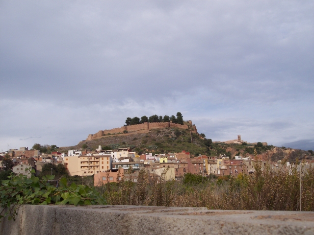
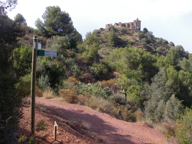
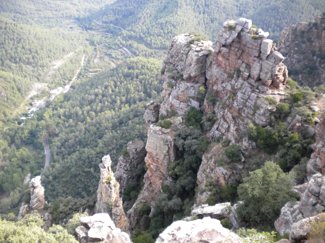
This route starts at the old Reixa mill, now the tourist office. From the old chapel of Santa Bárbara, you can contemplate a beautiful view of the town, its castle and the sea. You go down a narrow, aromatic path that descends, through a cork oak forest, to finally return to the mill.

Trail:
Loop
Technical data:
Length:
8,60 km
Estimated walking time:
02:40:00
Elevation gain:
255 m
Elevation loss:
255 m
MIDE ratings:
Level of natural risks:
2
Navigation on the trail:
2
Hiking difficulty:
2
Fitness level needed:
2

More information on Montaña Segura

Difficulty rating according to FEDME:
Unknown
Starting point:
Interest Tags:
Trail with environmental interes
Trail with historical-artistic interest

Useful information:
Date of certification:
24-05-2008
Date of the act of registration in the Public Register:
20-10-2015
Reference municipality:
Otros municipios por los que transcurre:
District:
Province:
Castellón/Castelló
Cartography IGN MTN25:
0640-2

Downloadable from the Catalogue of the IGN Map Library

See other trails of this promoter:
Protected Natural Spaces:

We advise you to look up the regulations and/or authorisations for using the trails in these conservation areas on the website of the Conselleria de Medio Ambiente, Agua, Infraestructuras y Territorio

  • Serra d'Espadà (Natural Park)
  • Sierra de Espadán y Curso Alto del Mijares (SIC - Site of Community Interest)
Key points of the route:

Molino de la Reixa (mill) - Riu sec de Betxí (river) - Ermita de Santa Bárbara (chapel) - Col - L'Horta d'Artesa (orchard) (SL-CV 106 connection) - El Carme

Route description (only available in Spanish)

El punto de partida es el Molí de la Reixa, antiguo molino del siglo XVIII y que en la actualidad acoge a la oficina de turismo. Salimos junto con el PR-CV 360 por la C/ Cervantes, girando ala derecha por la C/ San Elías, para tomar el camino al río en la C/ Escultor Folía, llegados al río , nos encontramos con el SL-CV 106 que lo cruzamos para dirigirnos al otro lado del mismo, lo pasamos y seguimos ascendiendo por el Camino de Sonella. Poco antes de llegar a la Urbanización Sonella dejamos el PR-CV 360 y seguimos por el camino de Santa Bárbara, que en serpenteante subida pasa cerca de las ruinas de la ermita del mismo nombre. Seguimos la subida hasta un collado donde veremos un repetidor. A partir de este punto comienza una bajada en senda entre pinares y alcornocales hasta llegar al camino donde está el pozo San Andrés de la Comunidad de Regantes, que nos acercará hasta Artesa, ya en compañía del SL-CV 106 llegamos hasta el lavadero donde lo dejamos y seguimos a la derecha por la C/ del Agua. Seguimos por el camino que va a la Iglesia del Carmen y Museo de Ciencias Naturales. Continuamos y por un camino estrecho pasamos por la Urbanización Nueva Onda, entrando a Onda por la C/ Estocolmo, C/ Copenhague, C/ Paterna, y finalmente de vuelta al Molí la Reixa. 

Downloads:

Beware! Navigation devices may fail, batteries may run out of power and devices may break down. Do not use only electronic means to track your activities in the mountains; they must be used as a complement to the map and compass. Get some proper training and enjoy the mountains.

Other trails connecting with this trail