Rate this trail

SL-CV 116 SOT DE FERRER - NAVAJO LEÓN

Promoter: Ayuntamiento de Sot de Ferrer

Certification status: Positive quality control

1 review

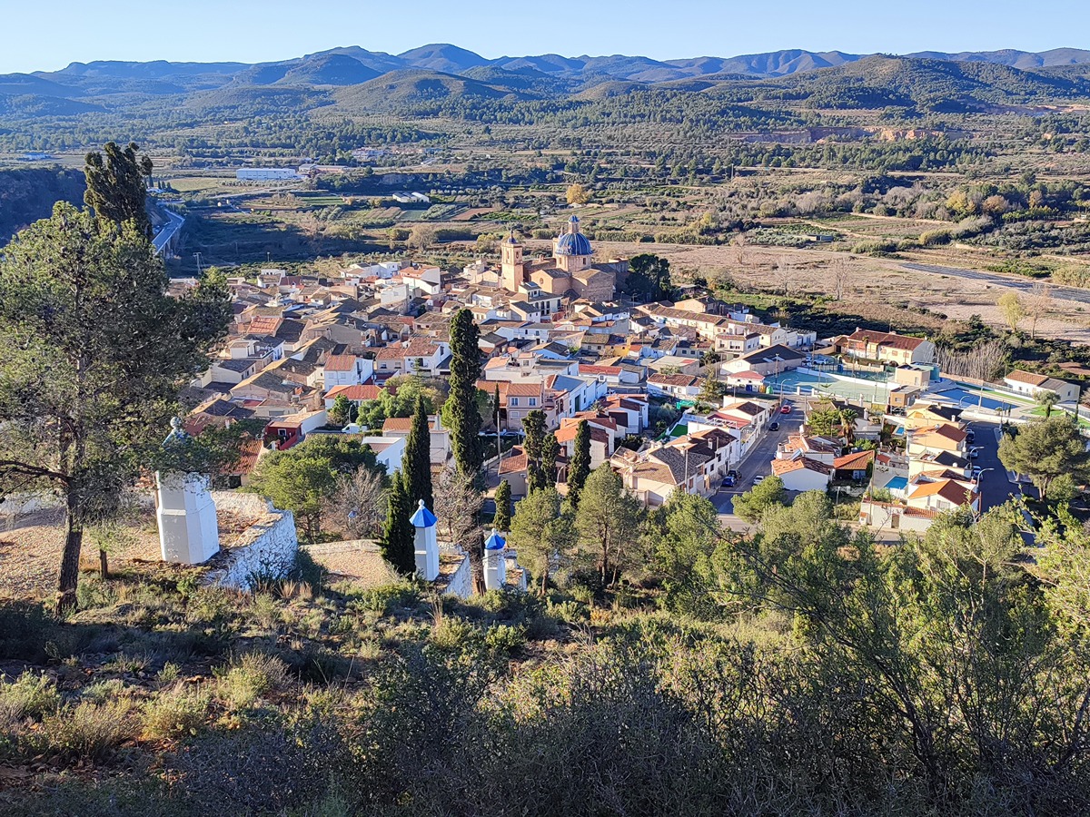
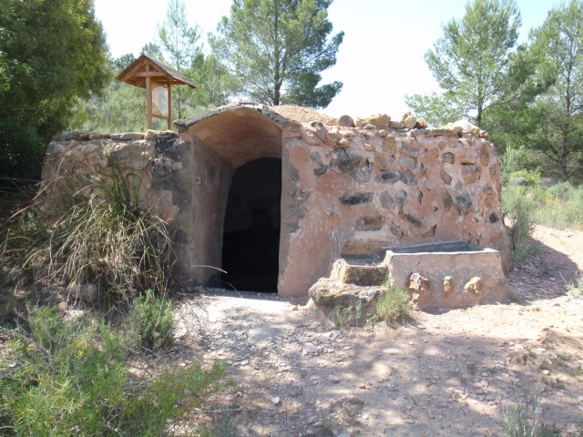
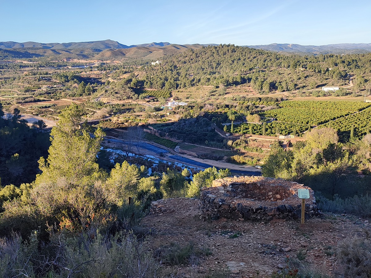
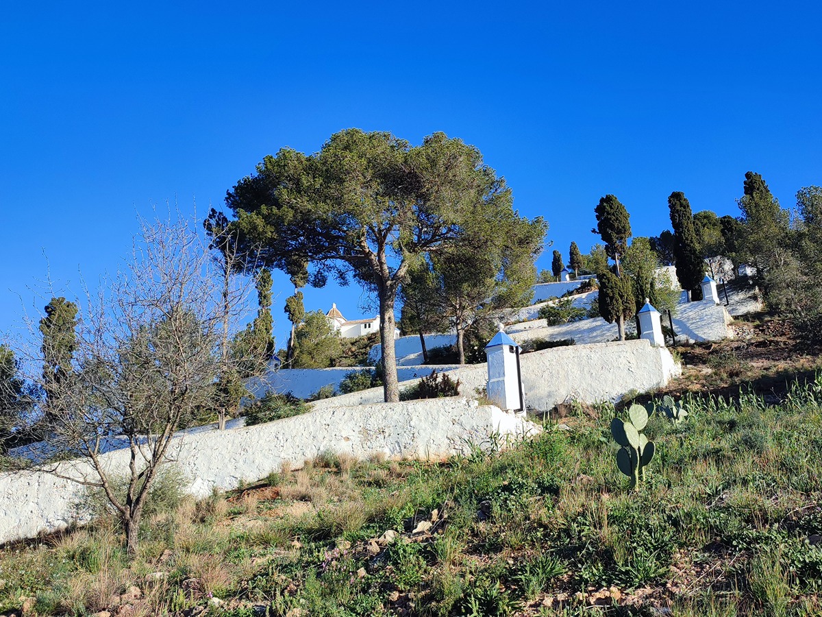
Pleasant route that takes us into a typical Mediterranean landscape of pine forests, crops and rural uses where we can enjoy beautiful views and discover vestiges of ancient rural life as the navajo León or the calera de San Antonio.

Trail:
Loop with some overlapping out and back sections
Technical data:
Length:
4,60 km
Estimated walking time:
01:30:00
Elevation gain:
165 m
Elevation loss:
165 m
MIDE ratings:
Level of natural risks:
1
Navigation on the trail:
2
Hiking difficulty:
2
Fitness level needed:
2

More information on Montaña Segura

Difficulty rating according to FEDME:
Unknown
Starting point:
Useful information:
Date of certification:
15-05-2011
Date of the last Quality Control:
december de 2024
Reference municipality:
District:
Province:
Castellón/Castelló
Cartography IGN MTN25:
0668-1

Downloadable from the Catalogue of the IGN Map Library

See other trails of this promoter:
Protected Natural Spaces:

We advise you to look up the regulations and/or authorisations for using the trails in these conservation areas on the website of the Conselleria de Medio Ambiente, Agua, Infraestructuras y Territorio

  • Curso Medio del Palancia (SIC - Site of Community Interest)
  • Curso medio del Palancia (SAC - Special Area of Conservation)
Key points of the route:

Sot de Ferrer - Cuevas del Terrero (cave) - Mirador de Remigio (view point) - Camino de Azuebar (path) - Navajo León (pound) - Calera San Antonio (limestone quarry) - Ermita San Antonio de Padua (hermitage)- Calvario (way of the cross) - Sot de Ferrer

Route description (only available in Spanish)

Salimos hacia la derecha por la calle Nueva hasta el final de esta donde una senda a nuestra izquierda nos llevará a las cuevas del Terrero. Continuamos por la senda y en 3 minutos pasamos por el mirador de Remigio, con magníficas vistas sobre la población y el río Palancia. Seguimos hasta un cruce de caminos donde giramos a la izquierda para volver a girar por un camino hasta llegar a otro cruce y continuar a la derecha. Más adelante, ya por senda llegaremos al Navajo León.

Seguimos por senda hasta llegar al cruce punto común del bucle principal de la ruta al cual regresaremos después. Ahora, seguimos a la derecha para visitar la calera de San Antonio y realizar otro bucle para volver al cruce y continuar hacia la ermita de San Antonio de Padua. Desde la ermita bajamos por el Calvario en una serie de zig-zag hasta llegar de nuevo a la población.

Downloads:

Beware! Navigation devices may fail, batteries may run out of power and devices may break down. Do not use only electronic means to track your activities in the mountains; they must be used as a complement to the map and compass. Get some proper training and enjoy the mountains.