Cambiar idioma a español / Cambiar idioma a english / Cambiar idioma a valencià

Rate this trail

SL-CV 49 SENDA DEL VEDAT

Promoter: Ayuntamiento de Torrent

Certification status: No quality controls

2 reviews

There is no proof of quality control on the record of this trail in the last years. For this reason, it is unknown whether it complies with the optimal signage and maintenance conditions for hikers to take the trail following these signs exclusively.
Hikers have to take into consideration that the information about the signage and maintenance of the trails for which the promoter entity is responsible might not be up to date anymore, since it refers to its state on the date of its approval. Furthermore, mountain sports entail risks associated with the activity itself and the environment where they take place, for which any person is fully liable. For this reason, hikes need to be planned properly and adequate training, equipment and sensible use of the trails are required.

The mountain of Vedat de Torrent offers a fun route that runs at all times through a lush Mediterranean forest, pine trees being the most predominant tree.

Trail:
Loop
Technical data:
Length:
4,60 km
Estimated walking time:
01:25:00
Elevation gain:
110 m
Elevation loss:
110 m
MIDE ratings:
Level of natural risks:
1
Navigation on the trail:
2
Hiking difficulty:
2
Fitness level needed:
2

More information at Montaña Segura

Difficulty rating according to FEDME:
Unknown
Useful information:
Date of certification:
15-01-2004
Date of the act of registration in the Public Register:
22-05-2007
Date of the last Quality Control:
june de 2021
Reference municipality:
District:
Province:
Valencia/València
Cartography IGN MTN25:

You can download them from the IGN Map Library Catalog

See other trails of this promoter:
Weather information:
Nearest AVAMET weather station
Key points of the route:

Environmental Education Centre - Cañada del Llop (cattle track) - Road connection - Camino del Romeral (path) - Arboretum - Muntanya de Cabrera (mountain) - La Devesa - El Pleyade - El Balcó - Residential area - Environmental Education Centre

Route description (only available in Spanish)

Partimos desde los paneles de inicio que estan situados, justo detrás de la pared situada en el lado Sur-oeste de las instalaciones del Centro de Educación Ambiental Natura y Cultura, en el Vedat. Desde aqui nos dirigimos rumbo N, por la senda que nos llevará hasta la Cañada del Llop. A unos 100 m. tomaremos rumbo NE, y unos 140 m. después, ya rumbo O, para llegar hasta la Cañada.
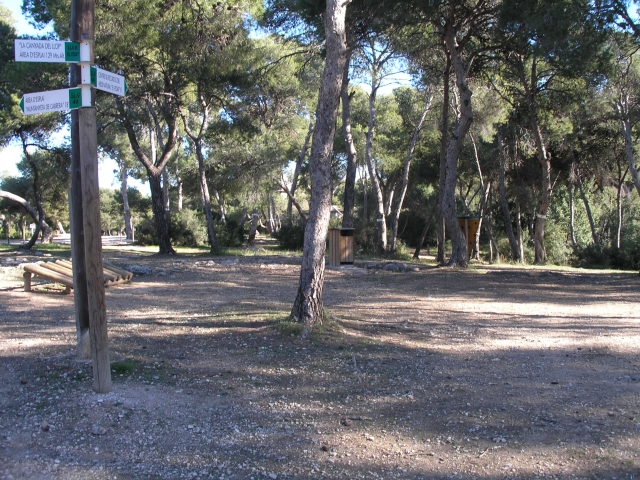
Una vez aquí, tomamos la senda que, rumbo N, nos llevará a cruzar la carretera (Camí del Romeral). Nada más cruzarla, giramos a la derecha por la senda paralela a la carretera, para en unos 50 m. desviarnos a la izquierda, rumbo NE, donde en unos 150 m. llegaremos al área del Arboretum. Una vez atravesado el arboretum, seguiremos la senda, dirección a La Muntamyeta de Cabrera que en sentido contrario a las agujas del reloj, la bordearemos recorriendo una distancia de unos 900 m. Después rumbo NO, y luego SE, y tras un recorrido de unos 1.100 m. bordearemos una pequeño bosque. Una vez el sendero queda abierto a la carretera, giiramos a nuestra derecha, para cruzar la carretera de nuevo y dirigirnos hacia La Devesa. Desde aquí, y siempre rumbo S, nos dirigimos hacia el área de El Pleyade, donde el sendero bordea el colegio del mismo nombre. Una vez sobrepasado dicho colegio y siempre rumbo S, y unos 500 m. más adelante llegaremos hasta el cruce con el Carrer del Gessamí, el cual cruzaremos y bordeando un desposito de agua por la cara Sur, y luego N., nos llevará hasta una calle muy estrecha y solo peatonal que entre viviendas de chalets, nos llevará hasta la urbanización de El Balcó, la cuál atravesaremos por su calle principal hasta llegar la parte S. del Centro de Educación Ambiental.

Downloads:

Beware! Navigation devices may fail, batteries may run out of power and devices may break down. Do not use only electronic means to track your activities in the mountains; they must be used as a complement to the map and compass. Get some proper training and enjoy the mountains.