ES / EN / VA

Rate this trail

SL-CV 98 CAP PRIM

Promoter: Ayuntamiento de Jávea

Certification status: Positive quality control

0 reviews

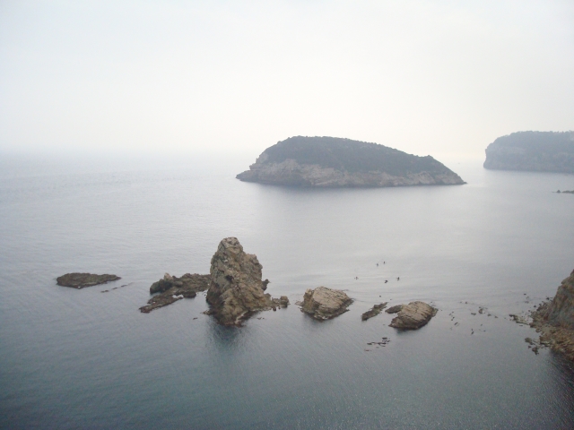
A short linear path that runs through pine and carob trees, with views of the impressive and vertiginous cliffs of the north of Alicante. This path finds itself in front of the island of Portitxol.

Trail:
One way (point-to-point)
Technical data:
Length:
1,00 km
Estimated walking time:
00:20:00
Elevation gain:
20 m
Elevation loss:
60 m
MIDE ratings:
Level of natural risks:
2
Navigation on the trail:
2
Hiking difficulty:
3
Fitness level needed:
1

More information on Montaña Segura

Difficulty rating according to FEDME:
Unknown
Starting point:
End Point:
Useful information:
Date of certification:
04-03-2008
Date of the act of registration in the Public Register:
20-10-2015
Date of the last Quality Control:
may de 2023
Reference municipality:
District:
Province:
Alicante/Alacant
Cartography IGN MTN25:
0832-1

Downloadable from the Catalogue of the IGN Map Library

See other trails of this promoter:
Protected Natural Spaces:

We advise you to look up the regulations and/or authorisations for using the trails in these conservation areas on the website of the Conselleria de Medio Ambiente, Agua, Infraestructuras y Territorio

  • Acantilados de la Marina (SIC - Site of Community Interest)
  • Acantilados de la Marina (SPAB - Special Protection Area for Birds)
  • Acantilados de la Marina (SAC - Special Area of Conservation)
Key points of the route:

Mirador de la cruz del Portitxol (viewpoint) - Cap de Prim (cape)

Route description (only available in Spanish)

Desde la Creu del Portitxol, seguir el sendero unos pocos metros hasta encontrar la bifurcación con el SL-CV 97. Tomar la bifurcación a izquierda en ligero descenso. Pasaremos por una pequeña pinada hasta llegar al collado del cap de Martí, donde veremos la bifurcación a la cala Sardineta a nuestra izquierda.

El sendero continúa bordeando los acantilados, protegidos con barandillas de madera, hasta alcanzar la cumbre de cap Prim.

Downloads:

Beware! Navigation devices may fail, batteries may run out of power and devices may break down. Do not use only electronic means to track your activities in the mountains; they must be used as a complement to the map and compass. Get some proper training and enjoy the mountains.

Other trails connecting with this trail