Rate this trail

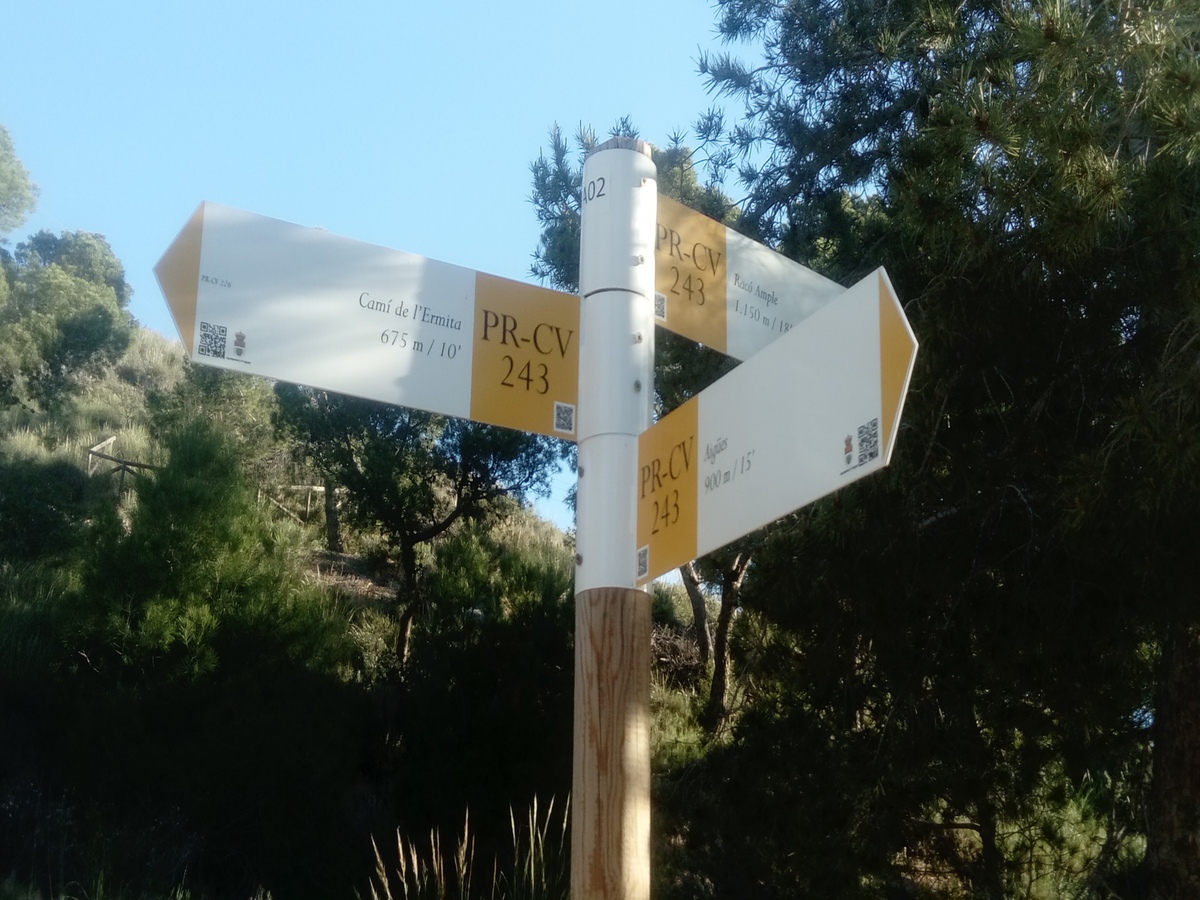
PR-CV 243 CAMÍ DE LA BACORERA

Promoter: Ayuntamiento de Aigües

Certification status: Positive quality control

1 review

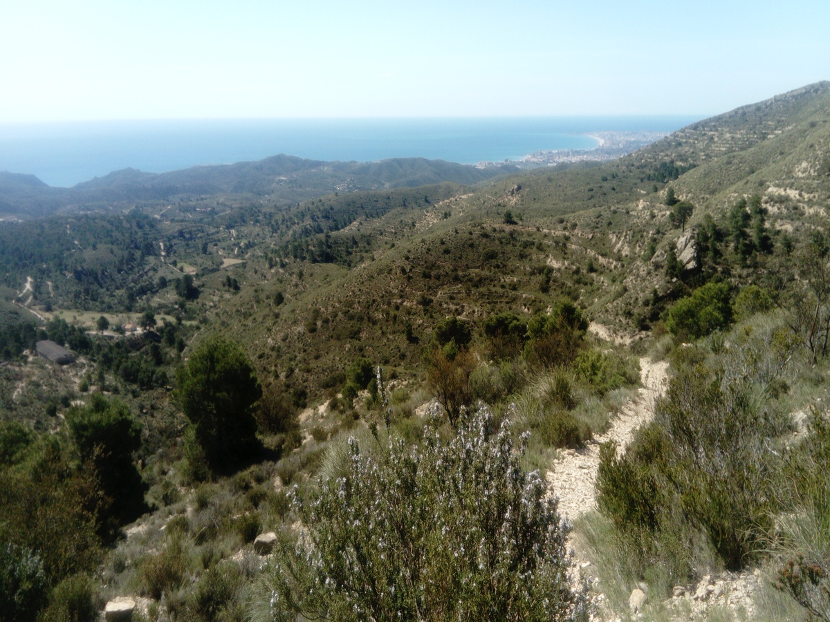
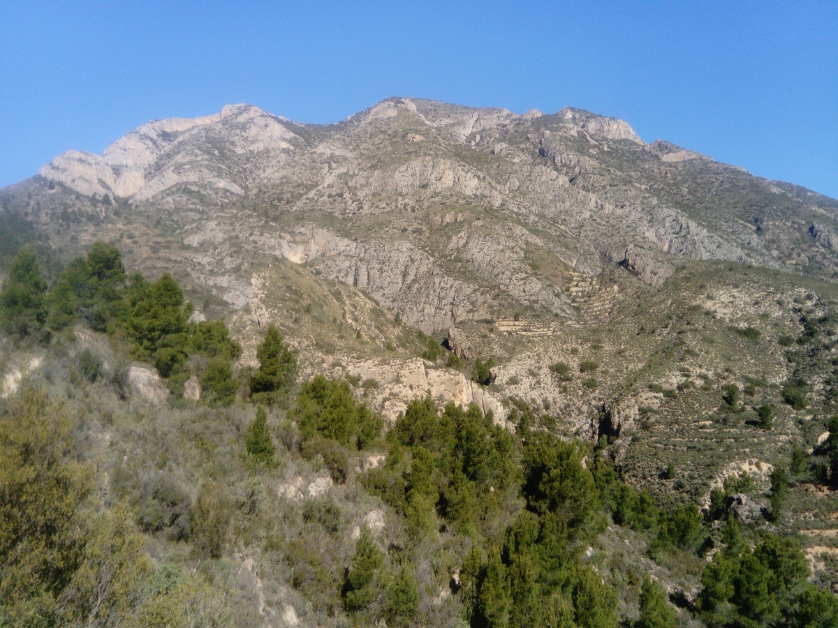
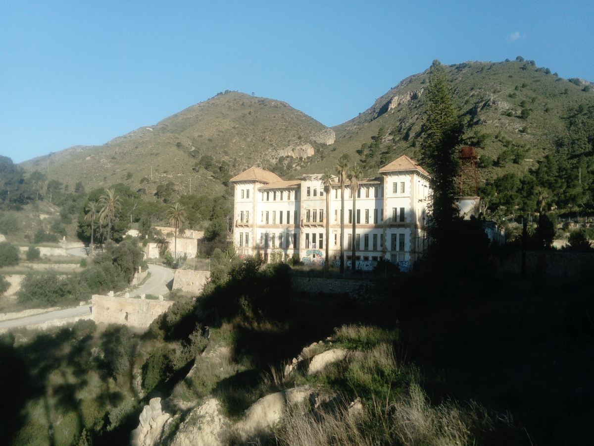
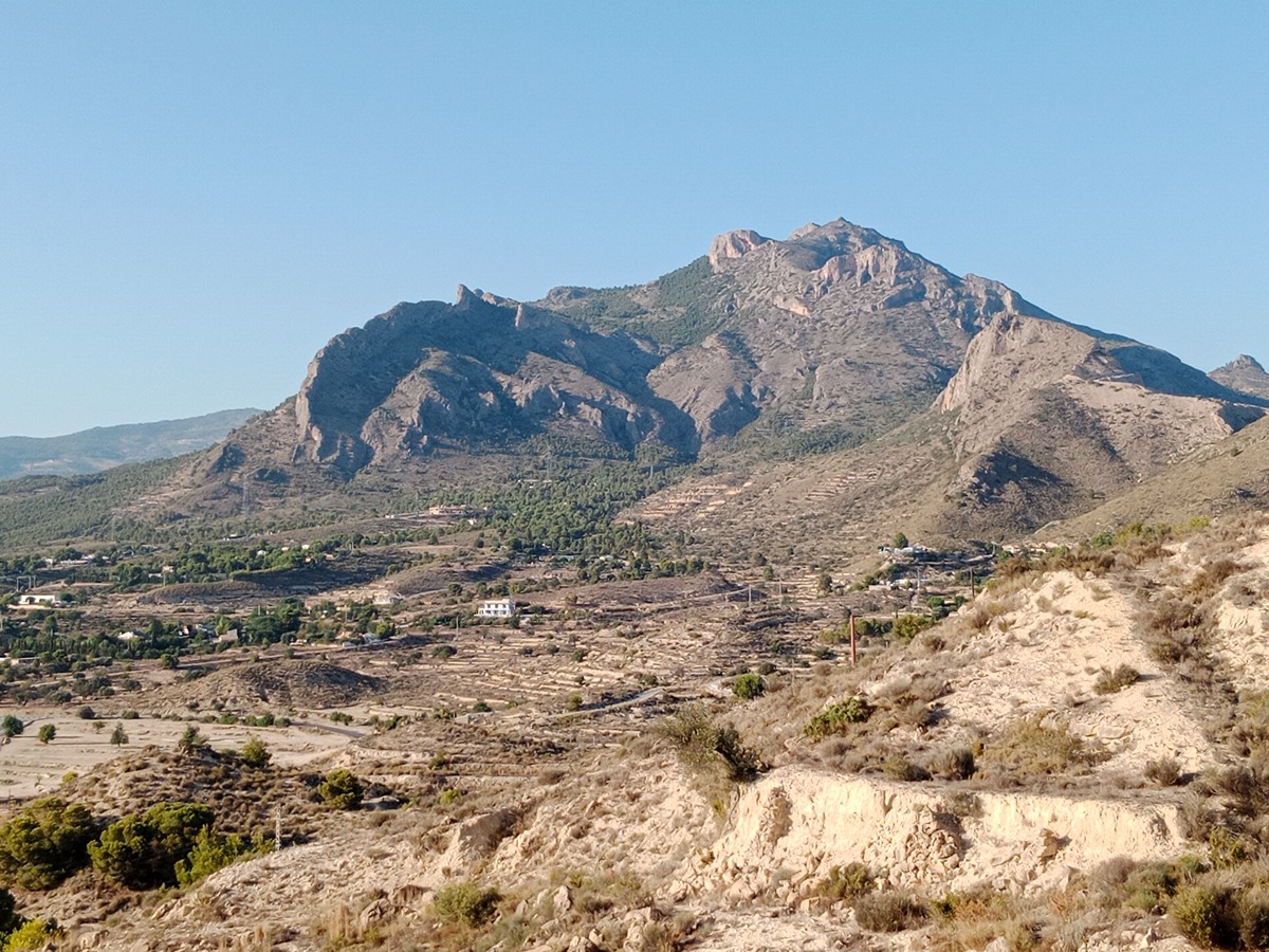
The trail runs along the eastern spurs of Sierra del Cabeçó d'Or from the beautiful town of Aigües, passing by its famous thermal spa (now in ruins). You will go up the shaded side of the path of Bacorera through a forest of Aleppo pines with varied Mediterranean undergrowth and aromatic plants until you reach the highest point of this route: the Salmitre Pass, where you will enjoy splendid views of the coast of Alicante and the Cabeçó d'Or summit.

Trail:
Loop with some overlapping out and back sections
Technical data:
Length:
8,90 km
Estimated walking time:
03:05:00
Elevation gain:
425 m
Elevation loss:
425 m
MIDE ratings:
Level of natural risks:
2
Navigation on the trail:
2
Hiking difficulty:
2
Fitness level needed:
3

More information on Montaña Segura

Difficulty rating according to FEDME:
Unknown
Starting point:
Interest Tags:
Trail with geological interest

Useful information:
Date of certification:
15-10-2008
Date of the act of registration in the Public Register:
22-02-2007
Date of the last Quality Control:
april de 2022
Reference municipality:
Otros municipios por los que transcurre:
District:
Province:
Alicante/Alacant
Cartography IGN MTN25:
0847-3

Downloadable from the Catalogue of the IGN Map Library

See other trails of this promoter:
Protected Natural Spaces:

We advise you to look up the regulations and/or authorisations for using the trails in these conservation areas on the website of the Conselleria de Medio Ambiente, Agua, Infraestructuras y Territorio

  • Cabeçó d'Or y la Grana (SPAB - Special Protection Area for Birds)
Key points of the route:

Aigües (connection SL-CV 121) - Balneario (thermal baths) - Racó Ample (connection SL-CV 121) - Coll de Salmitre (col) - Barranc de Salmitre (ravine) (connection PR-CV 226) - Alt del Cantal (peak) - Bassa de la Cava (pond) - connection PR-CV 226 - Aigües

Route description (only available in Spanish)

Subiremos por calle la calle Bonavista (enlace SL-CV 121) y nos desviaremos por un camino de tierra a nuestra derecha que nos lleva hacia el balneario de Aigües. Aquí, seguimos por nuestra derecha en el cruce de caminos, continuamos por una pista de tierra (camí de la Bacorera) durante un poco más de un kilómetro y llegaremos a una bifurcación de caminos en el Racó Ample (enlace SL-CV 121). Abandonaremos la pista y subiremos por un camino a la izquierda que pasa junto a una torre eléctrica. Pasada la torre dejaremos este camino y seguiremos por una senda que encontraremos a nuestra izquierda, es la senda de la umbría de la Bacorera por la que subiremos hasta llegar al punto más elevado de este itinerario en el coll de Salmitre. Desde este collado empezamos a bajar por el barranc de Salmitre, pasaremos por el acceso a la cova de les Dones y seguiremos descendiendo por la senda hasta salir a un camino de tierra (enlace PR-CV 226) por el que continuaremos por nuestra izquierda y que nos lleva al alt del Cantal. Aquí abandonaremos el camino para seguir de frente por una senda que desciende en lazadas por el barranc del Cantal. El sendero cruza el barranco finalmente y tras pasar por una acequia de riego y por el pozo del Cantal se convierte en camino. Seguiremos por este camino hasta la confluencia con una pista cerca de la bassa de la Cava donde continuaremos por nuestra izquierda. Después de andar durante un kilómetro por esta pista llegaremos a un cruce de caminos donde encontramos otro enlace del PR-CV 226, este sigue por el camino de la derecha y nosotros continuaremos rectos por la pista. Llegaremos así de nuevo al balneario de Aigües donde se completa el itinerario circular de este sendero. Ya solo nos queda desandar el tramo inicial para llegar a Aigües.

Downloads:

Beware! Navigation devices may fail, batteries may run out of power and devices may break down. Do not use only electronic means to track your activities in the mountains; they must be used as a complement to the map and compass. Get some proper training and enjoy the mountains.

Other trails connecting with this trail
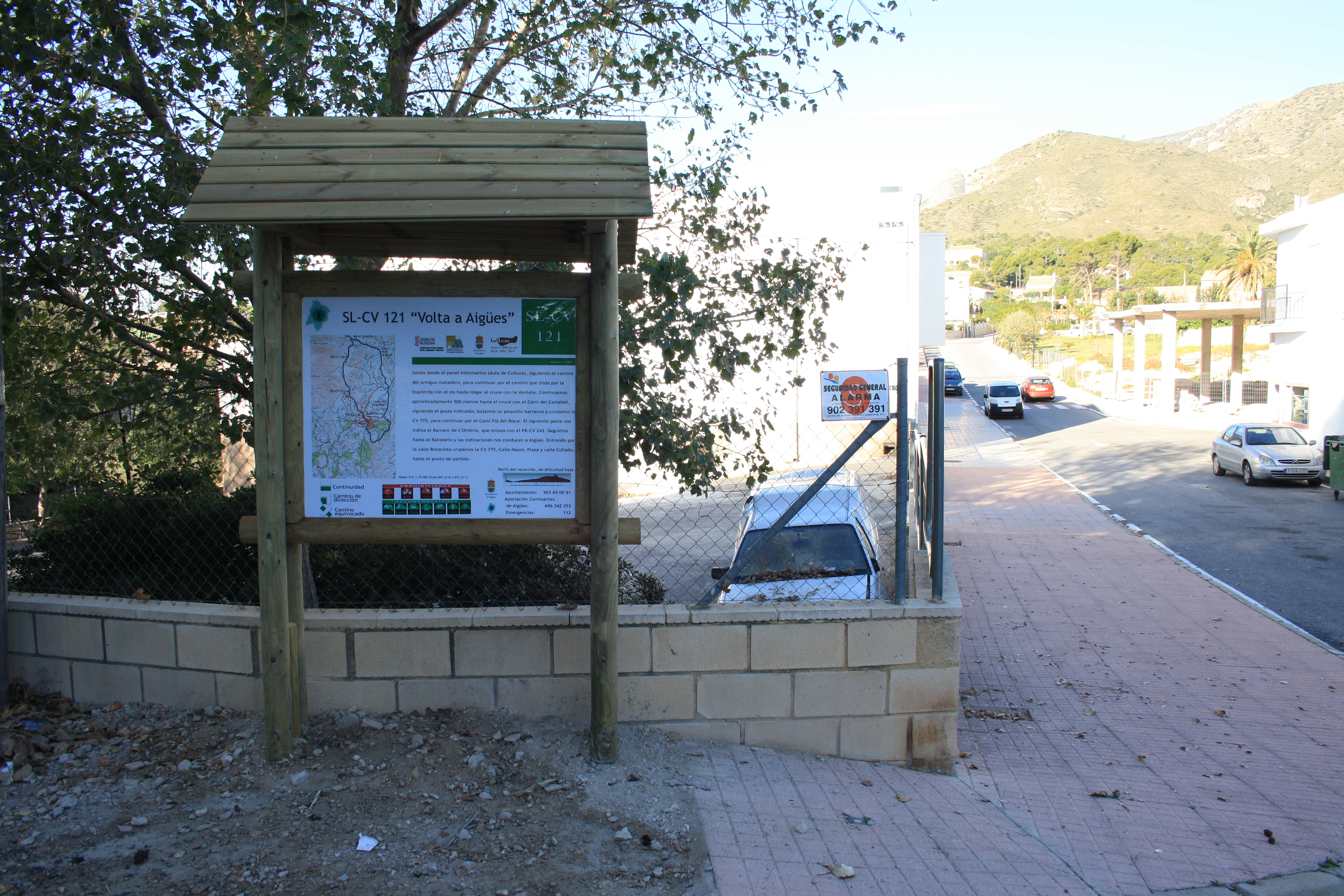