Rate this trail

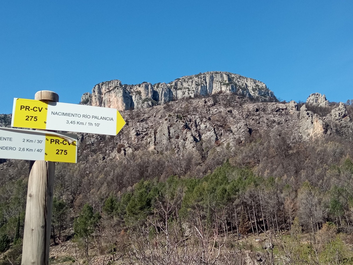
PR-CV 275 FUENTES DEL PALANCIA

Promoter: Ayuntamiento de Bejís

Certification status: Conditioned quality control

0 reviews

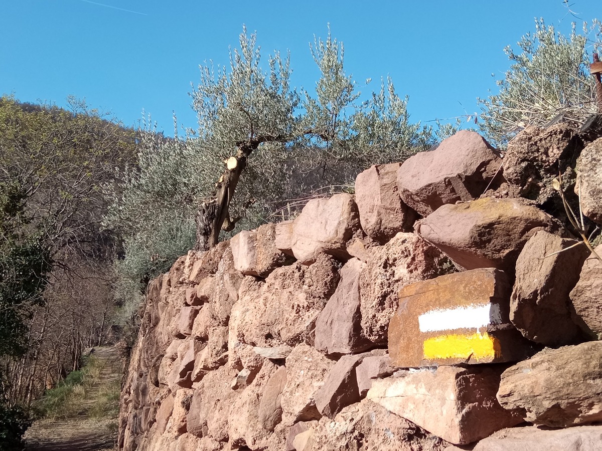
Following the inspection carried out by trail technicians, this trail has been declared of "limited adequacy" as a result of the faults detected in the signage. These include inadequate horizontal signs (paint markers) and/or vertical ones (trailheads and information boards) or lacking direction markers that do not provide sufficient information to properly follow the route. The builder of this trail has been informed of the situation.
For safety reasons and during maintenance work, it is advised to be extremely careful while taking this route. Furthermore, mountain sports entail risks associated with the activity itself and the environment where they take place, for which any person is fully liable. For this reason, hikes need to be planned properly and adequate training, equipment and sensible use of the trails are required.

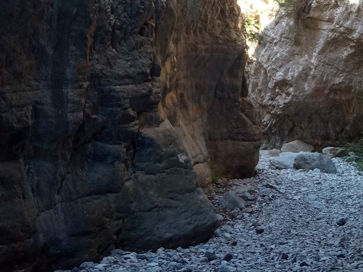
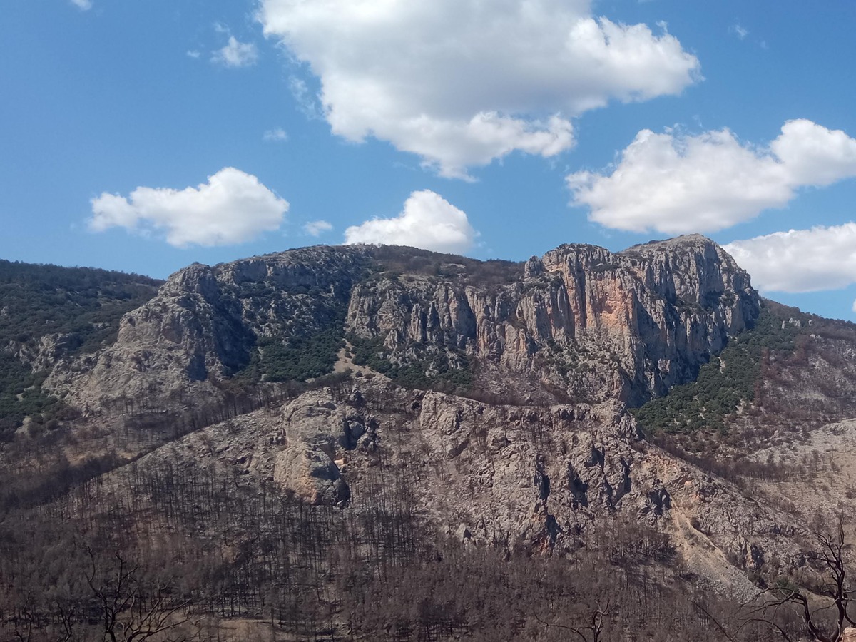
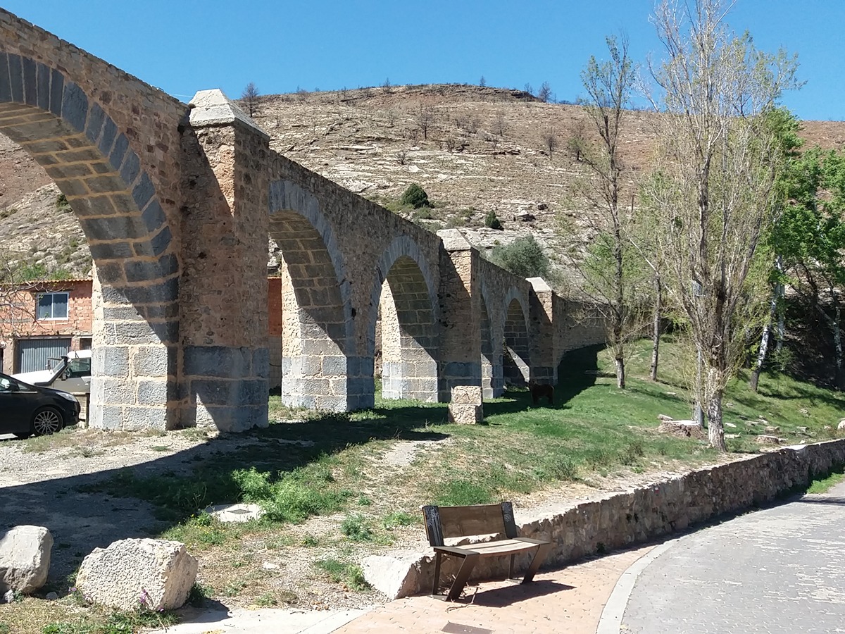
The source of the river Palancia has been listed as one of the "magical landscapes of Comunitat Valenciana". This trail follows the course of the river and allows you to go through areas used by men—with their country estates and crops with their dry stone architecture constructions —to a wilder environment close to the straits of the river Palancia, in the magnificent Cascajar strait.

Trail:
One way (point-to-point)
Technical data:
Length:
6,20 km
Estimated walking time:
02:00:00
Elevation gain:
305 m
Elevation loss:
135 m
MIDE ratings:
Level of natural risks:
2
Navigation on the trail:
2
Hiking difficulty:
2
Fitness level needed:
2

More information on Montaña Segura

Difficulty rating according to FEDME:
Unknown
Useful information:
Date of certification:
26-05-2023
Date of the last Quality Control:
may de 2023
Reference municipality:
Otros municipios por los que transcurre:
District:
Province:
Castellón/Castelló
Cartography IGN MTN25:
0639-1, 0639-3

Downloadable from the Catalogue of the IGN Map Library

See other trails of this promoter:
Protected Natural Spaces:

We advise you to look up the regulations and/or authorisations for using the trails in these conservation areas on the website of the Conselleria de Medio Ambiente, Agua, Infraestructuras y Territorio

  • Alto Palancia (SAC - Special Area of Conservation)
  • Alto Palancia (SIC - Site of Community Interest)
  • Peñaescabia (Municipal Natural Site)
Key points of the route:

Carretera de Los Cloticos (road) - Masía del Puente (estate) (PR-CV 275.1 connection) - Ríos Arriba - GR 231 connection - Information panel - Source of the Palancia River

Route description (only available in Spanish)

La senda de cemento nos conduce al cauce del Palancia a la altura de la masía del Puente. Aquí podemos elegir el PR-CV 275.1, variante que rodea el Cerro Simón. Seguimos a la izquierda por el camino que bordea el río para llegar al camping Los Cloticos. La fuente Seca y la fuente de la Mina salen a nuestro encuentro.

Por la pista cruzamos el río hacia la fuente de Los Cloticos, la más importante por la calidad de sus aguas y por su explotación industrial. De nuevo en la pista, en dirección Oeste, cerca del Molinar, subimos por la izquierda hacia la casa del Forestal. Más adelante cruzamos el barranco del Resinero y por la senda que remonta el Palancia llegaremos al magnífico cañón donde nace el río. Si el nivel del agua lo permite se puede recorrer en sus primeros tramos.

Downloads:

Beware! Navigation devices may fail, batteries may run out of power and devices may break down. Do not use only electronic means to track your activities in the mountains; they must be used as a complement to the map and compass. Get some proper training and enjoy the mountains.

Alternative routes and routes leading to nearby points of interest

Other trails connecting with this trail