
SL-CV 45 CAMÍ DELS MOLINS
Promoter: Ayuntamiento de Ares del Maestrat
Certification status: No quality controls
There is no proof of quality control on the record of this trail in the last years. For this reason, it is unknown whether it complies with the optimal signage and maintenance conditions for hikers to take the trail following these signs exclusively.
Hikers have to take into consideration that the information about the signage and maintenance of the trails for which the promoter entity is responsible might not be up to date anymore, since it refers to its state on the date of its approval. Furthermore, mountain sports entail risks associated with the activity itself and the environment where they take place, for which any person is fully liable. For this reason, hikes need to be planned properly and adequate training, equipment and sensible use of the trails are required.
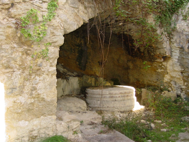
An old bridle path that runs along the unique hydraulic system preserved in the Molins ravine, which consists of five interconnected 18th century water-powered flour mills. It was declared an Asset of Cultural Interest (ACI) with the category of “ethnological space”.
Other trails connecting with this trail
GR 7 E28 ARES DEL MAESTRAT - CULLA
Promoter: Generalitat Valenciana
Certification status: Positive quality control
Etapa número: 28
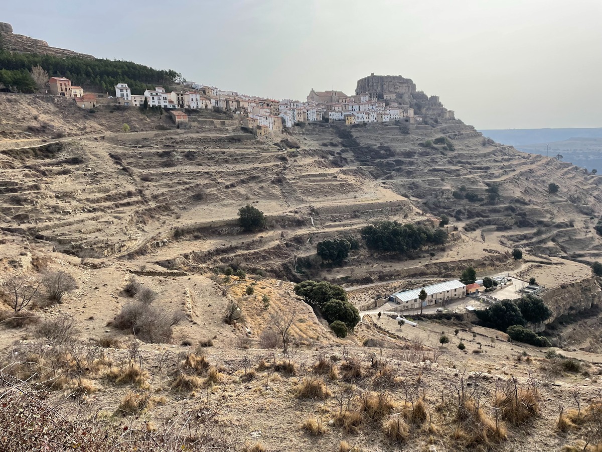
SL-CV 46 CAMÍ DE LA MOLA D´ARES
Promoter: Ayuntamiento de Ares del Maestrat
Certification status: No quality controls

SL-CV 171 ARES - LA MONTALBANA
Promoter: Ayuntamiento de Ares del Maestrat
Certification status: In process of approval
GR 331 E14 LA LLÈCUA - ARES DEL MAESTRAT
Promoter: Mancomunitat Comarcal Els Ports
Certification status: Valid
Etapa número: 14