ES / EN / VA

Rate this trail

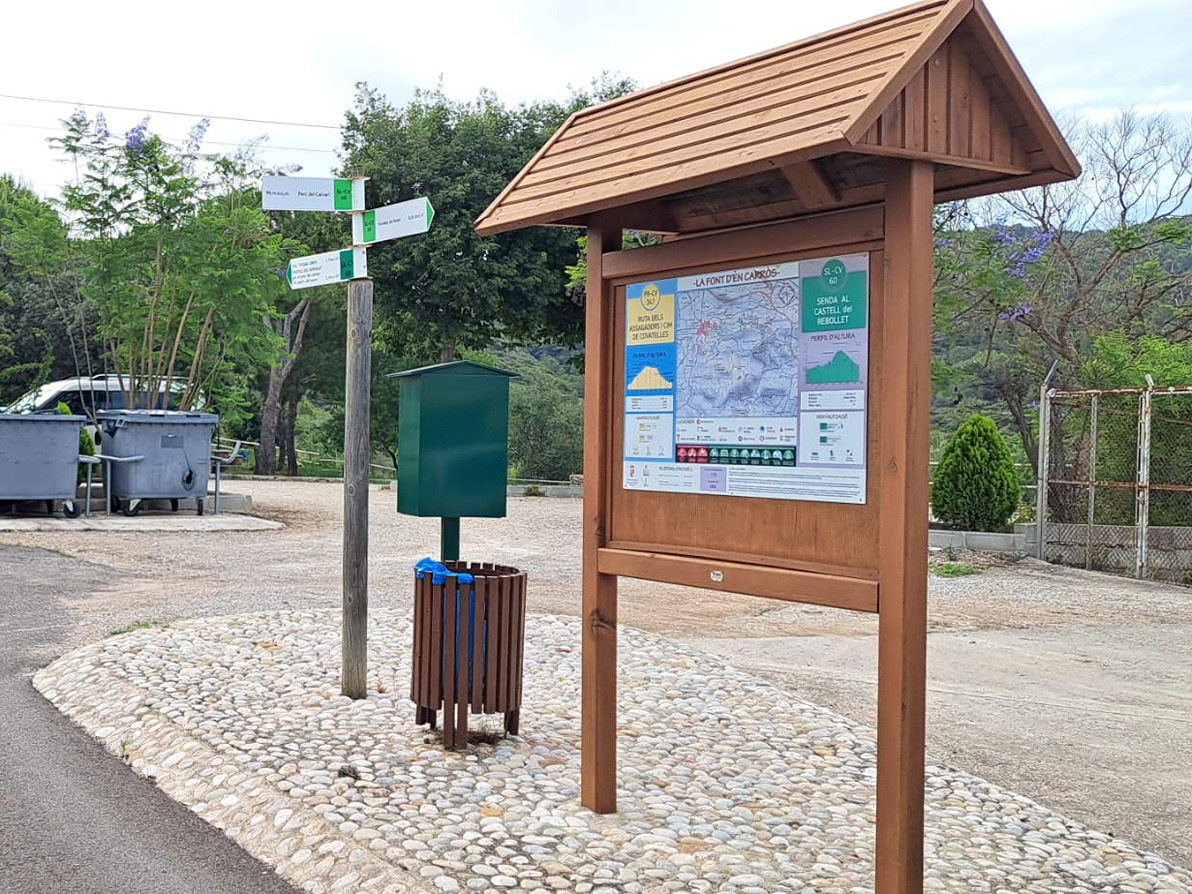
SL-CV 60 SENDA AL CASTILLO DE REBOLLET

Promoter: Ayuntamiento de la Font d'en Carròs

Certification status: No quality controls

0 reviews

There is no proof of quality control on the record of this trail in the last years. For this reason, it is unknown whether it complies with the optimal signage and maintenance conditions for hikers to take the trail following these signs exclusively.
Hikers have to take into consideration that the information about the signage and maintenance of the trails for which the promoter entity is responsible might not be up to date anymore, since it refers to its state on the date of its approval. Furthermore, mountain sports entail risks associated with the activity itself and the environment where they take place, for which any person is fully liable. For this reason, hikes need to be planned properly and adequate training, equipment and sensible use of the trails are required.

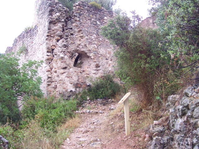
This path runs through mountainous areas of the municipality and a section of the Tossal Gros residential area. You can find old city walls and the castle. In the central part of this route you go up until you reach the hill and from there, you go downwards until you reach the end.

Trail:
Loop with some overlapping out and back sections
Technical data:
Length:
3,70 km
Estimated walking time:
01:20:00
Elevation gain:
170 m
Elevation loss:
170 m
MIDE ratings:
Level of natural risks:
1
Navigation on the trail:
2
Hiking difficulty:
2
Fitness level needed:
2

More information on Montaña Segura

Difficulty rating according to FEDME:
Unknown
Starting point:
Useful information:
Date of certification:
15-11-2005
Date of the act of registration in the Public Register:
22-05-2007
Date of the last Quality Control:
july de 2017
Reference municipality:
District:
Province:
Valencia/València
Cartography IGN MTN25:
0796-1; 0796-3

Downloadable from the Catalogue of the IGN Map Library

See other trails of this promoter:
Key points of the route:

Trail Start - Parque El Calvario (park)- Murallas de Rafali (walls) - Senda del Castell (path) - Font del Sarvatxo (spring) - Castel del Rebollet (fort) - Urbanizacion Tossal Gros (residential area) - Collado Barranc Fondo (col) - Raco de la Muriona - Trail End - Parque El Calvario (park)

Route description (only available in Spanish)

Partimos desde el Parque El Calvario, dirección a la antigua Muralla de el Rafalí punto desde el cual se origino la población. Seguiremos por la antigua Senda del Castillo dirección al Castillo del Rebollet con tramos de senda y desembocando en un camino de tierra que comienza a ascender con fuerte inclinación. Cruzaremos por el Barranco del Algepsar y empezaremos de nuevo a subir, pasaremos por un deposito de agua y siguiendo el camino daremos con el Castillo del Rebollet. Desde el Castillo del Rebollet volvemos atrás por el mismo tramo andado hasta el camino anterior hasta llegar a la urbanización del Tossal gros que recorreremos algunas de sus calles para adentrarnos de nuevo en el monte. Andaremos por terreno de monte, bancales, margenes de piedra seca, pinares, etc, cuesta bajo para terminar de nuevo en el Parque El Calvario.

Downloads:

Beware! Navigation devices may fail, batteries may run out of power and devices may break down. Do not use only electronic means to track your activities in the mountains; they must be used as a complement to the map and compass. Get some proper training and enjoy the mountains.

Other trails connecting with this trail