Cambiar idioma a español / Cambiar idioma a english / Cambiar idioma a valencià

Rate this trail

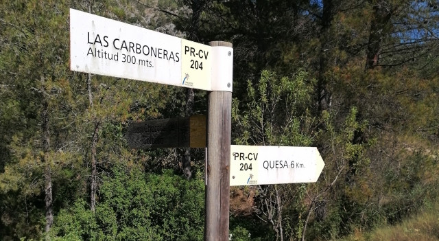
PR-CV 204 SENDERO DE LOS CHARCOS

Promoter: Ayuntamiento de Quesa

Certification status: Conditioned quality control

0 reviews

Following the inspection carried out by trail technicians, this trail has been declared of "limited adequacy" as a result of the faults detected in the signage. These include inadequate horizontal signs (paint markers) and/or vertical ones (trailheads and information boards) or lacking direction markers that do not provide sufficient information to properly follow the route. The builder of this trail has been informed of the situation.
For safety reasons and during maintenance work, it is advised to be extremely careful while taking this route. Furthermore, mountain sports entail risks associated with the activity itself and the environment where they take place, for which any person is fully liable. For this reason, hikes need to be planned properly and adequate training, equipment and sensible use of the trails are required.

The PR-CV 204 immediately takes you to landscapes full of vegetation and tranquility, a route to experience nature in its purest form, with views of the great Mediterranean forest of the Caroig Massif.

Trail:
One way (point-to-point)
Technical data:
Length:
8,40 km
Estimated walking time:
02:30:00
Elevation gain:
435 m
Elevation loss:
360 m
MIDE ratings:
Level of natural risks:
4
Navigation on the trail:
3
Hiking difficulty:
3
Fitness level needed:
2

More information at Montaña Segura

Difficulty rating according to FEDME:
Unknown
Useful information:
Date of certification:
15-02-2001
Date of the act of registration in the Public Register:
22-05-2007
Date of the last Quality Control:
august de 2025
Reference municipality:
Province:
Valencia/València
Cartography IGN MTN25:
0769-1

You can download them from the IGN Map Library Catalog

See other trails of this promoter:
Protected Natural Spaces:

It is recommended to consult the regulations and/or authorizations for the use of trails in these protected natural areas on the website of the Regional Ministry of Environment, Water, Infrastructure, and Territory

  • Muela de Cortes y el Caroche (SIC - Site of Community Interest)
  • Muela de Cortes y el Caroche (SAC - Special Area of Conservation)
  • Sierra de Martés - Muela de Cortes (SPAB - Special Protection Area for Birds)
Weather information:
Nearest AVAMET weather station
Key points of the route:

Quesa - Río Grande (river) - Paso del Collao (col) - Mirador de Arboleja (viewpoint) - El Estrecho - Las Carboneras (plot) - Casa de las Almas (state) - Fuente del Agujero (spring) - Las Cinglas - Charco de la Horteta (natural pool).

Route description (only available in Spanish)

Partimos de la rotonda en la salida de Quesa por la CV-580. Tras un breve tramo de asfalto, seguimos por senda y cruzamos el río Grande, ascendiendo hasta el mirador del Dique de la Arboleja. El recorrido continúa por el paso del Collado a 370 m de altitud.

Poco a poco comenzamos a bajar buscando de nuevo el río Grande hasta llegar a su cauce. Caminaremos por el mismo borde del río hasta llegar a la zona conocida como las Carboneras. Continuaremos y llegaremos a la zona de la huerta de las Almas. Continuamos de nuevo cerca del cauce con zonas accesibles al río por las Umbrías de Quesa. Unos 300 metros más adelante ya tendremos vista sobre el Charco de Horteta e inmediatamente después veremos la carretera y el enlace con el sendero PR-CV 203 antes de llegar al aparcamiento de los Charcos.

Downloads:

Beware! Navigation devices may fail, batteries may run out of power and devices may break down. Do not use only electronic means to track your activities in the mountains; they must be used as a complement to the map and compass. Get some proper training and enjoy the mountains.

Other trails connecting with this trail