Rate this trail

PR-CV 382 EMBARCADEROS Y CASTILLO DE CHIREL

Promoter: Ayuntamiento de Cofrentes

Certification status: Conditioned quality control

0 reviews

Following the inspection carried out by trail technicians, this trail has been declared of "limited adequacy" as a result of the faults detected in the signage. These include inadequate horizontal signs (paint markers) and/or vertical ones (trailheads and information boards) or lacking direction markers that do not provide sufficient information to properly follow the route. The builder of this trail has been informed of the situation.
For safety reasons and during maintenance work, it is advised to be extremely careful while taking this route. Furthermore, mountain sports entail risks associated with the activity itself and the environment where they take place, for which any person is fully liable. For this reason, hikes need to be planned properly and adequate training, equipment and sensible use of the trails are required.

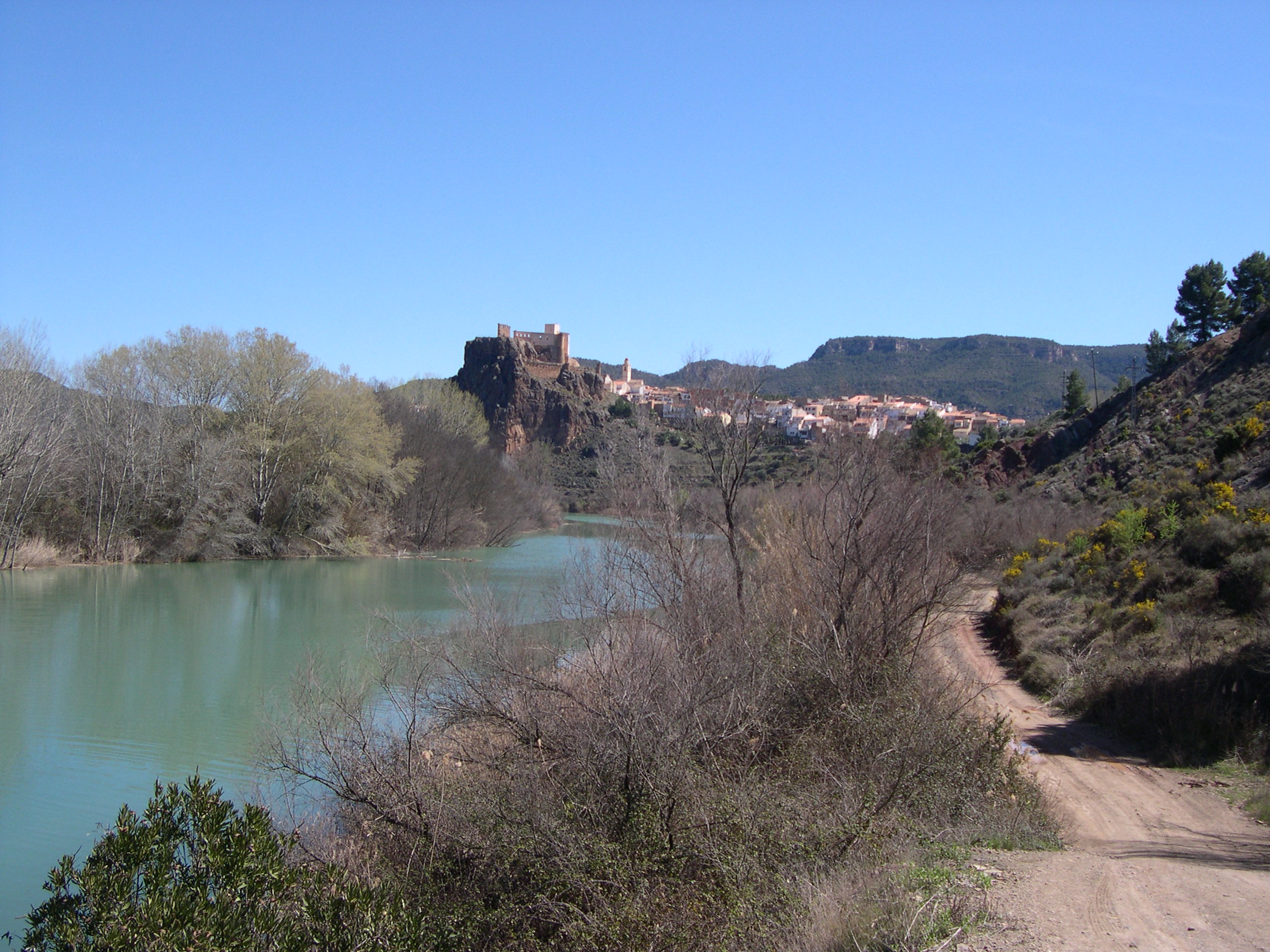
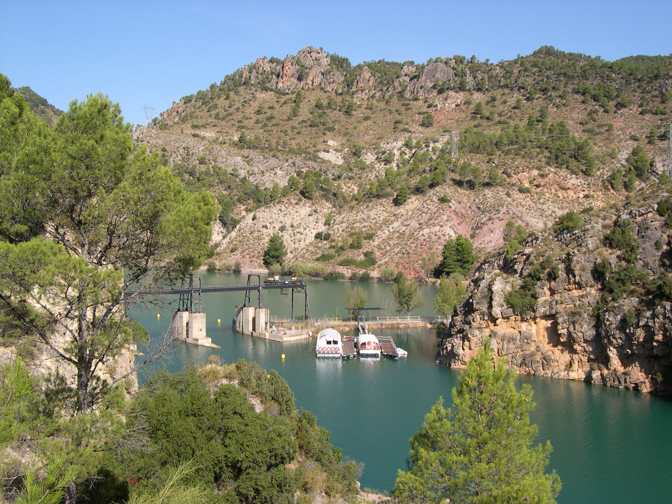
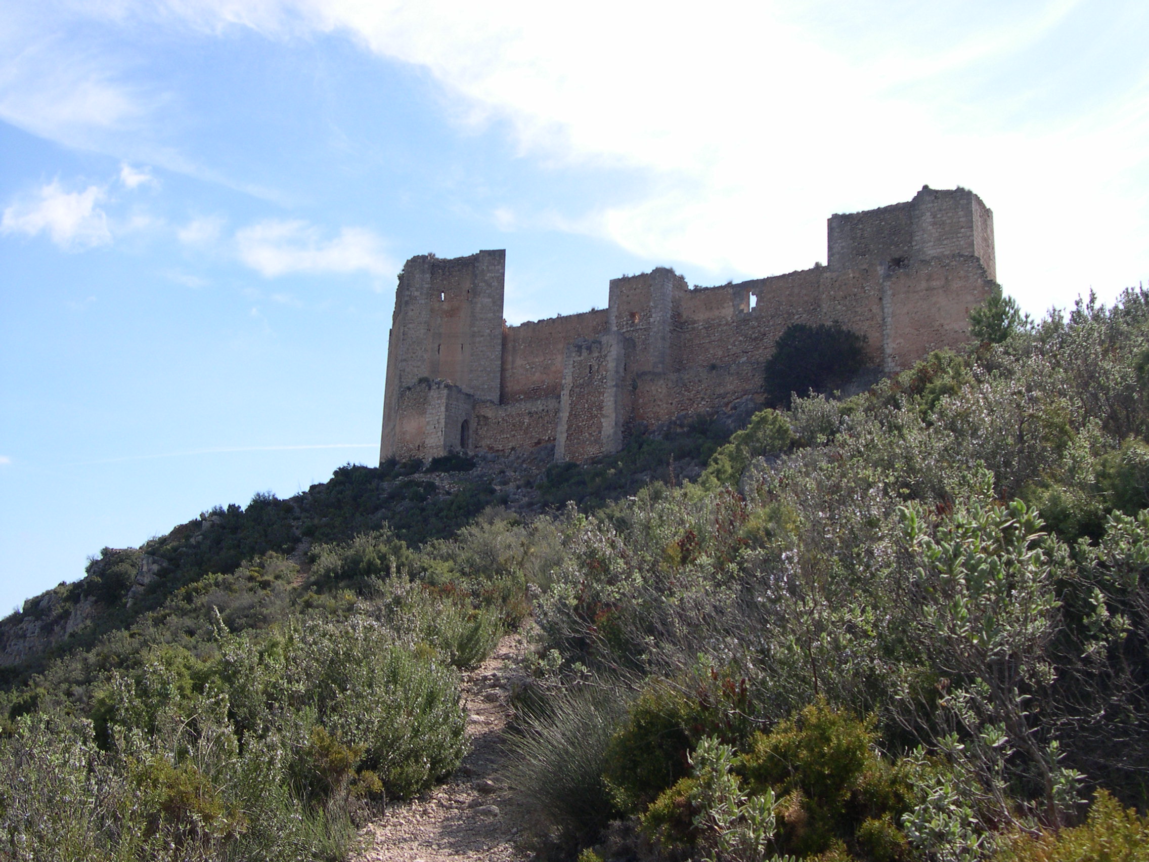
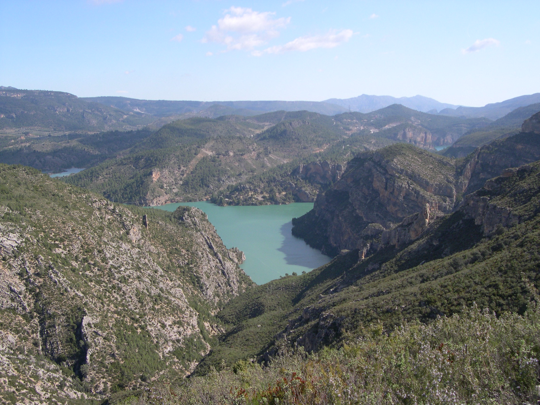
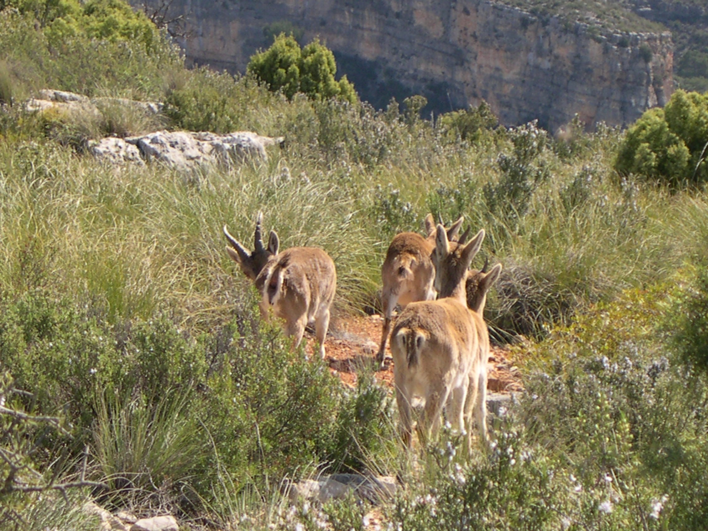
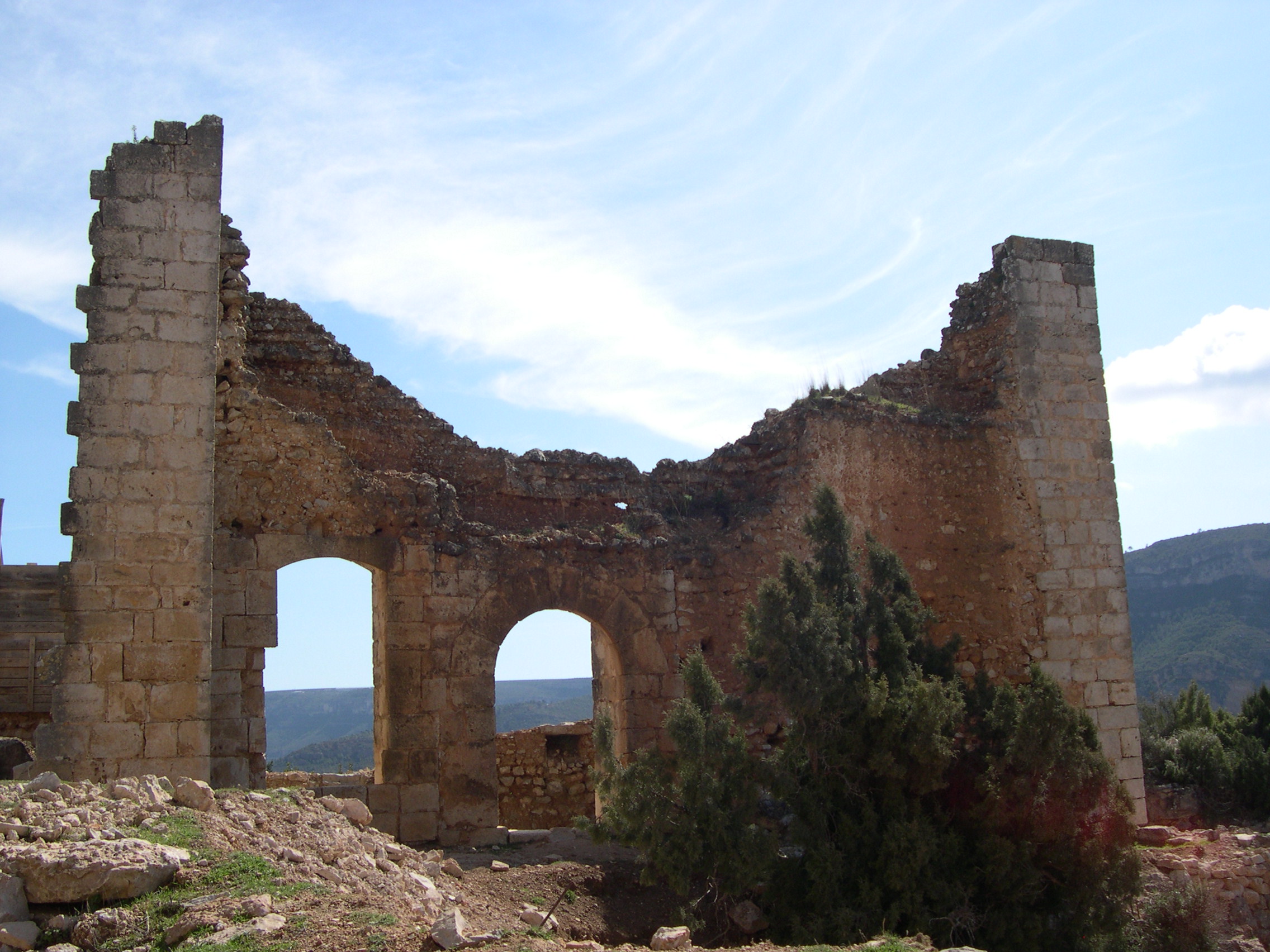
This linear trail connects the castles of Cofrentes and Chirel and it is reminiscent of the border between ancient kingdoms, offering spectacular views and river landscapes through the canyons of the Xúquer river.

Trail:
One way (point-to-point)
Technical data:
Length:
9,40 km
Estimated walking time:
03:05:00
Elevation gain:
460 m
Elevation loss:
230 m
MIDE ratings:
Level of natural risks:
1
Navigation on the trail:
2
Hiking difficulty:
2
Fitness level needed:
3

More information on Montaña Segura

Difficulty rating according to FEDME:
Unknown
Useful information:
Date of certification:
15-11-2010
Date of the act of registration in the Public Register:
20-10-2015
Date of the last Quality Control:
september de 2023
Reference municipality:
Otros municipios por los que transcurre:
District:
Province:
Valencia/València
Cartography IGN MTN25:
0745-3; 0745-4

Downloadable from the Catalogue of the IGN Map Library

See other trails of this promoter:
Protected Natural Spaces:

We advise you to look up the regulations and/or authorisations for using the trails in these conservation areas on the website of the Conselleria de Medio Ambiente, Agua, Infraestructuras y Territorio

  • Sierra de Martés - Muela de Cortes (SPAB - Special Protection Area for Birds)
  • Sierra de Martés y el Ave (SIC - Site of Community Interest)
  • Sierras de Martés y el Ave (SAC - Special Area of Conservation)
Key points of the route:

Cofrentes - Campo del Cura recreation area - Embarcadero (pier) - Castillo de Chirel (fort)

Route description (only available in Spanish)

El sendero arranca desde el casco urbano de Cofrentes, dirigiéndonos al puente de Hierro, donde confluyen el Júcar y el Cabriel. Siguiendo el camino asfaltado a nuestra derecha pasaremos el área recreativa de la Fuente del Cura y llegaremos al embalse de Embarcaderos. En este paraje tomamos la pista a la izquierda que nos sube hasta el alto de la loma del Mojón por el barranco de la Señora hasta confluir con el camino de Cofrentes a Cortes de Pallás, con espectaculares vistas del congosto del Júcar. Seguimos por el camino asfaltado hasta llegar al cruce señalizado con un camino a la derecha por el que nos desviamos. Descendemos por él hasta una pequeña explanada en la que continúa un sendero recto hacia arriba. El sendero, con un pequeño tramo de mayor pendiente al principio y siempre con trazado ascendente, nos conducirá hasta el mismo Castillo de Chirel donde termina nuestra ruta.

Downloads:

Beware! Navigation devices may fail, batteries may run out of power and devices may break down. Do not use only electronic means to track your activities in the mountains; they must be used as a complement to the map and compass. Get some proper training and enjoy the mountains.

Other trails connecting with this trail
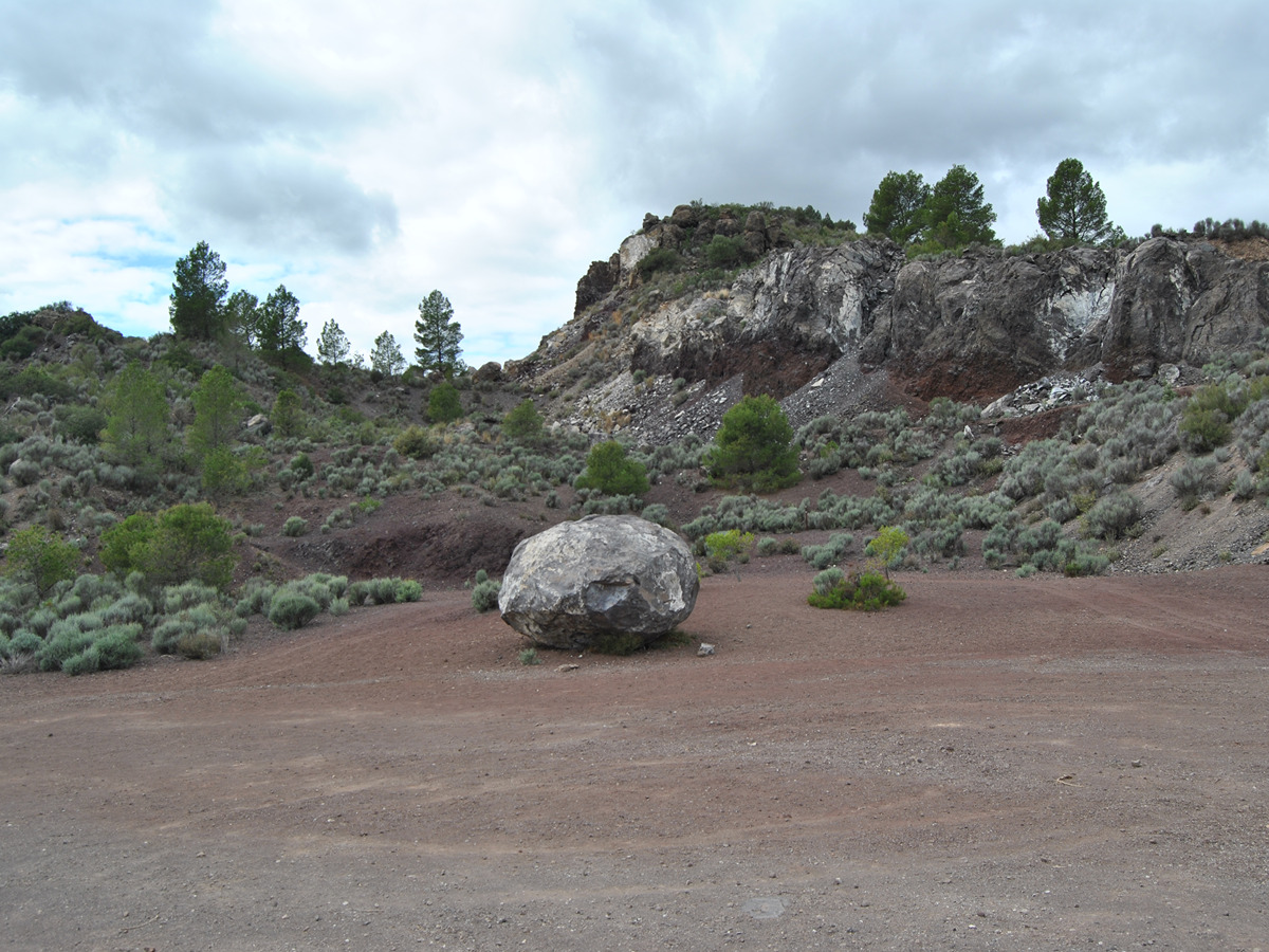