Rate this trail

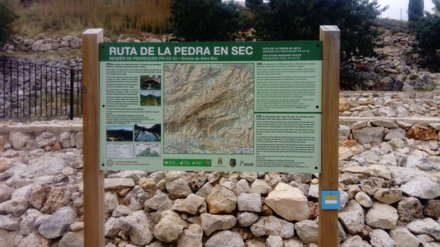
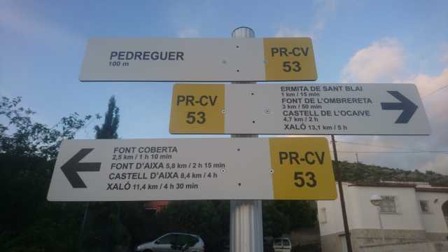
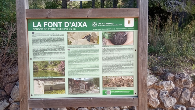
PR-CV 53 SENDER DE PEDREGUER

Promoter: Ayuntamiento de Pedreguer

Certification status: Conditioned quality control

1 review

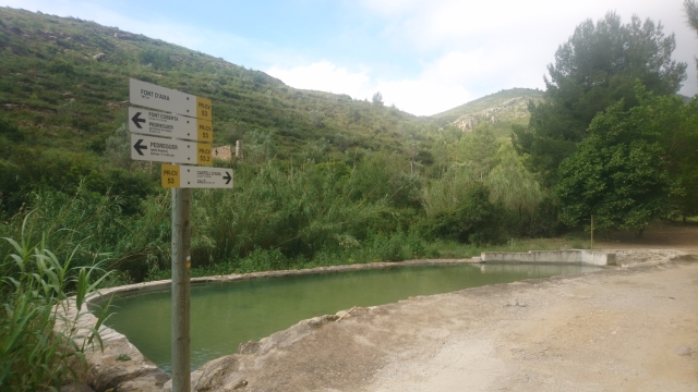
Following the inspection carried out by trail technicians, this trail has been declared of "limited adequacy" as a result of the faults detected in the signage. These include inadequate horizontal signs (paint markers) and/or vertical ones (trailheads and information boards) or lacking direction markers that do not provide sufficient information to properly follow the route. The builder of this trail has been informed of the situation.
For safety reasons and during maintenance work, it is advised to be extremely careful while taking this route. Furthermore, mountain sports entail risks associated with the activity itself and the environment where they take place, for which any person is fully liable. For this reason, hikes need to be planned properly and adequate training, equipment and sensible use of the trails are required.

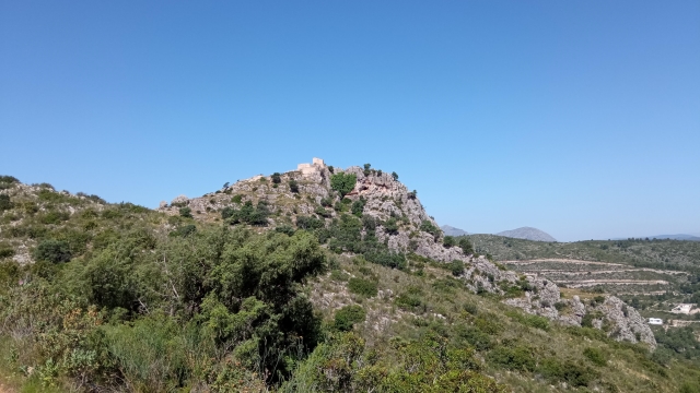
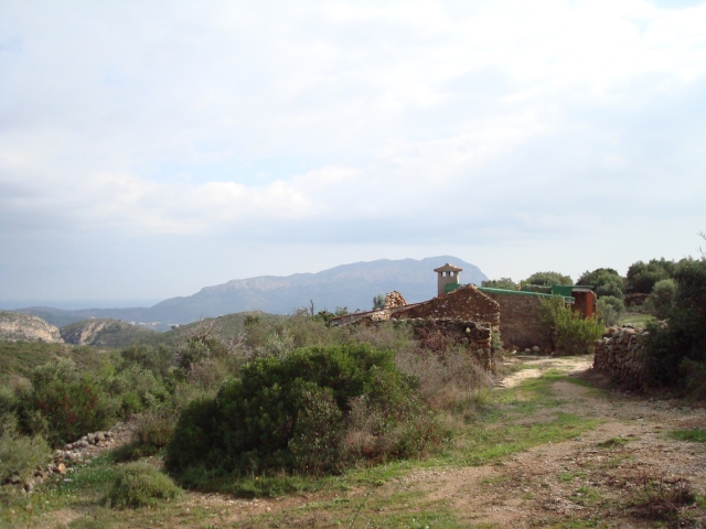
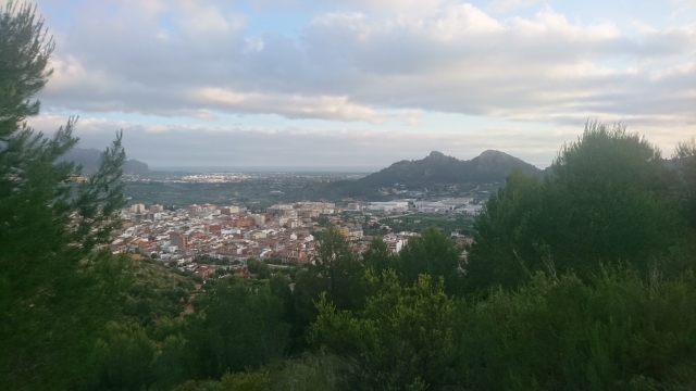
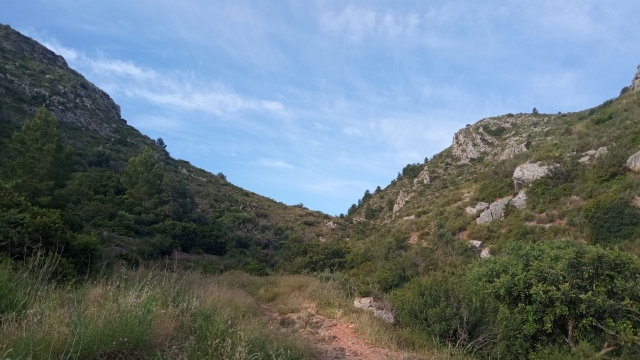
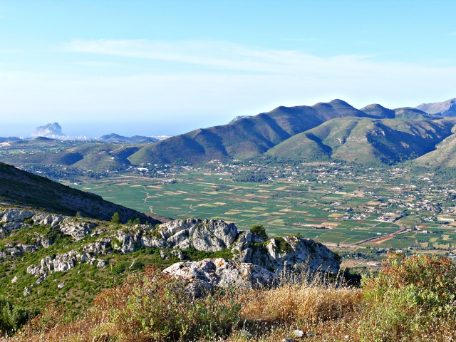
The Pedreguer trail, PR-CV 53 and its variants take you into the Castellet de la Solana mountain range, which takes up a large part of the municipality of Pedreguer. The area has surprisingly steep terrain despite its short distance from the sea. It also has abundant Mediterranean vegetation and an important historical legacy of human intervention with the remains of different castles, examples of dry stone architecture and remains of the country estates that used to exploit and still exploit the agriculture of the area with many cisterns still in use today.

Trail:
Loop
Technical data:
Length:
19,10 km
Estimated walking time:
07:05:00
Elevation gain:
1.120 m
Elevation loss:
1.120 m
MIDE ratings:
Level of natural risks:
1
Navigation on the trail:
2
Hiking difficulty:
2
Fitness level needed:
4

More information on Montaña Segura

Difficulty rating according to FEDME:
Unknown
Starting point:
Useful information:
Date of certification:
15-10-1996
Date of the act of registration in the Public Register:
22-05-2007
Date of the last Quality Control:
june de 2021
Reference municipality:
Otros municipios por los que transcurre:
District:
Province:
Alicante/Alacant
Cartography IGN MTN25:
0822-2

Downloadable from the Catalogue of the IGN Map Library

See other trails of this promoter:
Key points of the route:

Parc del Patronat (park) - Font Coberta recreation area. - Pla de l'Era (plain). PR-CV 53.1 Connection - - Font d'Aixa (spring). PR-CV 53.2 connection - Barranc de la Font d'Aixa (ravine) (PR-CV 53.3 connection) - Penyes Blanques (peak) (PR-CV 53.5 connection) - Cova de l'Ocaive (cave) (PR-CV 53.4 connection) - Font de l'Ombrereta recreation area. PR-CV connection 53.4 - Ermita de San Blai (chapel) (PR-CV connection 53.1)

Route description (only available in Spanish)

Iniciamos el sendero en el Parque del Patronato de Pedreguer desde donde sale una senda que sube por la ladera de la Muntanya Gran. Pasaremos por el acceso a la Cova del Tambor y más adelante por las ruinas de Casa del Romangat y el acceso a la senda del Cor del Enric. La senda comienza a llanear hasta llegar al acceso a la Font del Romangat desde donde bajaremos a la Font Coberta. Desde aquí el PR-CV 53 sube por el barranco de Les Fonts y trás pasar por el acceso a la Font del Rull llega al Pla de l´Era (enlace PR-CV 53.1). Seguiremos por una senda a nuestra izquierda que en descenso cruza el Barranco del Aigua  y donde  continuaremos por  un camino  que  conecta  con  el del  barranco  de la Font d´Aixa. Giraremos a la derecha en el cruce y llegaremos al enlace con el PR-CV 53.2 donde seguimos rectos por el camino hasta la Font d´Aixa. Desde esta fuente se sigue por una senda que remonta el Barranc de la Font d´Aixa, llega al enlace con el PR-CV 53.3 y continúa subiendo hasta Les Penyes Blanques donde encontramos el enlace al PR-CV 53.5 a Lliber. Seguiremos por  la derecha en el enlace y llegaremos al collado del castillo donde giraremos a la derecha para subir al Castell d´Aixa con un enlace al PR-CV 53.3. Volveremos sobre nuestros pasos para  bajar de nuevo al collado donde giraremos a la derecha y tras pasar  por el enlace del PR-CV 53.5 a Xaló continuaremos descendiendo por la senda hasta el acceso a la Font de la Tia Xima. Aquí giraremos a la derecha y seguiremos por un camino que nos lleva a la  Font de l´Ocaive. Desde esta fuente  continuaremos por una senda que sube a la Cova de l´Ocaive, con enlace al PR-CV 53.4 y bajaremos a la Font de l´Ombrereta con otro enlace al PR-CV 53.4. Cruzaremos el barranco de la fuente por un pequeño puente y siguiendo por la senda llegaremos a una tubería que seguiremos por la derecha hasta llegar al Calvario y a continuación a la Ermita de San Blai ya en Pedreguer, con enlace al PR-CV 53.1. 

Downloads:

Beware! Navigation devices may fail, batteries may run out of power and devices may break down. Do not use only electronic means to track your activities in the mountains; they must be used as a complement to the map and compass. Get some proper training and enjoy the mountains.

Alternative routes and routes leading to nearby points of interest