Rate this trail

SL-CV 18.1 LA GOTERA - ASSAGADOR D'EMPRIU

Promoter: Ayuntamiento de Villafranca del Cid

Certification status: No quality controls

0 reviews

There is no proof of quality control on the record of this trail in the last years. For this reason, it is unknown whether it complies with the optimal signage and maintenance conditions for hikers to take the trail following these signs exclusively.
Hikers have to take into consideration that the information about the signage and maintenance of the trails for which the promoter entity is responsible might not be up to date anymore, since it refers to its state on the date of its approval. Furthermore, mountain sports entail risks associated with the activity itself and the environment where they take place, for which any person is fully liable. For this reason, hikes need to be planned properly and adequate training, equipment and sensible use of the trails are required.

Trail:
One way (point-to-point)
Technical data:
Length:
7,15 km
Estimated walking time:
02:30:00
Elevation gain:
Unknown
Elevation loss:
Unknown
MIDE ratings:
Level of natural risks:
Unknown
Navigation on the trail:
Unknown
Hiking difficulty:
Unknown
Fitness level needed:
Unknown

More information on Montaña Segura

Difficulty rating according to FEDME:
Unknown
Starting point:
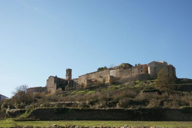
La Pobla del Bellestar. Vilafranca/Villafranca del Cid
End Point:
Assegador de l'Empriu (Enllaç PR-CV 402)
Useful information:
Date of the act of registration in the Public Register:
15-11-1998
Reference municipality:
District:
Province:
Castellón/Castelló
Cartography IGN MTN25:

Downloadable from the Catalogue of the IGN Map Library

See other trails of this promoter:
Key points of the route:

Pobla del Bellestar (connection PR-CV 1) - Molí Dolç (mill) - La Gotera - Molí d'en Rius (mill) - Assagador d'Empriu (cattle track) - Riu de les Truites (river) - Pobla del Ballestar

Route description (only available in Spanish)

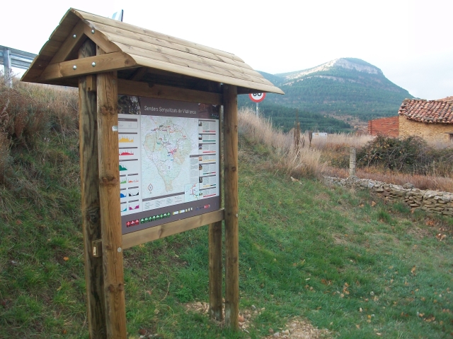
El sendero tiene el punto de salida en la margen derecha de la carretera CV-15 en el tramo desde Vilafranca con el límite con la Comunidad de Aragón, aproximadamente a 500 m del núcleo de población de la Pobla del Bellestar (P.1). La salida del sendero se efectúa por un sendero limitado por paredes de piedra. Hay un poste indicador a la salida. A unos metros de la salida del sendero hay un cruce con el PR-CV 402 proveniente de la Pobla del Bellestar (P.3).
Se recomienda efectuar la salida desde la Pobla del Bellestar (P.2) pues hay espacio para poder dejar el vehículo. Siguiendo el PR-CV 402 aproximadamente 900 m se empalma con el SL-CV 18.1 (P.2).
Desde el cruce con el PR-CV empieza la bajada hasta el río de las Truchas.
A mitad de la bajada (P.4) hay un poste por el cual, tomándolo a la izquierda, podemos llegar nuevamente a la Pobla del Bellestar pasante por el Moli Dolç y el Pont Antic. Este recorrido alternativo no se encuentra señalizado en condiciones y corresponde al trazado antiguo del sendero PR-CV 18.1. Como que sigue el margen izquierdo del río de las Truchas, se adentra en territorio aragones.
Al llegar al lecho del río (P.5) lo seguimos durante unos 300 m hasta llegar a una presa de agua muy interesante y una zona de chopos. Este espectacular lugar es conocido como La Gotera: un espectacular circo rocoso junto en el mismo río. (P.6) Esta zona se utiliza también para practicar escalada. La vegetación del lugar también es bastante espectacular. Hay una fuente.
Continuamos por el margen derecho del río. Utilizaremos como guía de nuestro camino la pared de la acequia que nos conduce a un molino: el Molí d'En Rius (P.7). Vamos ganando altura respecto a las aguas, llegamos al llamado molino, prácticamente derrocado. En este punto acaba la acequia, emprendiendo de una corta pero fuerte bajada continuamos por la pista que conduce también al molino. Esta pista se va alejando cada vez más del río y ganando altura (tiene fuerte pendiente). Nos conduce a un cruce de caminos (Assegador de l'Empriu) Apenas en este punto finaliza el sendero. Podemos continuar tomando el PR-CV. Si lo que queremos se volver en su punto de salida, habría que volver siguiendo dirección la Pobla del Bellestar hasta el punto P.2, si hemos efectuado el inicio desde la CV-15 (P.1) o hasta la Pobla del Bellestar (P.2).
 

Downloads:

Beware! Navigation devices may fail, batteries may run out of power and devices may break down. Do not use only electronic means to track your activities in the mountains; they must be used as a complement to the map and compass. Get some proper training and enjoy the mountains.

Other trails connecting with this trail