Rate this trail

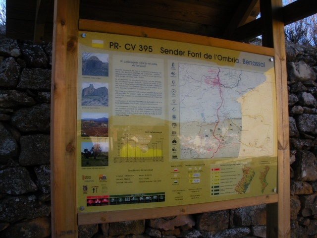
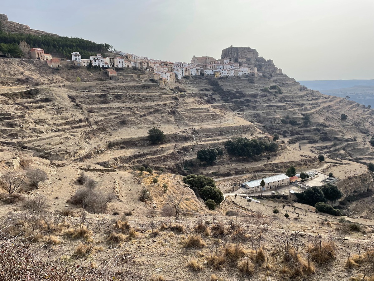
PR-CV 294 CAMI VELL DE BENASSAL A VISTABELLA (PEL MOLI DEL PAS)

Promoter: Ayuntamiento Benassal

Certification status: Conditioned quality control

0 reviews

Following the inspection carried out by trail technicians, this trail has been declared of "limited adequacy" as a result of the faults detected in the signage. These include inadequate horizontal signs (paint markers) and/or vertical ones (trailheads and information boards) or lacking direction markers that do not provide sufficient information to properly follow the route. The builder of this trail has been informed of the situation.
For safety reasons and during maintenance work, it is advised to be extremely careful while taking this route. Furthermore, mountain sports entail risks associated with the activity itself and the environment where they take place, for which any person is fully liable. For this reason, hikes need to be planned properly and adequate training, equipment and sensible use of the trails are required.

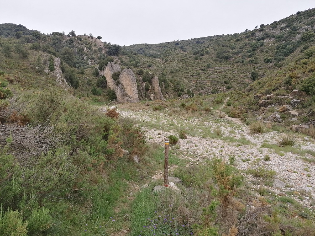
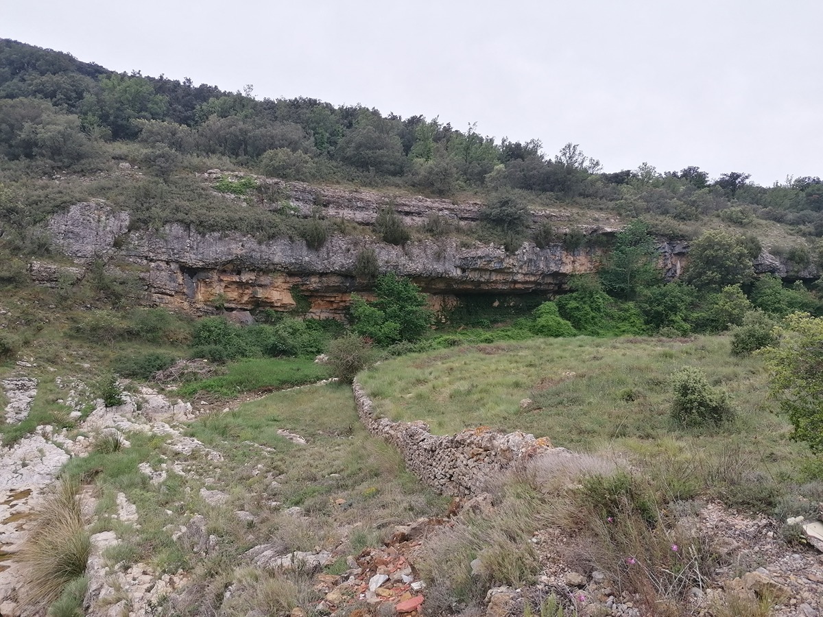
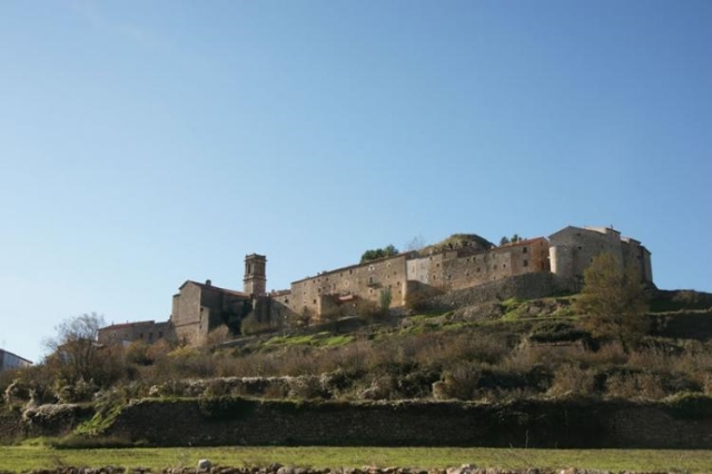
A route that takes you back in time. Centenary trees, old mills, country estates, landscapes and exceptional views are all crossed by deep ravines that are the hallmarks of this region.

Trail:
One way (point-to-point)
Technical data:
Length:
9,20 km
Estimated walking time:
03:00:00
Elevation gain:
270 m
Elevation loss:
470 m
MIDE ratings:
Level of natural risks:
2
Navigation on the trail:
2
Hiking difficulty:
2
Fitness level needed:
3

More information on Montaña Segura

Difficulty rating according to FEDME:
Unknown
Useful information:
Date of certification:
03-10-2003
Date of the act of registration in the Public Register:
20-02-2008
Date of the last Quality Control:
july de 2023
Reference municipality:
District:
Province:
Castellón/Castelló
Cartography IGN MTN25:
0569-4; 0570-3

Downloadable from the Catalogue of the IGN Map Library

See other trails of this promoter:
Protected Natural Spaces:

We advise you to look up the regulations and/or authorisations for using the trails in these conservation areas on the website of the Conselleria de Medio Ambiente, Agua, Infraestructuras y Territorio

  • L'Alt Maestrat (SIC - Site of Community Interest)
Key points of the route:

Benassal - Camino de Vilafranca (path) - Camino del Montlleó and Vistabella (path) - Río Sec (river) - Collado de les Vistes (col) - Escuela del Canto (old rural school) - Fuente de la Comuna (spring) - Río Montlleó (river). Molí del Pas (mill)

Route description (only available in Spanish)

Nuestro sendero comienza en la ermita Nuestra Señora de Loreto en Benassal, junto al cementerio. Bordearemos este por el lado derecho en sentido de nuestra marcha para enlazar con el camino de Vilafranca en su cruce con la colada de la Font dels Hortassos. Tomaremos el desvío a la izquierda dirección la masía de Mireta. A medio km iniciaremos un descenso hasta el cauce del riu Sec para ascender hasta el mas del Coll de les Vistes. Abandonaremos la senda 200 m antes de llegar al mas para seguir por pista. En menos de 1 km volvemos a abandonar la pista tomando un desvío a la izquierda que coincide con el enlace del PR-CV 1, camino de Culla a Villafranca. De nuevo por senda hasta el final de nuestro recorrido, pasando por la escuela del Canto y descender hasta el mas del Bitxo, la font de la Comuna y finalmente al cauce del río Montlleó a la altura del molí del Pas.

Downloads:

Beware! Navigation devices may fail, batteries may run out of power and devices may break down. Do not use only electronic means to track your activities in the mountains; they must be used as a complement to the map and compass. Get some proper training and enjoy the mountains.

Other trails connecting with this trail