Rate this trail

SL-CV 94 SERRA D'EN GALCERAN

Promoter: Ayuntamiento de Sierra Engarcerán

Certification status: No quality controls

0 reviews

There is no proof of quality control on the record of this trail in the last years. For this reason, it is unknown whether it complies with the optimal signage and maintenance conditions for hikers to take the trail following these signs exclusively.
Hikers have to take into consideration that the information about the signage and maintenance of the trails for which the promoter entity is responsible might not be up to date anymore, since it refers to its state on the date of its approval. Furthermore, mountain sports entail risks associated with the activity itself and the environment where they take place, for which any person is fully liable. For this reason, hikes need to be planned properly and adequate training, equipment and sensible use of the trails are required.

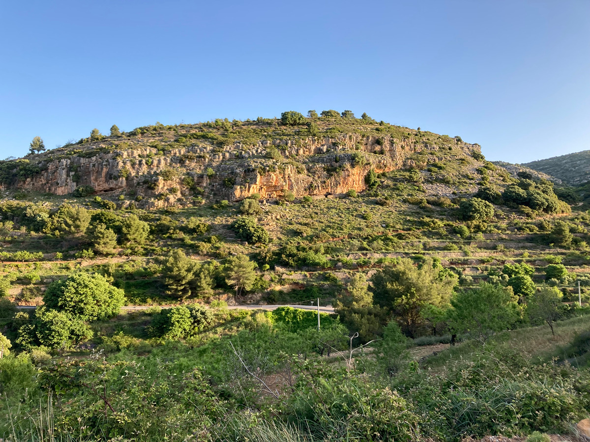
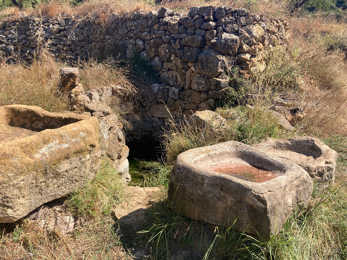
This circular route with gentle slopes is the perfect family friendly hike. In spite of being a short route, this trail has much to offer, as you will be visiting a great natural terrace from where you will have magnificent views, not only of the region of La Plana, but also of different mountain ranges, including the imposing peak of Penyagolosa. In the upper part of this route you can discover the remains of an Iberian settlement, now hidden among rocks and vegetation.

Trail:
Loop with some overlapping out and back sections
Technical data:
Length:
4,80 km
Estimated walking time:
01:40:00
Elevation gain:
270 m
Elevation loss:
270 m
MIDE ratings:
Level of natural risks:
2
Navigation on the trail:
2
Hiking difficulty:
2
Fitness level needed:
2

More information on Montaña Segura

Difficulty rating according to FEDME:
Unknown
Starting point:
Useful information:
Date of the act of registration in the Public Register:
20-10-2015
Reference municipality:
District:
Province:
Castellón/Castelló
Cartography IGN MTN25:
0593-2

Downloadable from the Catalogue of the IGN Map Library

See other trails of this promoter:
Protected Natural Spaces:

We advise you to look up the regulations and/or authorisations for using the trails in these conservation areas on the website of the Conselleria de Medio Ambiente, Agua, Infraestructuras y Territorio

  • Serra d'en Galceran (SAC - Special Area of Conservation)
Key points of the route:

CV-155 Road - Bassa del Clot de la Terra (natural pool) - Spur trail 1 - El Castellar - Font de l'Ombria (spring) - Roure Valencià (Valencian oak)

Route description (only available in Spanish)

La ruta comienza justo a la entrada desde Benlloc. Empezaremos unos pocos metros dirección norte hacia la población, para cruzar la ctra. y coger la calle ascendente hacia la Partida Collet. Una vez pasadas las viviendas, nos encontraremos en una pista que se incorpora a nuestra izquierda, (pista por la que regresaremos). A continuación cogeremos la bifurcación a izquierda en ligero ascenso unos 100 metros, hasta una curva pronunciada. Aquí dejamos la pista para coger la senda junto a la pinada. Continuaremos toda la senda, ascendiendo entre bancales construidos en terrazas escalonadas, cuyos muros de piedra dan singularidad al terreno. Tras una ascensión pausada y con desnivel algo elevado, llegaremos a una gran explanada del terreno que forma un inapreciable collado entre la Mola y el Castellar, aquí haremos un giro a la izquierda para buscar la linea de bosque de la umbría. Poco antes de alcanzar la pista, y antes de girar a la izquierda, tendremos a derecha la bifurcación de la derivación a la senda (ida y vuelta) que nos lleva a la cumbre del Castellar y sus restos de poblado íbero. Volvemos a la pista y llegamos a la Font de l'Ombria.  Desde aquí, caminaremos por la pista en ligero descenso a través de la arbolada. Una vez en la parte baja encontramos un ejemplar singular de quejigo o Roure Valencià. Seguimos bajando hasta llegar a la pista del comienzo que nos lleva al inicio   

Downloads:

Beware! Navigation devices may fail, batteries may run out of power and devices may break down. Do not use only electronic means to track your activities in the mountains; they must be used as a complement to the map and compass. Get some proper training and enjoy the mountains.

Other trails connecting with this trail