Rate this trail

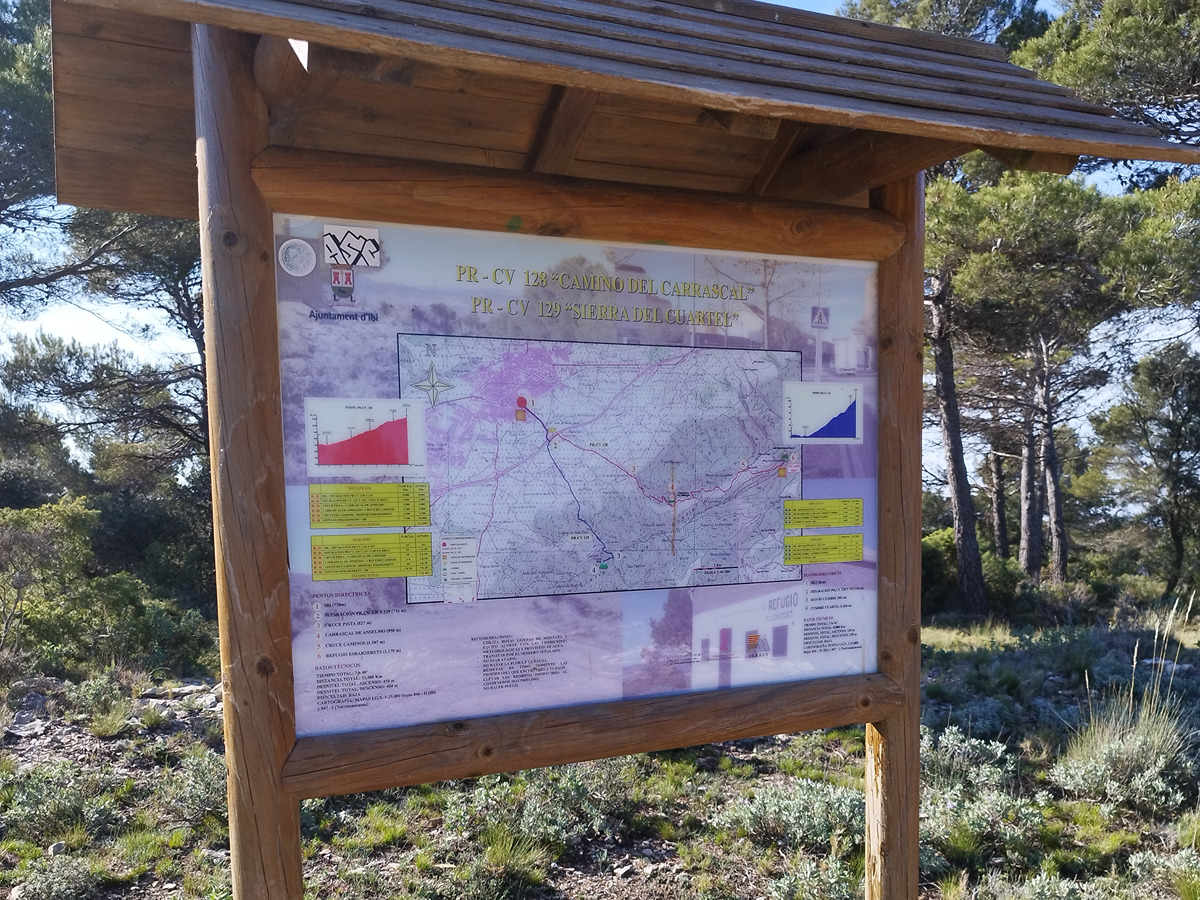
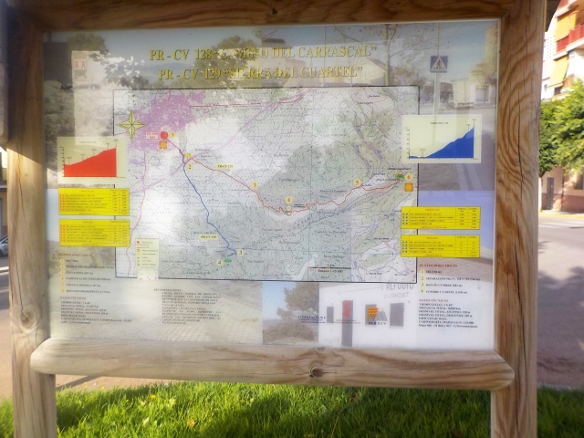
PR-CV 128 CAMÍ DEL CARRASCAL

Promoter: Ayuntamiento de Ibi

Certification status: Conditioned quality control

2 reviews

Following the inspection carried out by trail technicians, this trail has been declared of "limited adequacy" as a result of the faults detected in the signage. These include inadequate horizontal signs (paint markers) and/or vertical ones (trailheads and information boards) or lacking direction markers that do not provide sufficient information to properly follow the route. The builder of this trail has been informed of the situation.
For safety reasons and during maintenance work, it is advised to be extremely careful while taking this route. Furthermore, mountain sports entail risks associated with the activity itself and the environment where they take place, for which any person is fully liable. For this reason, hikes need to be planned properly and adequate training, equipment and sensible use of the trails are required.

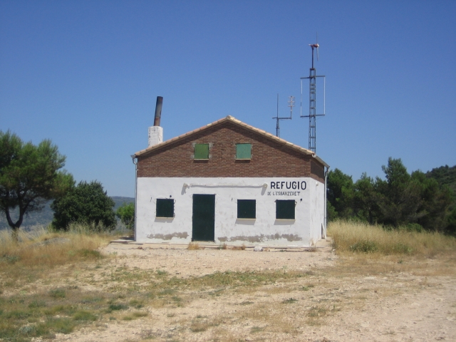
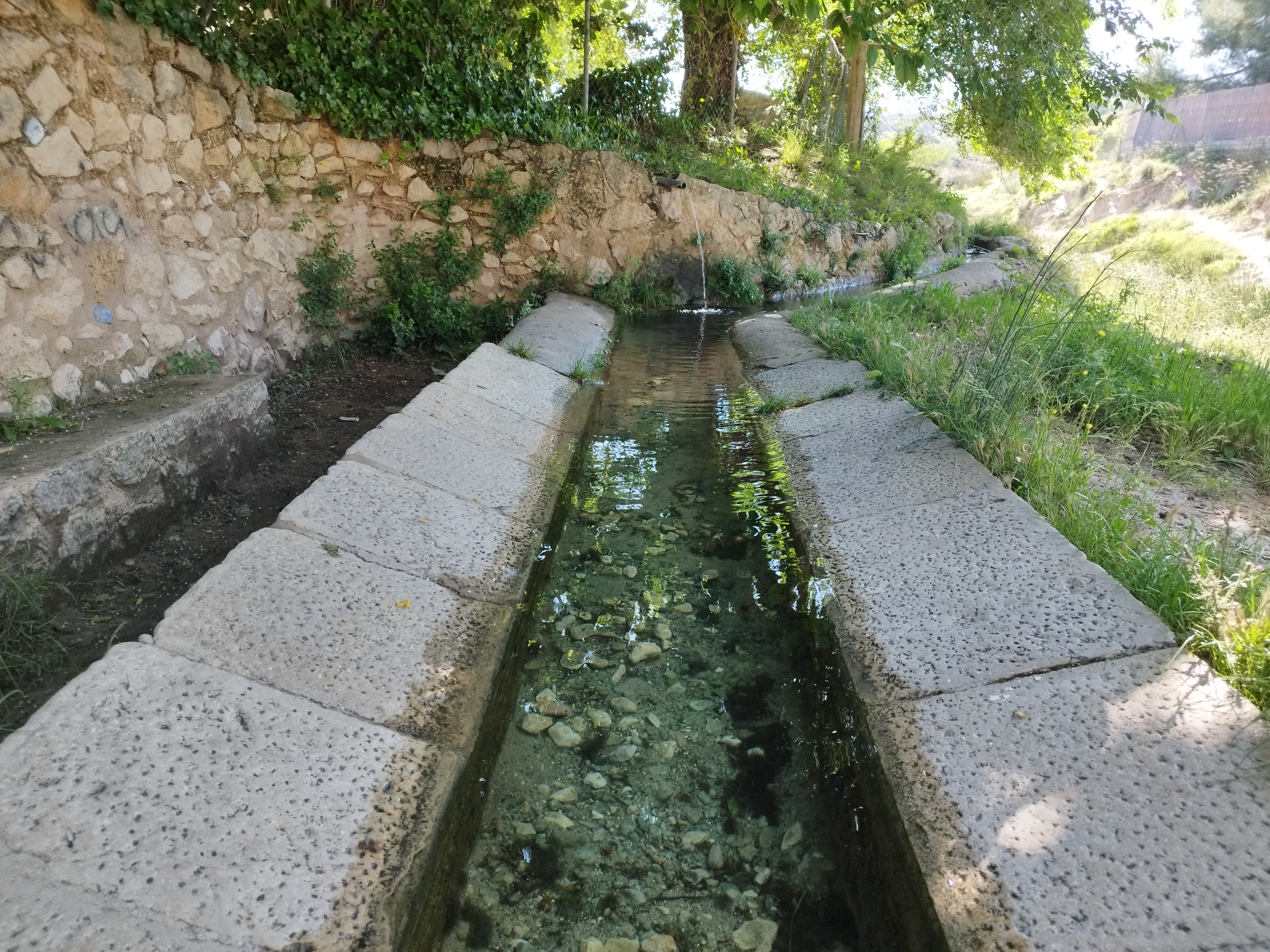
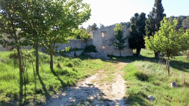
An entertaining route that takes you from Ibi to one of the highest places in Carrasqueta. You will ascend through pine trees on north-facing slopes, which will make the climb easier, passing by the Carrascal de Anselmo country house and the Carrasca spring until you reach the Carrasqueta peak, next to the Els Esbarzerets refuge.

Trail:
One way (point-to-point)
Technical data:
Length:
7,60 km
Estimated walking time:
02:30:00
Elevation gain:
455 m
Elevation loss:
20 m
MIDE ratings:
Level of natural risks:
1
Navigation on the trail:
2
Hiking difficulty:
2
Fitness level needed:
2

More information on Montaña Segura

Difficulty rating according to FEDME:
Unknown
Starting point:
Useful information:
Date of certification:
15-06-1998
Date of the act of registration in the Public Register:
22-05-2007
Date of the last Quality Control:
june de 2023
Reference municipality:
District:
Province:
Alicante/Alacant
Cartography IGN MTN25:
0846-2; 0847-1

Downloadable from the Catalogue of the IGN Map Library

See other trails of this promoter:
Key points of the route:

Ibi - Puente de la Pileta (bridge) (PR-CV 82, PR-CV 83 and PR-CV 129 connection) - Barranco Boquera (ravine) - Mas del Carrascar de Anselmo (estate) (connection PR-CV 82) - Font del Carrascal (spring) - Esbarzerets Refuge

Route description (only available in Spanish)

Tomamos la calle Vicente Aleixandre, pasamos el campo de fútbol y cruzamos el puente de las Piletas. Seguimos rectos con cierta tendencia al descenso hasta encontrarnos con nuestro primer cruce en el cual cogeremos a la derecha, dirección Suroeste. Seguiremos bajando sin dejar el camino asfaltado, veremos un puente que cruza la nueva autovía que une la población de Alcoy con Alicante. Cruzamos por él y al final enlazan los PR-CV 82, 83 y 129. Aquí giramos a la izquierda, dirección noroeste, para en pocos metros girar hacia la derecha para encontrarnos con el mas El Regalo, con su curiosa arquitectura.

Una vez pasado el mas, seguimos recto junto al barranco de la Boquera por la carretera asfaltada desechando varios caminos que salen a derecha e izquierda hasta llegar a una curva muy cerrada y con sentido descendente, cruzando el barranco de la Boquera por un puente. Aquí cogeremos la pista que sale a la derecha, dirección sur.

Desde aquí iremos en continuo ascenso hasta llegar al mas del Carrascar de Anselmo, el cual lo dejamos a nuestra izquierda para seguir ascendiendo, pasando por otras masías en ruinas como la de Concha Sello y Ntra. Señora del Consuelo. Pocos cientos de metros después de esta última nos encontramos con la fuente del Carrascal. Seguiremos hasta encontrarnos con un cruce de varios caminos en el collado de la Carrasqueta. Nosotros cogeremos el de la izquierda, dirección noroeste, que nos llevará al Refugio dels Esbarzerets.

Downloads:

Beware! Navigation devices may fail, batteries may run out of power and devices may break down. Do not use only electronic means to track your activities in the mountains; they must be used as a complement to the map and compass. Get some proper training and enjoy the mountains.

Other trails connecting with this trail