Province
Alicante/Alacant
Castellón/Castelló
Valencia/València
District
Alt Vinalopó
Baix Segura/Vega Baja
Baix Vinalopó
Camp de Turia
El Alto Mijares
El Alto Palancia
El Baix Maestrat
El Camp de Morvedre
El Comtat
El Valle de Ayora
Els Ports
L'Alacantí
L'Alcalaten
L'Alcoià
L'Alt maestrat
L'Horta Nord
L'Horta Oest
L'Horta Sud
La Canal de Navarrés
La Costera
La Hoya de Buñol
La Marina Alta
La Marina Baixa
La Plana Alta
La Plana Baixa
La Ribera Alta
La Ribera Baixa
La Safor
La Vall d'Albaida
Los Serranos
Requena-Utiel
Rincón de Ademúz
València
Vinalopò Mitja
Passes by
Ademuz
Ador
Agost
Agres
Agullent
Aielo de Malferit
Aielo de Rugat
Aigües
Ain
Albaida
Albal
Albalat dels Tarongers
Albatera
Albocasser
Alborache
Alcalà de Xivert
Alcalalí
Alcoleja
Alcora (l')
Alcoy/Alcoi
Alcublas
Alcúdia (l')
Alcudia de Veo
Alfafar
Alfafara
Alfauir
Alfondeguilla
Algar de Palancia
Algemesí
Algimia d'Alfara
Alginet
Algorfa
Algueña
Alicante/Alacant
Almazora/Almassora
Almedijar
Almiserà
Almoradí
Almussafes
Alpuente
Altea
Altura
Alzira
Andilla
Anna
Arañuel
Aras de los Olmos
Arcos de las Salinas
Ares del Maestrat
Argelita
Artana
Aspe
Atzeneta d'Albaida
Atzeneta del Maestrat
Ayódar
Ayora
Banyeres de Mariola
Barracas
Barx
Barxeta
Bejís
Bèlgida
Benafer
Benafigos
Benagéber
Benaguasil
Benasau
Benassal
Beneixama
Benejúzar
Beniarbeig
Beniardà
Beniarrés
Beniatjar
Benicasim/Benicàssim
Benidoleig
Benidorm
Benifaió
Benifairó de la Valldigna
Benifairó de les Valls
Benifato
Benigànim
Benigembla
Benijófar
Benimantell
Benimassot
Benimeli
Beniparrell
Benissa
Benissoda
Benitachell/Poble Nou de Benitatxell (El)
Benitandus
Bétera
Betxi
Biar
Bicorp
Bigastro
Bocairent
Bolbaite
Bolulla
Borriol
Bufali
Bugarra
Buñol
Busot
Cabanes
Calles
Callosa d'en Sarrià
Callosa de Segura
Calpe/Calp
Campello (El)
Campo de Mirra/Camp de Mirra (El)
Camporrobles
Cañada
Canals
Canet lo Roig
Cantavieja
Carcaixent
Carlet
Carrícola
Casas Altas
Casas Bajas
Castalla
Castell de Cabres
Castell de Castells
Castell de Guadalest (El)
Castellfort
Castellnovo
Castelló
Castelló de la Plana
Castelló de Rugat
Castellonet de la Conquesta
Castielfabib
Catadau
Catarroja
Cati
Caudete de las Fuentes
Caudiel
Chella
Chelva
Chera
Chert/Xert
Cheste
Chiva
Chodos/Xodos
Chovar
Chulilla
Cinctorres
Cocentaina
Cofrentes
Confrides
Corbera
Cortes de Arenoso
Cortes de Pallás
Cox
Crevillent
Culla
Cullera
Dénia
Dolores
Domeño
Dos Aguas
Elche/Elx
Elda
Enguera
Ènova (l')
Eslida
Espadilla
Estivella
Estubeny
Fageca
Famorca
Fanzara
Favara
Figueroles
Finestrat
Fondó de les Neus (El)/Hondón de las Nieves
Font d'En Carròs (La)
Font de la Figuera (La)
Fontanars dels Alforins
Forcall
Fuente la Reina
Fuenterrobles
Fuentes de Ayodar
Gaianes
Gaibiel
Gandia
Gata de Gorgos
Gátova
Gavarda
Geldo
Genovés
Gestalgar
Gilet
Godelleta
Granja de Rocamora
Guadassuar
Guardamar del Segura
Herbers
Herbés
Higueras
Higueruelas
Hondón de los Frailes
Ibi
Iglesuela del Cid, La
Jalance
Jana (La)
Jarafuel
Jérica
La Barraca d'Aigües Vives
Llaurí
Llíber
Llíria
Llocnou de Sant Jeroni
Llombai
Llosa (La)
Llutxent
Lorcha/Orxa (l')
Loriguilla
Losa del Obispo
Losilla de Aras
Lucena del Cid/Llucena
Ludiente
Macastre
Manuel
Marines
Massanassa
Mata de Morella (La)
Matet
Millares
Moixent/Mogente
Monforte del Cid
Monòver/Monóvar
Montán
Montanejos
Montesa
Montesinos (los)
Montitxelvo/Montichelvo
Montserrat
Morella
Murla
Muro d'Alcoi
Mutxamel
Nàquera/Náquera
Navajas
Navarrés
Novelda
Novetlè
Nucia (La)
Nules
Olba
Oliva
Olocau
Olocau del Rey
Onda
Ondara
Onil
Ontinyent
Orba
Orihuela
Oropesa del Mar/Orpesa
Orxeta
Otos
Palanques
Palomar (El)
Parcent
Pedralba
Pedreguer
Peníscola/Peñíscola
Petrer
Picassent
Pina de Montalgrao
Pinet
Pinós (El)/Pinoso
Pobla de Benifassà (La)
Pobla de Vallbona (La)
Pobla Llarga (La)
Pobla Tornesa (La)
Polop
Portell de Morella
Puçol
Puebla de Arenoso
Puebla de San Miguel
Puig de Santa Maria, El
Quart de les Valls
Quatretonda
Quatretondeta
Quesa
Rafelguaraf
Ràfol d'Almúnia (El)
Ráfol de Salem
Real
Redován
Requena
Ribesalbes
Rojales
Romana (La)
Rossell
Ròtova
Rugat
Sacañet
Sagunt/Sagunto
Salem
Salinas
Salvacañete
Sant Joan d'Alacant
Sant Joan de Moró
Sant Mateu
Sant Vicent del Raspeig/San Vicente del Raspeig
Santa Cruz de Moya
Santa Pola
Sax
Sedaví
Segart
Segorbe
Sella
Senija
Serra
Serratella (La)
Sierra Engarcerán
Siete Aguas
Silla
Simat de la Valldigna
Sinarcas
Sollana
Soneja
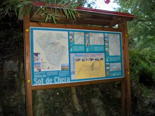
Sot de Chera
Sot de Ferrer
Sueca
Suera/Sueras
Sumacàrcer
Tales
Tàrbena
Tavernes de la Valldigna
Teresa
Teresa de Cofrentes
Terrateig
Teulada
Tibi
Titaguas
Todolella
Toga
Tollos
Toras
Tormos
Toro (El)
Torralba del Pinar
Torre d'En Besora (La)
Torrebaja
Torrechiva
Torremanzanas/Torre de les Maçanes (La)
Torrent
Torrevieja
Tous
Traiguera
Tuéjar
Turís
Useres (les)/Useras
Utiel
València
Vall d'Alcalà (La)
Vall d'Uixó (La)
Vall de Gallinera
Vall de Laguar (La)
Vallada
Vallanca
Vallat
Vallibona
Veguillas de la Sierra
Venta del Moro
Verger (El)
Vila-real
Vilafames
Vilamarxant
Vilar de Canes
Vilavella (La)
Villafranca del Cid/Vilafranca
Villahermosa del Río
Villajoyosa/Vila Joiosa (La)
Villalonga
Villamalur
Villanueva de Viver
Villargordo del Cabriel
Villena
Villores
Vinaròs
Vistabella del Maestrat
Viver
Xàbia/Jávea
Xaló
Xàtiva
Xeraco
Xeresa
Xirles
Xixona/Jijona
Yátova
Yesa (La)
Zarra
Zorita del Maestrazgo
Zucaina
Conservation area
Acantilados de la Marina - SAC - Special Area of Conservation
Acantilados de la Marina - SIC - Site of Community Interest
Acantilados de la Marina - SPAB - Special Protection Area for Birds
Agulles dels Frares - Flora Micro-reserve
Aitana, Serrella y Puig Campana - SAC - Special Area of Conservation
Aitana, Serrella y Puig Campana - SIC - Site of Community Interest
Albufera - Natural Park
Albufera - SIC - Site of Community Interest
Albufera - SPAB - Special Protection Area for Birds
Alt de la Gralla - SAC - Special Area of Conservation
Alt de la Gralla - SIC - Site of Community Interest
Alto Palancia - SAC - Special Area of Conservation
Alto Palancia - SIC - Site of Community Interest
Alto Turia - SAC - Special Area of Conservation
Alto Turia - SIC - Site of Community Interest
Alto Turia - Biosphere reserve
Alto Turia y Sierra del Negrete - SPAB - Special Protection Area for Birds
Alts de la Drova - Flora Micro-reserve
Arroyo Cerezo - SIC - Site of Community Interest
Barracas y El Toro - SIC - Site of Community Interest
Barranc de l'Assut - Flora Micro-reserve
Barranc de l'Emboixar - Flora Micro-reserve
Barranc de la Fos - Municipal Natural Site
Barranc de Manesa - Flora Micro-reserve
Barranc del Toll - Flora Micro-reserve
Barranco de Enmedio - Flora Micro-reserve
Barranco la Hoz - Municipal Natural Site
Barrancos Carrasca - Gatillo - Municipal Natural Site
Cabeçó d'Or y la Grana - SPAB - Special Protection Area for Birds
Cabezo de la Sal - Natural Monument
Calderona - SAC - Special Area of Conservation
Camí dels Peregrins de les Useres - Natural Monument
Cap d'Or - Flora Micro-reserve
Cape Cervera-Litoral - SIC - Site of Community Interest
Caroche - Flora Micro-reserve
Carrascal de la Font Roja - Natural Park
Carrascar de la Font Roja - Natural Park
Chera - Sot de Chera - Natural Park
Cim de Crevillent - Flora Micro-reserve
Cim del Puig Campana - Flora Micro-reserve
Clots de la Sal y monte de la Mola - Municipal Natural Site
Coll de Sant Juri - Flora Micro-reserve
Coll del Ventisquer - Flora Micro-reserve
Cova de les Rates y Casa dels Garcies - Flora Micro-reserve
Cova del Aigua - Flora Micro-reserve
Cruz de los Tres Reinos - Flora Micro-reserve
Cueva Ahumada - Flora Micro-reserve
Curs mitjà del riu Palància - SAC - Special Area of Conservation
Curs mitjà del riu Palància - SIC - Site of Community Interest
Curso Alto del río Mijares - SIC - Site of Community Interest
Curso medio del Palancia - SAC - Special Area of Conservation
Curso Medio del Palancia - SIC - Site of Community Interest
Curso Medio del río Albaida - SIC - Site of Community Interest
Desert de les Palmes - Natural Park
Desert de les Palmes - SIC - Site of Community Interest
Desert de les Palmes - SPAB - Special Protection Area for Birds
Dunes of Guardamar - Flora Micro-reserve
Dunes of Guardamar - SIC - Site of Community Interest
El Cabezo A y B - Flora Micro-reserve
El Fondo - Natural Park
El Mollet - Municipal Natural Site
El Molón - Flora Micro-reserve
El Molón - Municipal Natural Site
El Surar - Municipal Natural Site
El Tajar - Flora Micro-reserve
El Tello - Municipal Natural Site
Els Alforins - SAC - Special Area of Conservation
Els Alforins - SIC - Site of Community Interest
Els Arcs - Municipal Natural Site
Els Plantadets - Municipal Natural Site
Font del Baladre – Fontanars – Riu d’Agres - Municipal Natural Site
Font Roja - Natural Park
Fuente Bellido - Municipal Natural Site
Hoces del Cabriel - Natural Park
Hoces del Cabriel - SIC - Site of Community Interest
Hoces del Cabriel - SPAB - Special Protection Area for Birds
Hontanar - La Ferriza - SPAB - Special Protection Area for Birds
Hort dels Frares - Flora Micro-reserve
L'Alt Maestrat - SIC - Site of Community Interest
L'Alt Maestrat, Tinença de Benifassà, Turmell i Vallibana - SPAB - Special Protection Area for Birds
La Cabrentà - Municipal Natural Site
La Canal - Flora Micro-reserve
La Cova Negra - Municipal Natural Site
La Dehesa - Municipal Natural Site
La Fenosa - Municipal Natural Site
La Granadella - Flora Micro-reserve
La Manguilla - Municipal Natural Site
La Murta y la Casella - Municipal Natural Site
La Pilarica-Sierra de Callosa - Municipal Natural Site
La Rodana Gran - Flora Micro-reserve
La Sierra - Municipal Natural Site
La Sierra - Redován - Municipal Natural Site
Laderas del Castillo de Sax y Arenal de l´Almorxó - Municipal Natural Site
Lagoons of La Mata and Torrevieja - SIC - Site of Community Interest
Lagoons of La Mata and Torrevieja - SPAB - Special Protection Area for Birds
Laguna de Salinas - SIC - Site of Community Interest
Lagunas de la Mata y Torrevieja - Natural Park
Las Blancas - Flora Micro-reserve
Las Callejuelas - Flora Micro-reserve
Les Coves - Flora Micro-reserve
Les Coves Llongues - Flora Micro-reserve
Les Fontanelles - Municipal Natural Site
Les Rodanes - Municipal Natural Site
Les Xemeneies - Flora Micro-reserve
Los Algezares - Municipal Natural Site
Los Calderones - Municipal Natural Site
Los Chorradores - Municipal Natural Site
Maigmó y Sierras de la Foia de Castalla - SAC - Special Area of Conservation
Maigmó y Sierras de la Foia de Castalla - SIC - Site of Community Interest
Maigmó y Sierras de la Foia de Castalla - SPAB - Special Protection Area for Birds
Mola de la Vila - Municipal Natural Site
Mola de Serelles - Flora Micro-reserve
Mola d´Ares - Municipal Natural Site
Montañas de Alicante - SPAB - Special Protection Area for Birds
Montdúver - Marjal de la Safor - SPAB - Special Protection Area for Birds
Monte Coto - Protected Landscape
Monte Coto-Pinoso - Municipal Natural Site
Monte Hurchillo - Flora Micro-reserve
Montgó - Natural Park
Montgó - Natural Park
Montgó - SIC - Site of Community Interest
Montgó-Cap de Sant Antoni - SPAB - Special Protection Area for Birds
Morella y mola d'en Camaràs - Municipal Natural Site
Muela de Cortes y el Caroche - SAC - Special Area of Conservation
Muela de Cortes y el Caroche - SIC - Site of Community Interest
Muela de los Tres Reinos - Municipal Natural Site
Muntanyes de la Marina - SPAB - Special Protection Area for Birds
Muntanyes de la Marina. Aitana, Serrella y Puig Campana - SPAB - Special Protection Area for Birds
Muntanyeta dels Sants - Flora Micro-reserve
Nacimiento del río Tuéjar - Municipal Natural Site
Palomita - Municipal Natural Site
Parpalló - Borell - Municipal Natural Site
Peñaescabia - Municipal Natural Site
Penya de la Font Vella - Flora Micro-reserve
Penya del Benicadell - Flora Micro-reserve
Penyagolosa - Natural Park
Penyagolosa - SIC - Site of Community Interest
Penyagolosa - SPAB - Special Protection Area for Birds
Penyalba - Flora Micro-reserve
Penyes Albes - Municipal Natural Site
Penyeta de l'Hedra - Flora Micro-reserve
Pina de Montalgrao y Benafer - SAC - Special Area of Conservation
Pla de Mora - Flora Micro-reserve
Puebla de San Miguel - SIC - Site of Community Interest
Puig Campana y Ponotx - Protected Landscape
Puntal de Bujes, Bco. de Pertecaste y Port de Tous - Flora Micro-reserve
Puntal de l'Abella - Flora Micro-reserve
Racó de Sant Bonaventura-Els Canalons - Municipal Natural Site
Racó de Seva y Cova del Canelobre - Flora Micro-reserve
Racó del Frare - Municipal Natural Site
Rambla de Alcotas - Flora Micro-reserve
Rambla de Celumbres - Municipal Natural Site
Rambla de las Ventanas - Flora Micro-reserve
Riberas del río Tuéjar - Flora Micro-reserve
Rincón de Bonanza - Flora Micro-reserve
Río Bohilgues - Flora Micro-reserve
Río Ebrón - Flora Micro-reserve
Ríos del Rincón de Ademuz - SIC - Site of Community Interest
Riu Bergantes - SIC - Site of Community Interest
Riu de Barxeta - Municipal Natural Site
Riu Gorgos - SIC - Site of Community Interest
Riu Montnegre - SPAB - Special Protection Area for Birds
Riu Xúquer - SIC - Site of Community Interest
Romeu - Municipal Natural Site
Sabinar de Alpuente - SIC - Site of Community Interest
Sabinar de Alpuente - Alto Turia - SAC - Special Area of Conservation
Salinas de Santa Pola - Natural Park
Sant Pasqual - Torretes - Municipal Natural Site
Serpis - Protected Landscape
Serra d'en Galceran - SAC - Special Area of Conservation
Serra d'en Galceran - SIC - Site of Community Interest
Serra d'Irta - SIC - Site of Community Interest
Serra de Bèrnia i Ferrer - Protected Landscape
Serra de Crevillent - SIC - Site of Community Interest
Serra de l'Ombria - Pou Clar - Municipal Natural Site
Serra de la Creu - Flora Micro-reserve
Serra de la Safor - SIC - Site of Community Interest
Serra de Quatretonda - Municipal Natural Site
Serra del Castell - Flora Micro-reserve
Serra del Castell de Xátiva - SIC - Site of Community Interest
Serra del Motduver i Marxuquera - SIC - Site of Community Interest
Serra Perenxisa - Municipal Natural Site
Serres del Ferrer i Bèrnia - SIC - Site of Community Interest
Serres del Montdúver i Marxuquera - SAC - Special Area of Conservation
Serres del Sud d'Alacant - SPAB - Special Protection Area for Birds
Sierra Calderona - Natural Park
Sierra Calderona - SIC - Site of Community Interest
Sierra Calderona - SPAB - Special Protection Area for Birds
Sierra de Bernia y Ferrer - Protected Landscape
Sierra de Callosa de Segura - SAC - Special Area of Conservation
Sierra de Callosa de Segura - SIC - Site of Community Interest
Sierra de Chiva - Municipal Natural Site
Sierra de Corbera - SAC - Special Area of Conservation
Sierra de Corbera - SIC - Site of Community Interest
Sierra de Crevillent - SAC - Special Area of Conservation
Sierra de Enguera - SAC - Special Area of Conservation
Sierra de Enguera - SIC - Site of Community Interest
Sierra de Espadán - Natural Park
Sierra de Espadán - SIC - Site of Community Interest
Sierra de Espadán - SPAB - Special Protection Area for Birds
Sierra de Espadán y Curso Alto del Mijares - SIC - Site of Community Interest
Sierra de Irta - Natural Park
Sierra de Irta - SPAB - Special Protection Area for Birds
SIerra de las Águilas y San Pascual - Municipal Natural Site
Sierra de Malacara - SAC - Special Area of Conservation
Sierra de Malacara - SIC - Site of Community Interest
Sierra de Malacara - SPAB - Special Protection Area for Birds
Sierra de Mariola - Natural Park
Sierra de Mariola y Carrascal de la Font Roja - SPAB - Special Protection Area for Birds
Sierra de Mariola y Carrascar de la Font Roja - SIC - Site of Community Interest
Sierra de Martés - Muela de Cortes - SPAB - Special Protection Area for Birds
Sierra de Martés y el Ave - SIC - Site of Community Interest
Sierra de Orihuela - SIC - Site of Community Interest
Sierra de Salinas - SIC - Site of Community Interest
Sierra del Maigmó y Sierra del Sit - Protected Landscape
Sierra del Negrete - SAC - Special Area of Conservation
Sierra del Negrete - SIC - Site of Community Interest
Sierras de Martés y el Ave - SAC - Special Area of Conservation
Sierras del Ferrer y Bèrnia - SAC - Special Area of Conservation
Sierras del Sur de Alicante - SPAB - Special Protection Area for Birds
Solana del Benicadell - Protected Landscape
Solana y Barranco Lucía - Municipal Natural Site
Tabarla - Municipal Natural Site
Teixera d'Agres - Flora Micro-reserve
Tinença de Benifassà - Natural Park
Tinença de Benifassà, Turmell y Vallivana - SIC - Site of Community Interest
Torrecilla y puntal de Navarrete - Municipal Natural Site
Túnel de Canals - SAC - Special Area of Conservation
Túnel de Canals - SIC - Site of Community Interest
Turia - Natural Park
Umbría de Bèrnia y Arc de Bernia - Flora Micro-reserve
Umbría de la Covalta - Flora Micro-reserve
Umbría del Algaiat - Flora Micro-reserve
Umbría del Benicadell - Protected Landscape
Umbría del Garrofer - Flora Micro-reserve
Umbría del Oret - Flora Micro-reserve
Umbría La Plana - Municipal Natural Site
Valle de Ayora y sierra del Boquerón - SAC - Special Area of Conservation
Valle de Ayora y Sierra del Boquerón - SIC - Site of Community Interest
Valle del Cabriel - Biosphere reserve
Valls de la Marina - SAC - Special Area of Conservation
Valls de la Marina - SIC - Site of Community Interest
Water Mill Park - Municipal Natural Site
