

GR 7 COMUNITAT VALENCIANA. FREDES - EL PINÓS/PINOSO
Promoter: Generalitat Valenciana
Certification status: See stages
0 reviews
The GR 7 long-distance trail, E 4 E-path, comes all the way from the Peloponnese (in Greece), starting at the temple of Delphi. It is just over 6,000 km long and it crosses the Mediterranean arc, passing through Bulgaria, Serbia, Croatia, Slovenia, Italy, France and Andorra. Once you make it through the Pyrenees mountain range, this trail runs through the Spanish Mediterranean regions as far as Tarifa.
Trail:
One way (point-to-point)
Stages
GR 7 E24 FRONTERA CV - FREDES
Promoter: Generalitat Valenciana
Certification status: Positive quality control
Etapa número: 24
Reference municipality: Pobla de Benifassà (La)
Length: 4,50 km
Estimated walking time: 01:35:00
Elevation gain: 140 m
Elevation loss: 300 m
(0)
GR 7 E25 FREDES - VALLIBONA
Promoter: Generalitat Valenciana
Certification status: Positive quality control
Etapa número: 25
Reference municipality: Pobla de Benifassà (La)
Length: 20,40 km
Estimated walking time: 06:40:00
Elevation gain: 570 m
Elevation loss: 985 m
(0)
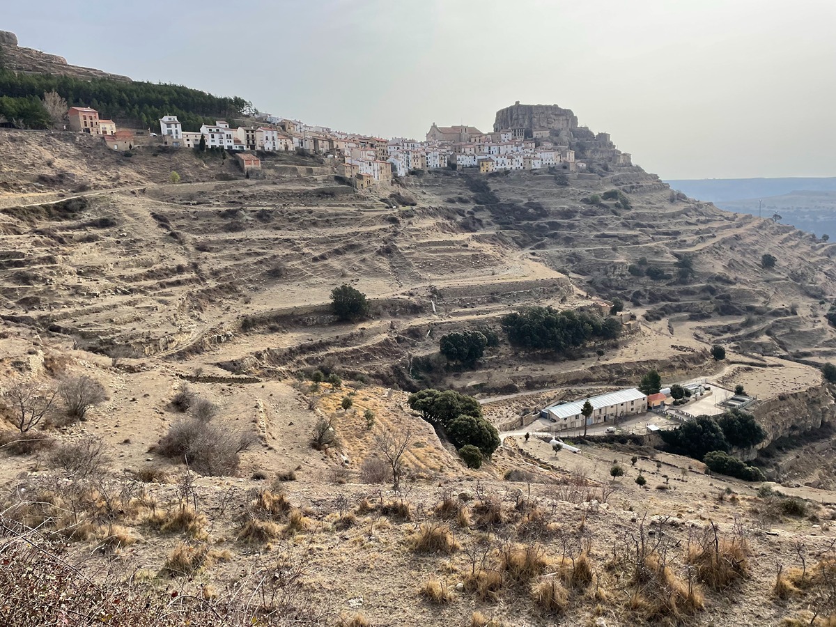
GR 7 E26 VALLIBONA - MORELLA
Promoter: Generalitat Valenciana
Certification status: Positive quality control
Etapa número: 26
Reference municipality: Vallibona
Length: 16,80 km
Estimated walking time: 05:30:00
Elevation gain: 735 m
Elevation loss: 485 m
(0)
GR 7 E27 MORELLA - ARES DEL MAESTRAT
Promoter: Generalitat Valenciana
Certification status: Positive quality control
Etapa número: 27
Reference municipality: Morella
Length: 24,20 km
Estimated walking time: 07:25:00
Elevation gain: 780 m
Elevation loss: 530 m
(0)
GR 7 E28 ARES DEL MAESTRAT - CULLA
Promoter: Generalitat Valenciana
Certification status: Positive quality control
Etapa número: 28
Reference municipality: Ares del Maestrat
Length: 18,00 km
Estimated walking time: 05:45:00
Elevation gain: 550 m
Elevation loss: 670 m
(0)
GR 7 E29 CULLA - VISTABELLA DEL MAESTRAT
Promoter: Generalitat Valenciana
Certification status: Positive quality control
Etapa número: 29
Reference municipality: Culla
Length: 18,90 km
Estimated walking time: 06:25:00
Elevation gain: 879 m
Elevation loss: 680 m
(0)
GR 7 E30 VISTABELLA DEL MAESTRAT - VILLAHERMOSA DEL RÍO
Promoter: Generalitat Valenciana
Certification status: Positive quality control
Etapa número: 30
Reference municipality: Vistabella del Maestrat
Length: 19,60 km
Estimated walking time: 06:10:00
Elevation gain: 395 m
Elevation loss: 935 m
(0)
GR 7 E31 VILLAHERMOSA DEL RÍO - SAN VICENTE DE PIEDRAHITA
Promoter: Generalitat Valenciana
Certification status: Positive quality control
Etapa número: 31
Reference municipality: Villahermosa del Río
Length: 12,10 km
Estimated walking time: 03:55:00
Elevation gain: 480 m
Elevation loss: 325 m
(0)
GR 7 E32 SAN VICENTE DE PIEDRAHITA - MONTANEJOS
Promoter: Generalitat Valenciana
Certification status: Positive quality control
Etapa número: 32
Reference municipality: Cortes de Arenoso
Length: 14,50 km
Estimated walking time: 05:05:00
Elevation gain: 540 m
Elevation loss: 925 m
(0)
GR 7 E33 MONTANEJOS - MAS DE NOGUERA
Promoter: Generalitat Valenciana
Certification status: Positive quality control
Etapa número: 33
Reference municipality: Montanejos
Length: 20,40 km
Estimated walking time: 07:10:00
Elevation gain: 1.155 m
Elevation loss: 740 m
(0)
GR 7 E34 MAS DE NOGUERA - BEJÍS
Promoter: Generalitat Valenciana
Certification status: Positive quality control
Etapa número: 34
Reference municipality: Caudiel
Length: 20,60 km
Estimated walking time: 06:05:00
Elevation gain: 415 m
Elevation loss: 510 m
(0)
GR 7 E35 BEJÍS - ANDILLA
Promoter: Generalitat Valenciana
Certification status: Positive quality control
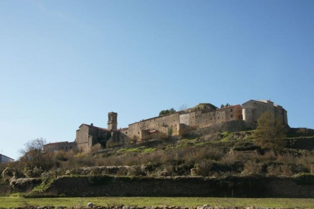
Etapa número: 35
Reference municipality: Bejís
Length: 21,90 km
Estimated walking time: 06:55:00
Elevation gain: 740 m
Elevation loss: 665 m
(0)
GR 7 E36 ANDILLA - CHELVA
Promoter: Generalitat Valenciana
Certification status: temporary cancellation
Etapa número: 36
Reference municipality: Andilla
Length: 25,90 km
Estimated walking time: 08:10:00
Elevation gain: 625 m
Elevation loss: 1.115 m
(0)
GR 7 E37 CHELVA - BENAGÉBER
Promoter: Generalitat Valenciana
Certification status: temporary cancellation
Etapa número: 37
Reference municipality: Chelva
Length: 16,80 km
Estimated walking time: 05:40:00
Elevation gain: 800 m
Elevation loss: 520 m
(0)
GR 7 E38 BENAGÉBER - CHERA
Promoter: Generalitat Valenciana
Certification status: temporary cancellation
Etapa número: 38
Reference municipality: Benagéber
Length: 26,60 km
Estimated walking time: 08:00:00
Elevation gain: 605 m
Elevation loss: 745 m
(0)
GR 7 E39 CHERA - SIETE AGUAS
Promoter: Generalitat Valenciana
Certification status: temporary cancellation
Etapa número: 39
Reference municipality: Chera
Length: 21,00 km
Estimated walking time: 06:35:00
Elevation gain: 650 m
Elevation loss: 595 m
(0)
GR 7 E40 SIETE AGUAS - CAMPAMENTO TABARLA
Promoter: Generalitat Valenciana
Certification status: temporary cancellation
Etapa número: 40
Reference municipality: Siete Aguas
Length: 24,60 km
Estimated walking time: 07:30:00
Elevation gain: 570 m
Elevation loss: 805 m
(0)
GR 7 E41 CAMPAMENTO TABARLA - CORTES DE PALLÁS
Promoter: Generalitat Valenciana
Certification status: temporary cancellation
Etapa número: 41
Reference municipality: Yátova
Length: 26,40 km
Estimated walking time: 08:50:00
Elevation gain: 1.035 m
Elevation loss: 1.090 m
(0)
GR 7 E42 CORTES DE PALLÁS - COLLADO CAROCHE
Promoter: Generalitat Valenciana
Certification status: Positive quality control
Etapa número: 42
Reference municipality: Cortes de Pallás
Length: 31,00 km
Estimated walking time: 09:25:00
Elevation gain: 1.030 m
Elevation loss: 440 m
(0)
GR 7 E43 COLLADO CAROCHE - CASAS DE BENALI
Promoter: Generalitat Valenciana
Certification status: Positive quality control
Etapa número: 43
Reference municipality: Teresa de Cofrentes
Length: 26,50 km
Estimated walking time: 08:15:00
Elevation gain: 680 m
Elevation loss: 970 m
(0)
GR 7 E44 CASAS DE BENALI - VALLADA
Promoter: Generalitat Valenciana
Certification status: Positive quality control
Etapa número: 44
Reference municipality: Enguera
Length: 28,20 km
Estimated walking time: 08:20:00
Elevation gain: 465 m
Elevation loss: 900 m
(0)
GR 7 E45 VALLADA - ONTINYENT
Promoter: Generalitat Valenciana
Certification status: Positive quality control
Etapa número: 45
Reference municipality: Vallada
Length: 18,00 km
Estimated walking time: 05:55:00
Elevation gain: 705 m
Elevation loss: 615 m
(0)
GR 7 E46 ONTINYENT - PARATGE FONT DE MARIOLA
Promoter: Generalitat Valenciana
Certification status: Positive quality control
Etapa número: 46
Reference municipality: Ontinyent
Length: 20,80 km
Estimated walking time: 06:35:00
Elevation gain: 890 m
Elevation loss: 375 m
(2)
GR 7 E47 PARAJE FONT DE MARIOLA - ALCOY
Promoter: Generalitat Valenciana
Certification status: Positive quality control
Etapa número: 47
Reference municipality: Bocairent
Length: 15,00 km
Estimated walking time: 04:15:00
Elevation gain: 500 m
Elevation loss: 715 m
(0)
GR 7 E48 BARRANC DEL CINC - SANTUARIO DE LA FONT ROJA
Promoter: Generalitat Valenciana
Certification status: Positive quality control
Etapa número: 48
Reference municipality: Alcoy/Alcoi
Length: 10,70 km
Estimated walking time: 03:50:00
Elevation gain: 725 m
Elevation loss: 340 m
(0)
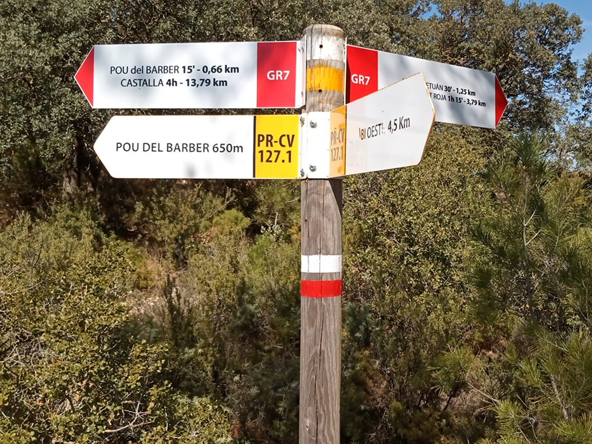
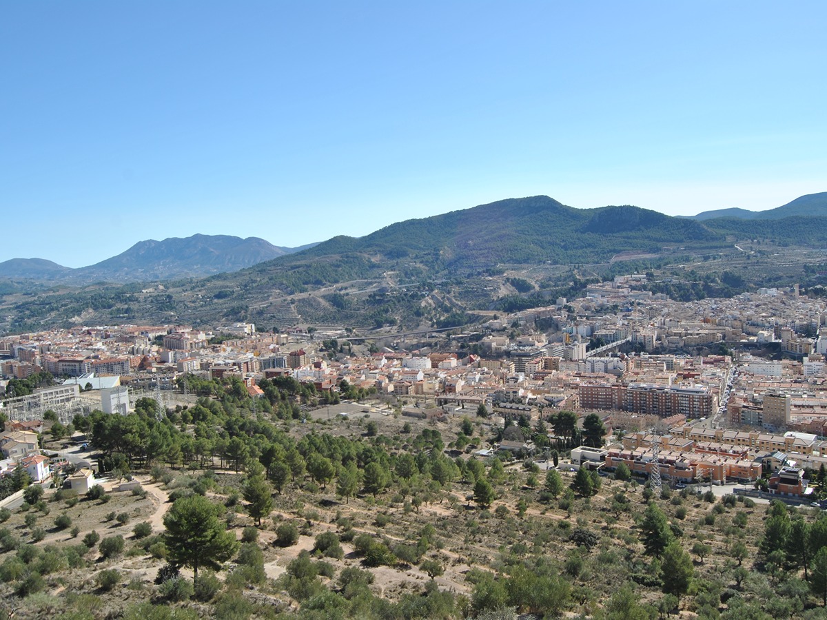
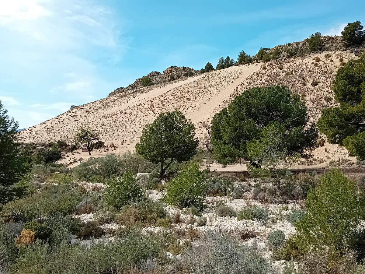
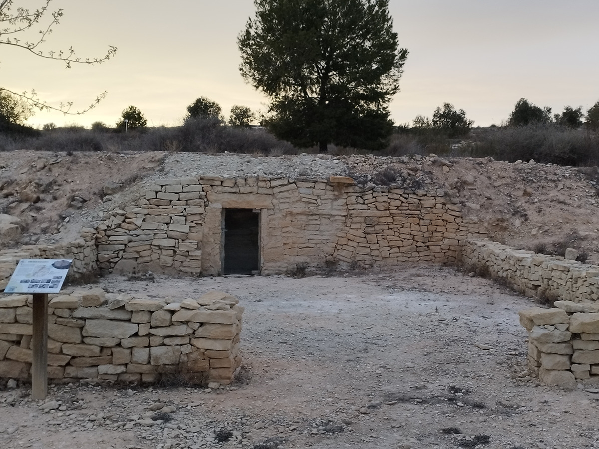
GR 7 E49 SANTUARIO DE LA FONT ROJA - CASTALLA
Promoter: Generalitat Valenciana
Certification status: Positive quality control
Etapa número: 49
Reference municipality: Alcoy/Alcoi
Length: 17,50 km
Estimated walking time: 04:20:00
Elevation gain: 245 m
Elevation loss: 655 m
(0)
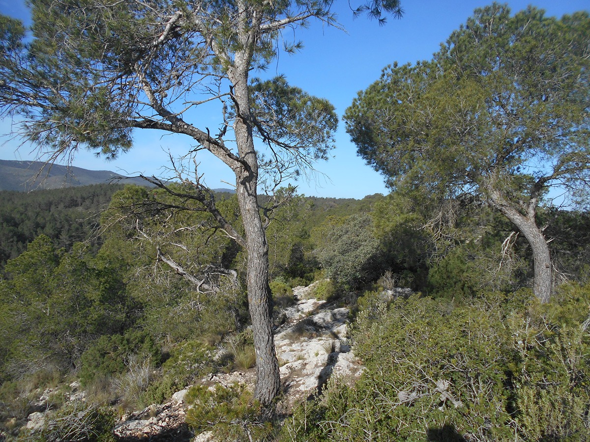
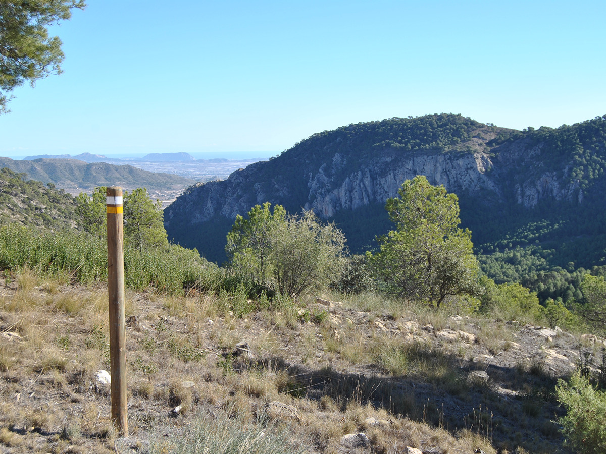
GR 7 E50 CASTALLA - ELDA
Promoter: Generalitat Valenciana
Certification status: Positive quality control
Etapa número: 50
Reference municipality: Castalla
Length: 24,00 km
Estimated walking time: 07:10:00
Elevation gain: 445 m
Elevation loss: 715 m
(0)
GR 7 E51 ELDA - PINOSO (LÍMITE MURCIA)
Promoter: Generalitat Valenciana
Certification status: Positive quality control
Etapa número: 51
Reference municipality: Elda
Length: 34,10 km
Estimated walking time: 07:40:00
Elevation gain: 510 m
Elevation loss: 260 m
(0)
Alternative routes and routes leading to nearby points of interest
GR 7 VARIANTE PEIRÓ TRENCAT
Promoter: Generalitat Valenciana
Certification status: Positive quality control
Reference municipality: Vallibona
Length: 6,30 km
Estimated walking time: 02:15:00
Elevation gain: 480 m
Elevation loss: 40 m
(0)
Other trails connecting with this trail
PR-CV 1 CULLA - VILAFRANCA DEL CID - LA POBLA DEL BELLESTAR - LA IGLESUELA DEL CID
Promoter: Ayuntamiento de Villafranca del Cid
Certification status: No quality controls
Reference municipality: Culla
Length: 31,80 km
Estimated walking time: 10:25:00
Elevation gain: 1.270 m
Elevation loss: 1.090 m
(0)
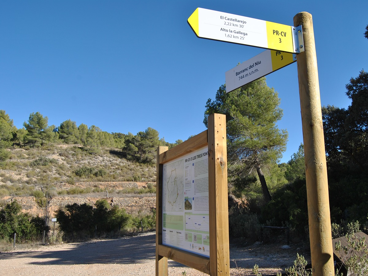
PR-CV 3 TRES FONTS - ENZEBRES - TRES FONTS
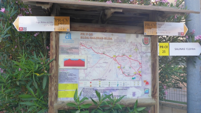
Promoter: Ayuntamiento de Pinoso
Certification status: Positive quality control
Reference municipality: Pinós (El)/Pinoso
Length: 8,90 km
Estimated walking time: 02:50:00
Elevation gain: 285 m
Elevation loss: 285 m
(0)
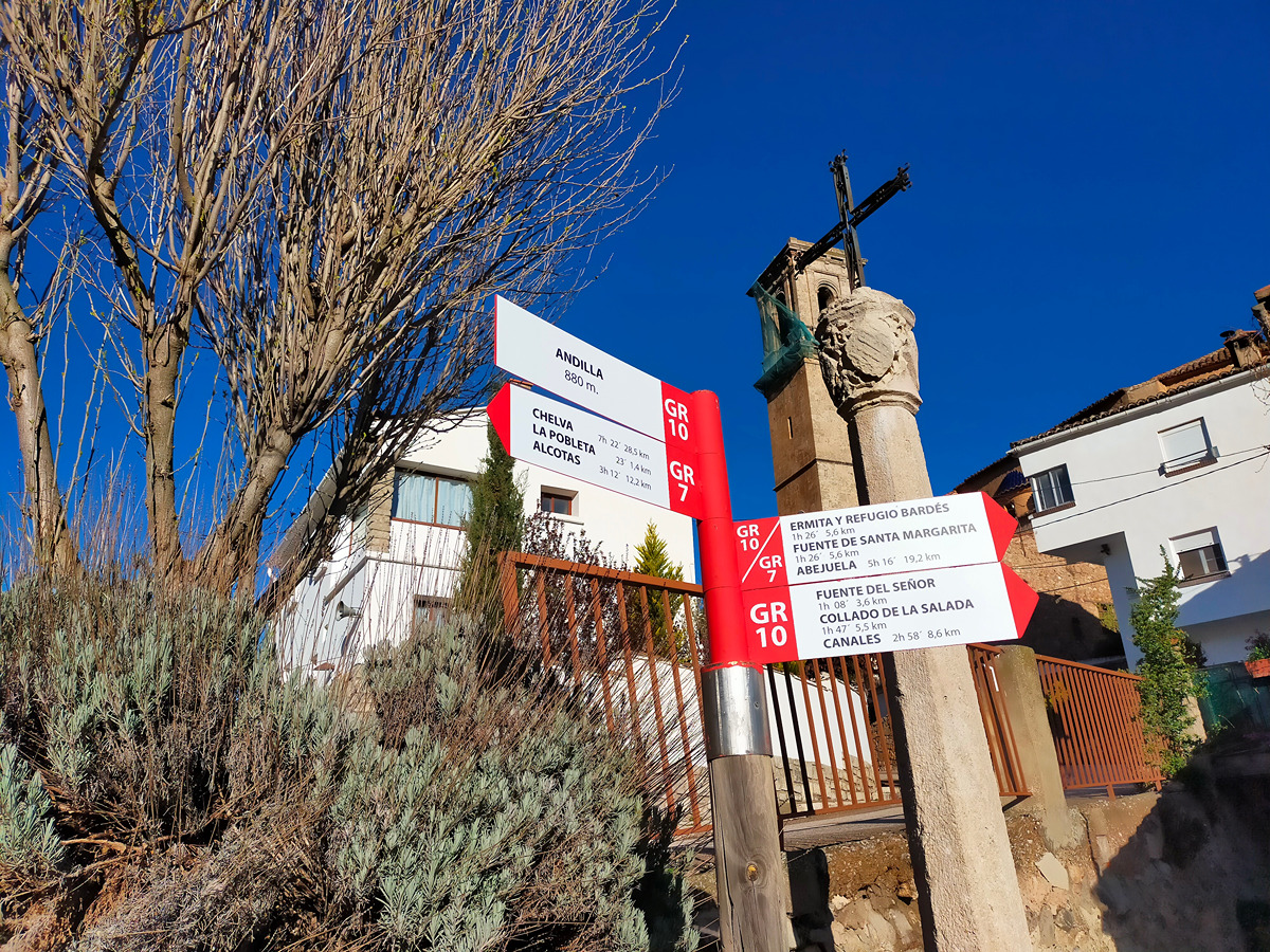
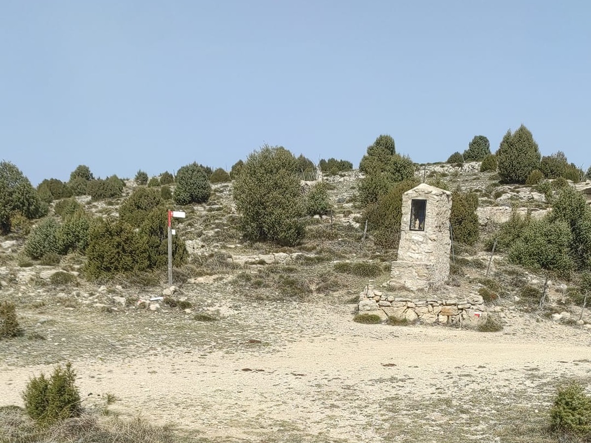
GR 10 E07 ANDILLA - COLLADO BARDÉS
Promoter: Generalitat Valenciana
Certification status: Positive quality control
Etapa número: 7
Reference municipality: Andilla
Length: 6,70 km
Estimated walking time: 02:20:00
Elevation gain: 565 m
Elevation loss: 45 m
(0)
GR 10 E06 SACAÑET - ANDILLA
Promoter: Generalitat Valenciana
Certification status: Positive quality control
Etapa número: 6
Reference municipality: Sacañet
Length: 15,00 km
Estimated walking time: 04:55:00
Elevation gain: 490 m
Elevation loss: 615 m
(0)
SL-CV 21 EL CERRO - COLLADO DEL PULPILLO
Promoter: Ayuntamiento de Yátova
Certification status: Conditioned quality control
Reference municipality: Yátova
Length: 12,20 km
Estimated walking time: 03:50:00
Elevation gain: 455 m
Elevation loss: 455 m
(0)
GR 33 E07 XODOS - SANT JOAN DE PENYAGOLOSA
Promoter: Diputación de Castellón
Certification status: Positive quality control
Etapa número: 7
Reference municipality: Chodos/Xodos
Length: 6,70 km
Estimated walking time: 02:00:00
Elevation gain: 420 m
Elevation loss: 215 m
(1)

GR 36 E06 TORRALBA DEL PINAR- MONTANEJOS
Promoter: Parque Natural de la Sierra de Espadán
Certification status: Negative quality control
Etapa número: 6
Reference municipality: Torralba del Pinar
Length: 17,50 km
Estimated walking time: 05:45:00
Elevation gain: 570 m
Elevation loss: 840 m
(0)
SL-CV 52 LOS MOLINOS
Promoter: Ayuntamiento de Bejís
Certification status: Conditioned quality control
Reference municipality: Bejís
Length: 4,60 km
Estimated walking time: 01:30:00
Elevation gain: 115 m
Elevation loss: 115 m
(0)
SL-CV 54 LOS MIRADORES
Promoter: Ayuntamiento de Bejís
Certification status: Conditioned quality control
Reference municipality: Bejís
Length: 9,20 km
Estimated walking time: 02:55:00
Elevation gain: 300 m
Elevation loss: 300 m
(0)
SL-CV 55 FUENTES DE ARTEAS
Promoter: Ayuntamiento de Bejís
Certification status: Conditioned quality control
Reference municipality: Bejís
Length: 5,50 km
Estimated walking time: 01:45:00
Elevation gain: 190 m
Elevation loss: 190 m
(0)
PR-CV 57 BARRANC DEL CINT - MONTCABRER - BARRANC DEL CINT
Promoter: Centre Excursionista d'Alcoi
Certification status: Negative quality control
Reference municipality: Alcoy/Alcoi
Length: 23,30 km
Estimated walking time: 07:50:00
Elevation gain: 975 m
Elevation loss: 975 m
(0)
PR-CV 62 MAS DE NOGUERA - PINA DE MONTALGRAO
Promoter: Ayuntamiento de Pina de Montalgrao
Certification status: No quality controls
Reference municipality: Pina de Montalgrao
Length: 8,00 km
Estimated walking time: 02:40:00
Elevation gain: 375 m
Elevation loss: 215 m
(0)
PR-CV 63.3 SIERRA ESPINA
Promoter: Mancomunidad Alto Palancia
Certification status: Negative quality control
Reference municipality: Barracas
Length: 22,20 km
Estimated walking time: 07:45:00
Elevation gain: 845 m
Elevation loss: 1.270 m
(0)
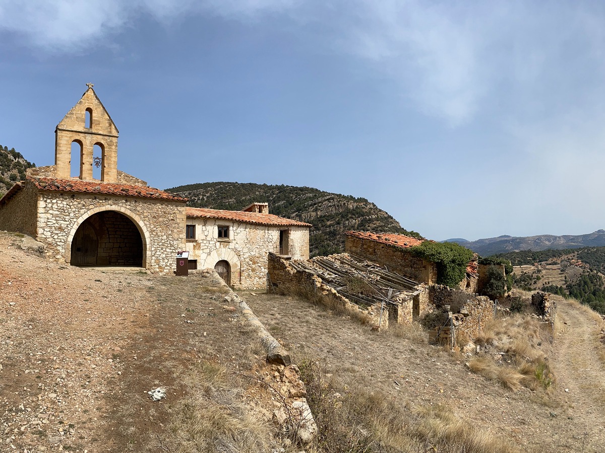
SL-CV 89 MURALLES DE MORELLA
Promoter: Ayuntamiento de Morella
Certification status: No quality controls
Reference municipality: Morella
Length: 3,80 km
Estimated walking time: 01:20:00
Elevation gain: 205 m
Elevation loss: 205 m
(0)
PR-CV 92 CHELVA - CALLES - PEÑA CORTADA - CHELVA
Promoter: Centro Excursionista de Chelva
Certification status: Negative quality control
Reference municipality: Chelva
Length: 13,80 km
Estimated walking time: 04:30:00
Elevation gain: 505 m
Elevation loss: 505 m
(0)
PR-CV 93 LA MOZAIRA
Promoter: Centro Excursionista de Chelva
Certification status: Negative quality control
Reference municipality: Chelva
Length: 18,30 km
Estimated walking time: 04:15:00
Elevation gain: 275 m
Elevation loss: 275 m
(0)
SL-CV 102 BARRANC DE LA FRESCA
Promoter: Ayuntamiento Benassal
Certification status: Positive quality control
Reference municipality: Benassal
Length: 9,20 km
Estimated walking time: 02:45:00
Elevation gain: 230 m
Elevation loss: 230 m
(1)
PR-CV 111.1 CORTES DE ARENOSO - SAN VICENTE DE PIEDRAHITA
Promoter: Ayuntamiento de Cortes de Arenoso
Certification status: Conditioned quality control
Reference municipality: Cortes de Arenoso
Length: 13,10 km
Estimated walking time: 03:25:00
Elevation gain: 325 m
Elevation loss: 455 m
(1)
PR-CV 111.3 CORTES DE ARENOSO - SAN VICENTE DE PIEDRAHITA (POR EL MAS DE MATEVA)
Promoter: Ayuntamiento de Cortes de Arenoso
Certification status: Negative quality control
Reference municipality: Cortes de Arenoso
Length: 14,50 km
Estimated walking time: 03:55:00
Elevation gain: 335 m
Elevation loss: 465 m
(0)
PR-CV 111.2 CORTES DE ARENOSO - SAN VICENTE DE PIEDRAHITA (POR EL REBOLLAR)
Promoter: Ayuntamiento de Cortes de Arenoso
Certification status: Positive quality control
Reference municipality: Cortes de Arenoso
Length: 8,40 km
Estimated walking time: 02:45:00
Elevation gain: 240 m
Elevation loss: 380 m
(107)
Reference municipality: Montanejos
Length: 16,40 km
Estimated walking time: 05:55:00
Elevation gain: 870 m
Elevation loss: 845 m
(1)
PR-CV 143 XORRET DE CATÍ - L´AVAIOL
Promoter: Diputación de Alicante
Certification status: Negative quality control
Reference municipality: Castalla
Length: 11,10 km
Estimated walking time: 03:20:00
Elevation gain: 155 m
Elevation loss: 400 m
(0)
PR-CV 144 EL PLANO – L´AVAIOL
Promoter: Diputación de Alicante
Certification status: De-registered / De-approved
Reference municipality: Sax
(0)
PR-CV 148 YATOVA - CASA DE TABARLA - POCICO VALENTÍN
Promoter: Ayuntamiento de Yátova
Certification status: Conditioned quality control
Reference municipality: Yátova
Length: 23,30 km
Estimated walking time: 06:15:00
Elevation gain: 710 m
Elevation loss: 845 m
(0)
GR 160 E02 PUEBLA DE ARENOSO – MONTANEJOS
Promoter: O.A.L. Patronato Provincial de Turismo de Castellón
Certification status: No quality controls
Etapa número: 2
Reference municipality: Puebla de Arenoso
Length: 14,50 km
Estimated walking time: 04:40:00
Elevation gain: 750 m
Elevation loss: 860 m
(0)
GR 160 E03 MONTANEJOS – CAUDIEL
Promoter: O.A.L. Patronato Provincial de Turismo de Castellón
Certification status: No quality controls
Etapa número: 3
Reference municipality: Montanejos
Length: 27,00 km
Estimated walking time: 07:55:00
Elevation gain: 1.135 m
Elevation loss: 970 m
(0)
PR-CV 166 L'ALMORQUÍ - LA CAVAFRÍA - LES TRES FONTS
Promoter: Ayuntamiento de Monóvar
Certification status: Positive quality control
Reference municipality: Monòver/Monóvar
Length: 12,90 km
Estimated walking time: 04:25:00
Elevation gain: 660 m
Elevation loss: 465 m
(1)
Reference municipality: Buñol
Length: 22,90 km
Estimated walking time: 08:05:00
Elevation gain: 1.310 m
Elevation loss: 885 m
(3)
Reference municipality: Elda
Length: 11,80 km
Estimated walking time: 03:25:00
Elevation gain: 230 m
Elevation loss: 230 m
(0)
GR 239 E03 XÀTIVA - MOIXENT
Promoter: Asociación de Amigos del Camino de Santiago
Certification status: Positive quality control
Etapa número: 3
Reference municipality: Xàtiva
Length: 28,50 km
Estimated walking time: 06:30:00
Elevation gain: 490 m
Elevation loss: 255 m
(0)
PR-CV 252 RUTA DEL FRANCHO
Promoter: Ayuntamiento de Cortes de Pallás
Certification status: Negative quality control
Reference municipality: Cortes de Pallás
Length: 10,60 km
Estimated walking time: 03:25:00
Elevation gain: 430 m
Elevation loss: 305 m
(0)
PR-CV 273 RESINERO - PEÑAS DEL DIABLO
Promoter: Ayuntamiento de Bejís
Certification status: Positive quality control
Reference municipality: Bejís
Length: 20,40 km
Estimated walking time: 05:35:00
Elevation gain: 790 m
Elevation loss: 630 m
(2)
PR-CV 297 COVA DEL BOVALAR
Promoter: Ayuntamiento de Culla
Certification status: No quality controls
Reference municipality: Culla
Length: 11,30 km
Estimated walking time: 03:45:00
Elevation gain: 430 m
Elevation loss: 430 m
(0)
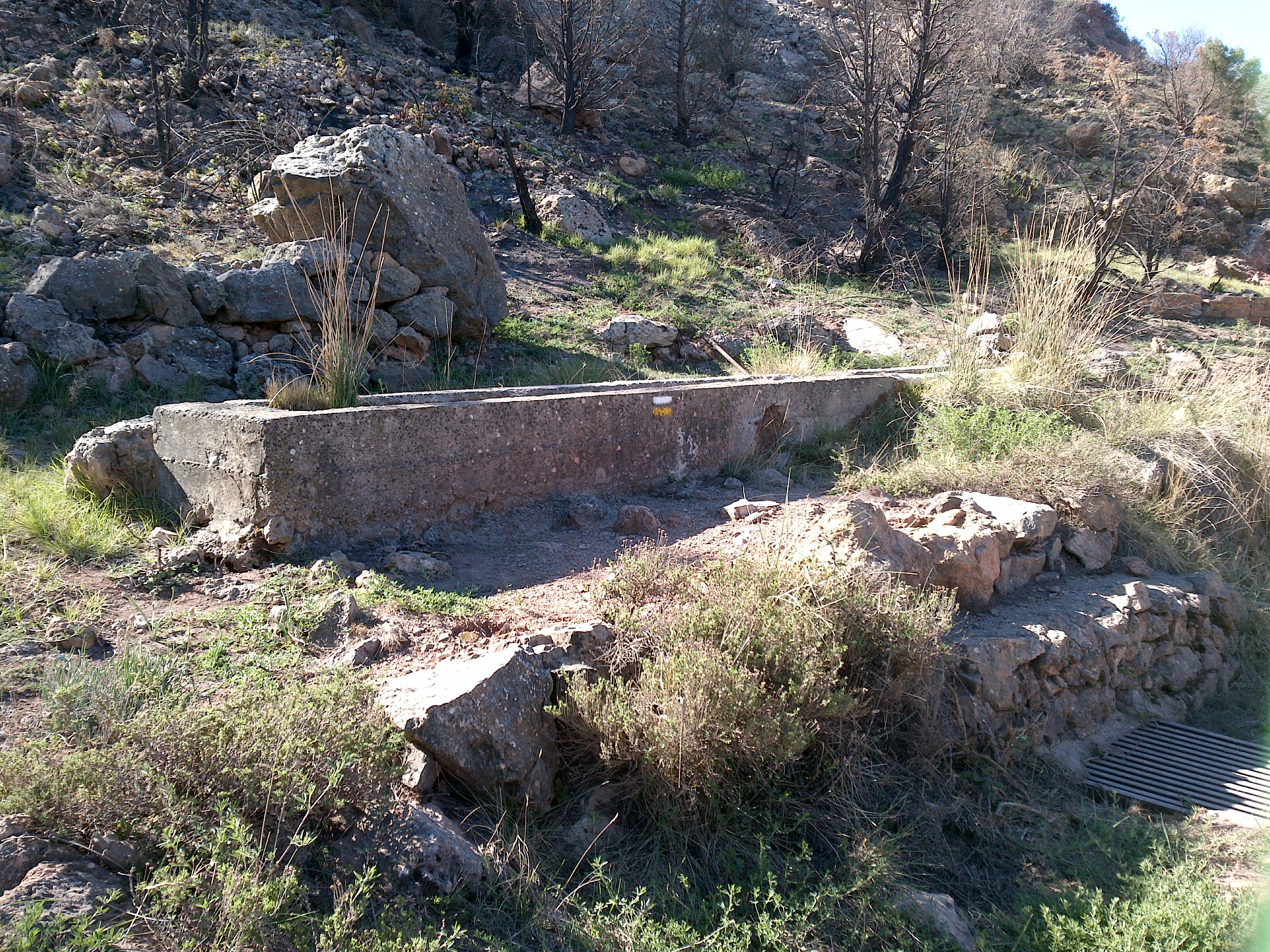
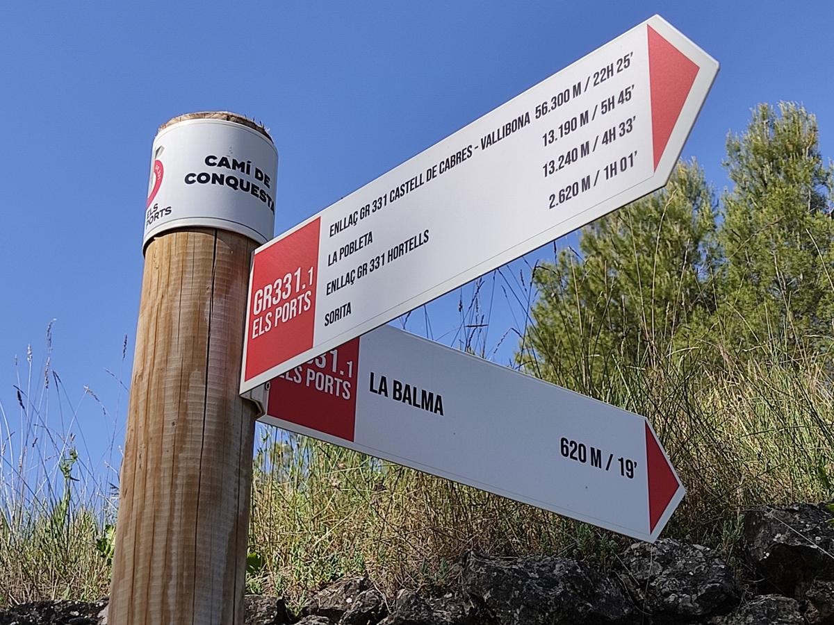
GR 331 E11 CASTELL DE CABRES - VALLIBONA
Promoter: Mancomunitat Comarcal Els Ports
Certification status: Valid
Etapa número: 11
Reference municipality: Castell de Cabres
Length: 10,70 km
Estimated walking time: 03:10:00
Elevation gain: 70 m
Elevation loss: 515 m
(0)
GR 331 E14 LA LLÈCUA - ARES DEL MAESTRAT
Promoter: Mancomunitat Comarcal Els Ports
Certification status: Valid
Etapa número: 14
Reference municipality: Morella
Length: 11,00 km
Estimated walking time: 03:50:00
Elevation gain: 300 m
Elevation loss: 170 m
(0)
Reference municipality: Morella
Length: 72,30 km
Estimated walking time: 24:05:00
Elevation gain: 2.950 m
Elevation loss: 2.750 m
(0)
GR 332 E03 GR 332 E03 BICORP - PICO DEL CAROCHE
Promoter: Mancomunitat de la Canal de Navarrés
Certification status: Positive quality control
Etapa número: 3
Reference municipality: Bicorp
Length: 19,20 km
Estimated walking time: 06:25:00
Elevation gain: 1.115 m
Elevation loss: 290 m
(1)
PR-CV 359 CHERA - EL REATILLO
Promoter: Ayuntamiento de Chera
Certification status: De-registered / De-approved
Reference municipality: Chera
(0)
PR-CV 381 ALTO DE ALCOLA
Promoter: Ayuntamiento de Cofrentes
Certification status: No quality controls
Reference municipality: Cofrentes
Length: 10,30 km
Estimated walking time: 03:40:00
Elevation gain: 565 m
Elevation loss: 420 m
(0)
PR-CV 387 CAMÍ DEL ROURE DE LES BERRUGUES
Promoter: Ayuntamiento de Ares del Maestrat
Certification status: No quality controls
Reference municipality: Ares del Maestrat
Length: 10,70 km
Estimated walking time: 03:10:00
Elevation gain: 155 m
Elevation loss: 360 m
(0)
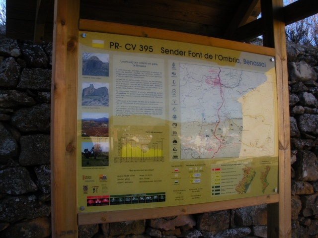
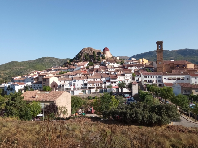
PR-CV 395 FONT DE L'OMBRIA
Promoter: Club de Muntanya de Benassal
Certification status: No quality controls
Reference municipality: Benassal
Length: 15,30 km
Estimated walking time: 04:25:00
Elevation gain: 640 m
Elevation loss: 640 m
(0)
PR-CV 424 BARONÍA DE ANDILLA
Promoter: Ayuntamiento de Andilla
Certification status: No quality controls
Reference municipality: Andilla
Length: 23,10 km
Estimated walking time: 07:40:00
Elevation gain: 900 m
Elevation loss: 900 m
(0)
PR-CV 449 PARDANCHINOS - OSSET - ANDILLA
Promoter: Ayuntamiento de Andilla
Certification status: No quality controls
Reference municipality: Andilla
Length: 14,40 km
Estimated walking time: 04:45:00
Elevation gain: 650 m
Elevation loss: 415 m
(0)